Understand land use policy with this practical guide covering zoning, land-value capture, equity impacts, international case studies, and reform design.
July 30, 2026
Land Use Policy Explained: Tools, Equity, and Reform
Understand land use policy with this practical guide covering zoning, land-value capture, equity impacts, international case studies, and reform design.
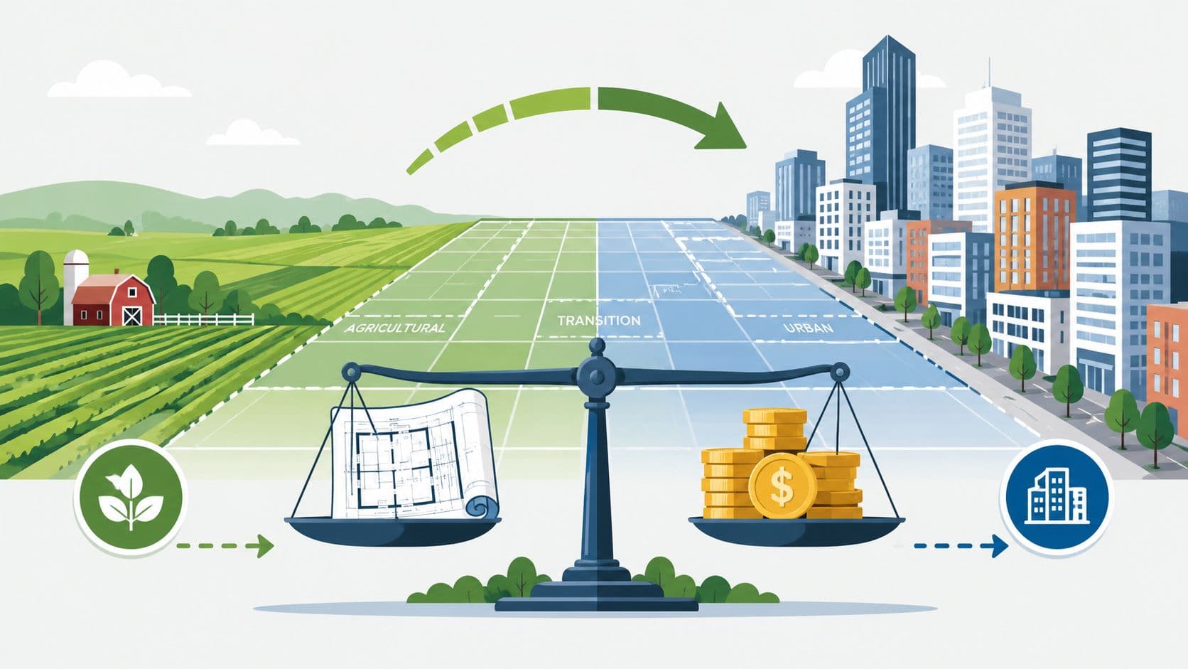
You're sitting in a room where a rezoning vote is running long. One neighbor worries about taller buildings blocking sunlight, another wants more apartments near transit, and a council member keeps asking who's paying for the sewers, sidewalks, and bus service if the map changes. That's land use policy in real life. It's not just a planning term, it's the set of rules and rights that decides what can happen on a parcel, what gets built there, and how the public shares in the costs and gains.
For finance ministries, city planners, housing agencies, and civic groups, the hard part is not spotting the word zoning. The hard part is seeing the whole system, the land, the buildings, the tax base, the permits, and the people who live with the consequences. Land use policy sits at the intersection of housing affordability, fiscal design, and environmental outcomes, which is why reform debates get so heated and so consequential. Historical milestones show that this framework is relatively recent in institutional terms, with organized planning emerging in the early 20th century and the OECD median planning system established in 1979 EBSCO research starter on land-use policy.
Table of Contents
- Why Land Use Policy Shapes Daily Life
- What Land Use Policy Actually Is
- The Main Instruments Governments Use
- Land Value, Land-Use Rights, and Tri-Factor Economics
- International Evidence and Case Studies
- Equity, Displacement, and Who Pays for Reform
- Designing and Implementing a Land Use Policy Reform
- Key Takeaways for Practitioners
Why Land Use Policy Shapes Daily Life
A city council hearing is a strange place to learn economics, but it's often the best classroom. One speaker wants the neighborhood upzoned so a developer can build apartments above shops, another insists the area should stay low-rise, and someone from the public works department reminds everyone that roads, drainage, and transit all cost money. That argument is really about land use policy, even if nobody uses the phrase out loud.
Land use policy determines what gets built where, how dense it can be, and which public rules shape the site. It also determines who gets a faster permit, who has to provide parking, and who absorbs the burden when infrastructure needs expand. Those decisions affect rent levels, commute patterns, business location, and whether a city grows inward or sprawls outward.
The history matters because it reminds us this is a policy choice, not a natural law. Organized planning and zoning emerged in the early 20th century, with Hartford creating a planning board in 1907, Wisconsin passing the first state enabling act in 1909, Massachusetts making planning mandatory in 1913, and New York City enacting the first zoning code in 1916 EBSCO research starter on land-use policy. In the OECD, the median planning system was established in 1979, and only three OECD countries had such systems before 1940 EBSCO research starter on land-use policy.
Practical rule: if a zoning fight sounds local, check the fiscal and infrastructure implications. The map is rarely just a map.
That's why serious reformers, from housing agencies to tax units, need the vocabulary and the policy logic together. The land discussion is about more than supply. It's about how a jurisdiction aligns housing, revenue, and environmental outcomes without treating each decision as if it lived in its own silo. The positive urbanization lens used by planners and economists is helpful here, because it frames growth as something that can be managed rather than feared. Unitism's urbanization overview
What Land Use Policy Actually Is
The cleanest way to think about land use policy is to start with the rights attached to a parcel, then add the public rules that modify those rights. A site isn't just dirt on a map. It comes with ownership, permitted uses, limits on height and setbacks, environmental constraints, and a legal framework that says what can happen there and what can't.
In practice, land use policy is the combination of property rights, land-use rights, land-use regulation, and land-use restriction. Those pieces shape whether a parcel can host housing, industry, shops, public space, or something else entirely. They also shape the speed and cost of development, because a rule that is clear and machine-readable is easier to administer than one buried in a PDF or interpreted differently across departments.
Why data structure matters
A technically sound system doesn't just list rules. It records each rule as existing, proposed, or future, and it ties the rule to a legal reference and an effective date. That makes zoning and plan data auditable across jurisdictions, and it lets cadastre, zoning, and planning systems talk to one another instead of living in separate files INSPIRE land-use data specification. In plain terms, a ministry can track compliance and rule changes over time instead of guessing from static maps.
People often confuse land-use rights with a land-value tax. They're not the same. Land-use rights are land leases repriced annually with no expiration dates, so people can buy and sell those rights at low cost because the public resets the price each year. A land-value tax, by contrast, taxes the site value itself. One is a lease structure, the other is a tax instrument. If you need a simple explainer on that difference, SteadStack's land preparation guide is a useful adjacent read because it helps readers think about land as an asset that has to be organized before productive use, even though it focuses on preparation rather than tax design.
A good land system tells you what the rule is, who made it, when it starts, and what happens next. If it can't do that, it's hard to trust the map.
The same distinction shows up in practical reform work. A lease-based land-use rights system can be designed so access to land is repriced regularly, while a land-value tax can be used to capture site value for public purposes. That distinction matters for ministries that want to separate land from buildings and reduce the tax burden on productive activity. Unitism's land-use-right explainer and its discussion of land value tax versus property tax are both useful reference points for that distinction.
The Main Instruments Governments Use
A developer may hear one rule at a zoning hearing and assume it stands alone. In practice, land use policy works more like a control panel. Governments use zoning, density limits, FAR limits, growth boundaries, inclusionary housing, transfers of development rights, special assessments, and land-value capture mechanisms, and each one changes a different part of the land market. The OECD's inventory of land-use instruments makes that mix visible because it separates fiscal tools such as land value taxes, special assessment taxes, use-value tax assessment, and split-rate property tax from regulatory tools like urban-growth boundaries and transfers of development rights OECD inventory of land-use instruments.
Comparing Core Land Use Policy Instruments
| Instrument | What It Changes | Typical Use |
|---|---|---|
| Zoning | Allowed uses and development form | Separates or mixes uses across parcels |
| Density and FAR limits | Feasible intensity | Caps how much floor space can be built |
| Growth boundaries | Expansion path | Limits outward sprawl |
| Inclusionary housing | Unit mix and affordability outcomes | Requires or encourages affordable units |
| Transfers of development rights | Where intensity can be shifted | Moves development potential from one site to another |
| Special assessments | Who pays for infrastructure | Charges beneficiaries for local improvements |
| Land-value capture | Public share of uplift | Recovers value created by planning or infrastructure |
Each instrument touches a different pressure point. Zoning and FAR caps set what can be built, growth boundaries set where growth can go, and inclusionary housing shapes who can live in the new units. Special assessments and land-value capture affect the fiscal side, which matters because streets, utilities, and transit all need a funding source.
The trade-offs are easy to see in hearings, even when they are hard to agree on. Parking minimums and height caps lower feasible intensity and add friction, especially on constrained sites. A high-value neighborhood can look underbuilt on paper while still being hard to redevelop because the rule stack makes the project slow, costly, or both.
Policy shorthand: if a tool changes price only, it probably is not enough. If it changes quantity only, it can still leave the fiscal bill unresolved.
That is why reform usually pairs regulatory tools with fiscal ones. A site rule can open the door, but a tax or assessment can decide whether the public gets a share of the uplift. For readers comparing options for a project, find the right regulatory structure is a useful companion because it treats structure as a design choice, not a slogan. For a clear comparison of tax design, Unitism's property tax comparison helps separate land from improvements.
Land Value, Land-Use Rights, and Tri-Factor Economics
Tri-factor economics starts from a simple distinction. Land is nature and location, capital is buildings and machines, and labor is work. If policy lumps them together, it ends up taxing the wrong thing, subsidizing speculation, or penalizing construction that society wants.
That's why land-value capture fits so neatly into this frame. A land-value charge, tax, dividend, or related mechanism targets the site rental value rather than the sale price of a building package. It aims at the value created by location, public investment, and surrounding activity, not the value added by a builder or worker. In policy terms, that means governments can shift revenue toward land while easing taxes on labor and productive capital.
Why the distinction matters for finance ministries
A transactional property tax treats the parcel as a single bundle. A land-value approach separates the bundle. That separation matters because a building can be repaired, upgraded, or replaced without changing the underlying location value, while the land itself retains the public and neighborhood advantages that drive much of its price. Unitism's highest and best use discussion is useful here, because it shows how location and feasible use interact rather than collapse into one generic real-estate number.
Land-use rights fit into that same logic as an operational tool. If a government reprices the lease on land each year, the public can capture some of the uplift while keeping rights tradable at low cost. That makes land access more fluid than a system that ties value to a one-time purchase and then leaves the site underused for years. In a reform sequence, that often means starting with land and land-use rights, then adjusting taxes on buildings and transactions so the system stops discouraging investment.
The OECD's inventory of fiscal instruments matters here because it shows land policy is not just zoning. It includes land value taxes, special assessment taxes, use-value tax assessment, and split-rate property tax as separate instruments OECD inventory of land-use instruments. That menu gives ministries a way to sequence reform instead of trying to fix everything with one lever.
The cleanest reform path usually starts with land, not buildings. That keeps construction incentives intact while letting the public claim part of the location value it helped create.
For policymakers, the mental model is straightforward. Treat land as a public-relevant value base, treat labor and capital as productive inputs that shouldn't be discouraged, and then design land-use rights and land-value capture to keep the system flexible. That's the core of the tri-factor lens.
International Evidence and Case Studies
The international record is more useful than the slogans. Different countries have used land policy to solve different problems, and the design choices matter as much as the label. The long-run U.S. pattern is a good reminder of the scale of the issue, because urban land nearly tripled in area since 1949, while agricultural land fell from 63% in 1949 to 52% in 2012 USDA land use primer. That shift explains why developed-land expansion keeps pushing up housing, infrastructure, and fiscal pressure.
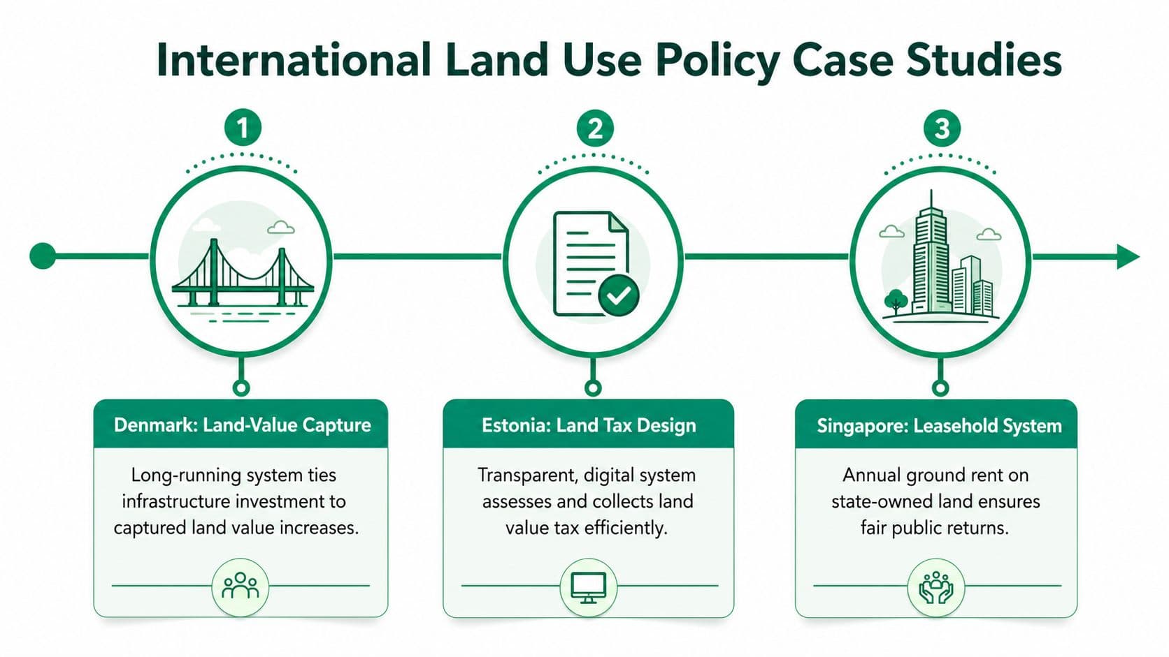
Six cases that teach different lessons
Denmark is often cited for long-running land-value capture tied to infrastructure. The lesson isn't that one tax solves everything. It's that public investment can be paired with a mechanism that brings part of the uplift back into public hands.
Estonia's land tax design is frequently discussed for its clean emphasis on land rather than a broader property bundle. That matters because the tax base sends a signal about what the public wants to discourage, holding land idle or building on it productively.
Singapore is a practical model for land-use rights. Its leasehold system uses annual ground rent on state-owned land, which shows how a public owner can reprice access over time rather than selling the site outright. The institutional lesson is simple: keep the right to use land tradable, but don't let public value leak away permanently.
Canberra's split-rate property tax shows the fiscal side of the same logic. The structure taxes land and improvements differently, which changes incentives for holding sites versus improving them.
Alaska's resource dividend shows a different kind of land-related public return, where resource rents can be distributed to residents rather than kept entirely by the state. Allentown's two-rate tax experiment belongs in the same family of ideas, because it uses differential tax treatment to alter behavior without pretending land and buildings are the same thing.
A practical evidence checklist helps cut through the noise:
- Ask what base is being taxed. Land, buildings, transactions, or a mix.
- Check whether the rule changes behavior. Idle land, redevelopment, or infrastructure financing.
- Look for administrative clarity. A policy that can't be assessed or collected consistently won't scale.
- Separate design from outcomes. A leasehold system, a split-rate tax, and a dividend can each work for different reasons.
The common thread across these examples is that land policy works best when the jurisdiction knows exactly what value it is targeting. The macro trend in U.S. land conversion is the warning sign, more developed land means more pressure on affordability and infrastructure, so the policy has to be precise.
Equity, Displacement, and Who Pays for Reform
A rezoning can add housing and still leave people worse off. If new units appear in one neighborhood while renters or small businesses get priced out somewhere else, residents experience that as a loss, even if the plan looks efficient on paper. A serious land use reform has to ask who gains, who pays, and which groups face displacement risk.
Brookings recommends that a land-use racial equity impact assessment should test likely costs and benefits by racial group, displacement risk, and effects on segregation Brookings on equitable development. That is a stricter test than asking whether a code change adds density somewhere. It forces the reform team to compare outcomes by group, not just total units or total revenue.
Commission versus omission
Anguelovski and coauthors draw a useful line between harms caused by policy commission and harms caused by policy omission. Commission is when a rule or project directly displaces low-income communities. Omission is when planning protects already privileged areas while leaving disadvantaged neighborhoods exposed. The difference matters because a city can call itself neutral and still make unequal outcomes more likely.
A good equity review goes beyond participation. Public meetings matter, but they do not show whether the benefits and burdens are balanced. Fiscal incidence has to sit beside racial and geographic analysis, because shifting the tax base toward land value can be more progressive than taxing wages and transactions, but only if exemptions, rate design, and transition relief are handled carefully. A reform that looks tidy in a spreadsheet can still fail on the ground if the distribution of costs is lopsided.
If a map change improves averages but intensifies displacement, the politics will catch up with the model.
For teams doing outreach, Helbling Digital Media real estate shows how complex land and property topics can be explained to different audiences without losing the details. The point is not marketing polish. The point is making sure residents understand the rules well enough to judge the trade-offs.
Unitism's distributional analysis fits into the same question. Distributional analysis asks who absorbs higher costs, who captures the gains, and how those effects change once land value, land-use rights, and development controls are separated instead of treated as one bundle. That matters in places where a reform can raise nearby land values, change the return to holding a site, and shift pressure onto tenants at the same time.
A distributional checklist helps keep the process honest:
- Who pays more? Owners, tenants, new buyers, or existing residents.
- Who benefits first? Nearby landowners, new households, or the broader tax base.
- Who faces displacement risk? Renters, small firms, or long-standing communities.
- What relief exists? Phase-ins, exemptions, or targeted protections.
- How will success be measured? Not just permits, but neighborhood stability too.
That is the standard a reform team should use before changing the map. If the distributional story is unclear, the policy probably is not ready.
Designing and Implementing a Land Use Policy Reform
A workable reform rarely starts with a vote. It starts with scoping, valuation, and a data stack that can support the law. The most practical sequence is simple, assess the land base, model impacts, design the legal rules, engage stakeholders, phase the rollout, and then evaluate the outcomes.
The data layers that need to line up
A jurisdiction needs to integrate land-use category, ownership, infrastructure, density, environmental constraints, present use, and development controls such as permitted uses, maximum FAR, height, setbacks, parking minimums, and open-space requirements. New York City's technical manual shows why those layers matter, because affected sites have to be mapped with tax lots, zoning boundaries, roads, buildings, and physical features to make policy legible on the ground NYC land use and zoning manual.
If the map can't be linked to the law, the law will be hard to enforce and harder to explain.
That's also where modeling comes in. Suitability analysis uses price, infrastructure, environmental features, and existing activities to estimate where land-use change is possible. Tighter zoning envelopes and parking requirements reduce feasible intensity, so the model has to reflect those constraints rather than pretend every parcel is equally buildable.
Unitism's support fits naturally into that workflow, because it works across valuation, distributional and fiscal modeling, legislative drafting, cadastre integration, training, public materials, and interactive tools. For a ministry or city, those functions are not separate deliverables. They're the pieces of a single implementation chain that has to hold together from the first memo to the final compliance workflow.
The policy-combination problem is real too. A 2026 Frontiers review says research on land-use policy has surged, but most studies still examine single policies in isolation and don't give a unified framework for ecological resilience and social equity Frontiers review on land-use policy. That makes sequencing and administrative capacity central, not optional.
A practical rollout plan usually includes:
- Scoping and valuation. Define the geography and estimate site value.
- Impact modeling. Test who pays, who benefits, and what changes in revenue.
- Legal and administrative design. Match the policy to statutes, databases, and workflows.
- Stakeholder engagement. Explain the rule changes in plain language.
- Phased implementation. Reduce shock and watch the data.
- Evaluation. Track permits, revenue, and displacement indicators over time.
The best reforms are usually specific, not sweeping. Pick one or two instruments, model them against local data, and test the administrative path before changing the map at scale.
Key Takeaways for Practitioners
Land use policy is a young institutional tool, which is exactly why it's still adjustable. The main job is to separate land-use rights from land-value taxes, then choose the instrument mix that matches the local problem instead of forcing zoning to do everything. Track housing starts and prices by income decile, permit times, land-value capture revenue, displacement indicators, and fiscal incidence so the reform can be judged on more than rhetoric.
The next move is practical. Pick the smallest credible package, model it on local data, and bring residents into the design before the map changes. If you want help with valuation, impact modeling, legislative design, or public-facing materials, Unitism® works on land-value reform as a policy and implementation problem, not just a theory problem.
If you're weighing a reform and want a clearer path from zoning theory to implementation, Unitism® can help with valuation, modeling, legislative drafting, and stakeholder materials suited to land use policy. The right mix of tools depends on your local data, your legal framework, and the distributional risks you're trying to avoid.