Compare 10 land value estimator by address tools by data sources, accuracy, use cases, limitations, workflows, and policy-analysis fit.
September 28, 2026
10 Land Value Estimator by Address Tools
Compare 10 land value estimator by address tools by data sources, accuracy, use cases, limitations, workflows, and policy-analysis fit.
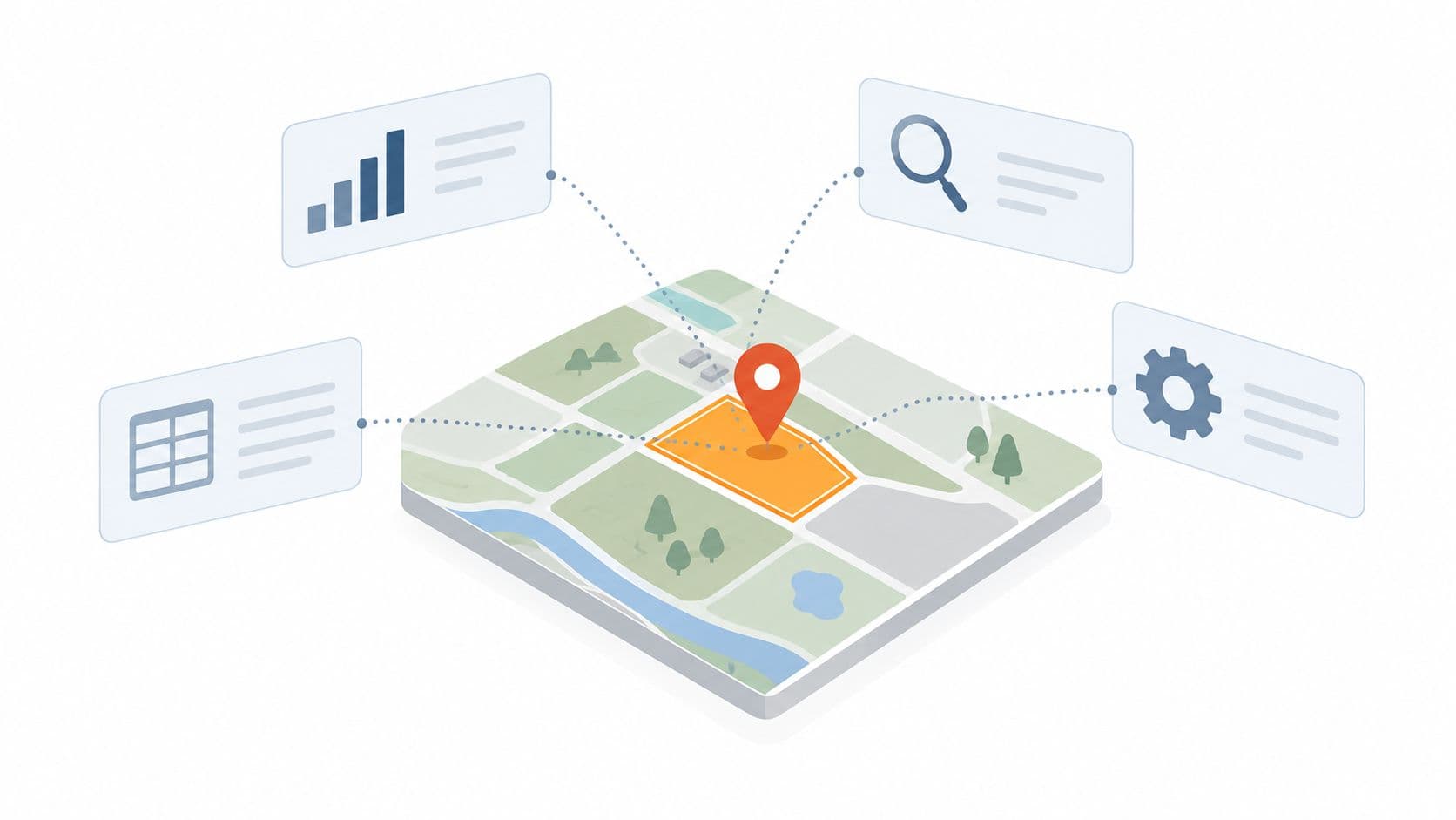
Typing an address into a property website doesn't reveal one definitive land value. It reveals a result produced for a particular purpose, from a particular dataset, on a particular date. An assessor's land value may support taxation, a market estimate may approximate what buyers could pay, comparable-sales analysis may explain the number, and a resource-oriented platform may identify value tied to solar, minerals, carbon, or other uses. Those outputs can all be useful while remaining different.
A reliable land value estimator by address should therefore be judged by more than its headline figure. The important questions are whether it identifies the correct parcel, exposes assessor data, finds comparable sales, separates land from improvements, shows resource and planning constraints, and lets you export evidence for review. Check the valuation date, geographic coverage, land use, zoning, data quality, and whether buildings are included.
This distinction also matters for policy. A land-value tax applies to unimproved land, excluding buildings and other improvements, as explained by the Federal Highway Administration's land-value-tax overview. It isn't the same as a renewable or non-renewable fixed-price lease, and neither should be mislabeled a land-use right. An indefinite land-use right has no expiration, requires no renewal, and is repriced annually, as set out in Unitism's explanation of land value. For broader real-estate workflows, teams may also pair parcel research with AI for real estate agents.
Table of Contents
- 1. Acres
- 2. AcreValue
- 3. LandGate
- 4. Regrid Property App
- 5. CoreLogic RealQuest Professional
- 6. ATTOM Property Navigator
- 7. LightBox Vision
- 8. PropStream
- 9. ParcelQuest
- 10. LandComp AI
- Top 10 Land Value-by-Address Tools Comparison
- Turn an Address Result Into a Defensible Decision
1. Acres
Acres is strongest when the question is, “What do comparable land sales say about this parcel?” rather than, “What single automated number does an algorithm assign to this address?” Its address and APN search brings together parcel boundaries, assessor information, ownership context, zoning, flood and infrastructure layers, and land-sale evidence in a map-first workflow. That structure resembles an appraiser's reasoning more closely than a general home-value AVM.
The platform is particularly useful when selecting comps requires judgment. Filters for acreage, land use, and recency can narrow a broad sales universe, including transactions in non-disclosure states. The result is a working evidence set that a lender, appraiser, investor, or internal reviewer can inspect instead of a black-box output.
Why the workflow matters
A sales-comparison approach is the primary method for land valuation when sufficient sales exist, according to the International Association of Assessing Officers' mass-appraisal standard. Acres fits that logic by making the comparable selection visible and adjustable.
Practical rule: Treat the estimate as a conclusion you build from verified comps, not as a number you accept without review.
The tradeoff is speed versus independence. Acres can assemble the analysis quickly, but it expects the user to verify whether each sale really matches the subject parcel's access, zoning, size, and development potential. Advanced feature pricing isn't publicly listed, so budget suitability needs confirmation directly from Acres.
2. AcreValue
AcreValue is built for agricultural and rural parcels, where soil capability, acreage, land use, and local sales context can matter more than a generic neighborhood average. An address search can surface parcel boundaries, ownership context, soils, sales history, and market information. Those layers help explain why two apparently similar rural properties may support different estimates.
The platform's value lies in connecting location with productive characteristics. An assessor's land value alone may overlook soil differences, agricultural suitability, access, or the distinction between cultivated, pasture, recreational, and development-oriented land. AcreValue helps users examine those factors before selecting comparable sales. The result is better suited to market research than to treating an assessor value as a market conclusion.
A better fit for rural evidence
Its verified-comps workflow and county-level coverage indicators help users judge whether the available evidence is substantial or limited. Educational content also explains the comparable-sales method for users who are not professional appraisers. That distinction matters because the defensibility of a land estimate depends on the relevance and quality of its comparison set.
AcreValue has limits. Urban infill, redevelopment parcels, and unusual non-agricultural sites may require zoning research, entitlement analysis, or a separate local sales review. Some features require a paid tier, and pricing is not fully public. Check parcel and sales coverage against official records and local evidence before relying on an output.
The Unitism guide to mass appraisal methods explains why standardized data can improve consistency without removing local uncertainty. For agricultural or large-lot residential research, start with AcreValue, then test whether its parcel data and comparable-sales assumptions match the property's actual use and highest-and-best-use possibilities.
3. LandGate
LandGate takes a different route from assessor-first tools. It combines address-based parcel reports with estimated land-sale values and resource-oriented indicators for solar, wind, minerals, carbon, and environmental conditions. That makes it relevant when a site's potential depends on more than its conventional vacant-land comparables.
A standard land estimate may reflect observed transactions for similar parcels, but those transactions don't always reveal the full value of a site with unusual energy or natural-resource characteristics. LandGate can help identify those possibilities early, especially for investors, utilities, municipalities, and landowners screening portfolios.
Resource potential isn't market value
A resource index isn't automatically a sale price. Solar exposure, wind conditions, mineral potential, carbon characteristics, or environmental constraints may influence a site's future use, but monetization depends on infrastructure, permits, contracts, financing, access, and actual demand. A parcel report should therefore be read as an additional layer of investigation, not as proof that a resource premium will be realized.
The platform's exportable PDF reports and portfolio features make it practical for screening multiple addresses and communicating findings to stakeholders. Yet low-data areas can produce weaker estimates, and local vacant-land comps remain important. Advanced capabilities are placed behind paid PowerTools, so users should confirm the required access level with LandGate.
For policy work, resource valuation also needs careful separation from site value. A map that identifies natural capital may support scenario analysis, but it shouldn't merge land rent, resource rents, building value, and entrepreneurial returns into one unexplained figure. Unitism's value map illustrates why location-specific land analysis can be useful while still requiring clear definitions.
4. Regrid Property App
Regrid Property App is most useful when the task is to retrieve a parcel record and its assessor-reported land value, rather than generate a standalone market estimate. Its property schema can show land value, improvement value, total assessed value, boundaries, ownership, and use information. Parcel identity matters first: an incorrect address match can make every later comparison unreliable.
The strength is the explicit split
Many public tools foreground total assessed value and make the land-versus-improvement allocation difficult to locate. Regrid is more practical for checking the assessor's stated split, confirming the associated parcel or APN, and reviewing records through a web or mobile interface.
Address and APN searches cover 157M+ parcels, according to Regrid's Property App. That product claim still requires local verification. Confirm that the relevant county is covered and that its land, improvement, ownership, and assessment fields are available.
The assessor's land field answers, “What value does this assessment system assign to the land?” It doesn't automatically answer, “What would a buyer pay for the site today?”
County systems use different update schedules, definitions, exemptions, and assessment practices. Values can lag market conditions, and comparisons across counties may reflect administrative differences rather than real differences in site value. A practical workflow is to use Regrid for parcel identity and assessor data, then check recent vacant-land sales, zoning, access, and the valuation date separately.
The free starter tier can support initial research, while a defensible market conclusion requires evidence beyond the record. Regrid does not replace comparable-sales analysis or a review of resource potential. For policy analysis, keep assessed land value separate from building value and other improvements. The discussion of lot value helps frame that distinction. Use Regrid Property App when record retrieval is the priority, and treat its land value as one evidence point rather than the final answer.
5. CoreLogic RealQuest Professional
CoreLogic RealQuest Professional is aimed at institutional property research rather than casual address lookups. A report can combine assessor land values, assessment metrics, ownership and lien information, sales history, comparable evidence, and optional AVM products. That breadth makes it useful in underwriting, due diligence, and professional valuation workflows where data lineage matters as much as convenience.
The platform's main advantage is the ability to place a land figure inside a wider property record. A land value that looks plausible in isolation may change meaning when the analyst reviews prior transfers, liens, ownership structure, market activity, or the characteristics of nearby sales. RealQuest supports that broader review instead of treating the address as a standalone input.
Built for reviewable decisions
Enterprise users may also need batch processing, integrations, and standardized reporting. Those capabilities can support repeatable workflows across portfolios, but they come with a learning curve and a more complex subscription structure than consumer-facing tools. Costs and access depend on the product configuration, so prospective users should confirm current terms through CoreLogic RealQuest Professional.
An AVM output should remain distinct from an assessor value and a comparable-sales conclusion. Commercial AVM guidance explains that an address report may include both an estimated value and an estimated range, while reliability varies with the model, data, and technology, as described in Cotality's consumer AVM assistance. That is a useful warning for professional users too.
The platform is most appropriate when land research forms part of lending, acquisition, compliance, or valuation due diligence. Analysts studying residual land value should also keep the development residual method separate from an assessor field or an AVM. Unitism's residual land value guide provides a policy-oriented reference for that distinction.
6. ATTOM Property Navigator
ATTOM Property Navigator combines address, owner, and APN search with assessor attributes, comparable properties, AVMs, lists, exports, and developer tools. It suits analysts who want land-related context and broader market indicators in one interface, particularly when the same research process covers many properties rather than one isolated parcel.
Its value lies in triangulation. An analyst can inspect the assessor's land and lot data, review comparable sales, consider an AVM, and export records for further analysis. Those outputs shouldn't be averaged mechanically. They answer different questions and may rely on different dates, definitions, and coverage.
A useful middle ground
Property Navigator has a clearer interface than many enterprise research systems, while retaining options for custom integrations. The product page presents search across 150M+ properties, a quantitative coverage claim that should be checked against the relevant state and county before a project begins. Annual plan pricing is published for professional use, but premium state data and add-ons may carry extra costs.
A persistent limitation is that a pure site-value AVM isn't universal. Land value may appear through assessor fields, while market interpretation still depends on comparable sales and the improvements attached to the parcel. A home-heavy AVM can mislead when the building contributes most of the modeled value or when the lot has unusual development potential.
For teams that need exports or API access, ATTOM Property Navigator is a practical candidate. Validate its parcel identity first, then label each result as assessor, AVM, or comparable-sales evidence in the final analysis.
7. LightBox Vision
LightBox Vision, formerly LandVision, is a mapping and property-intelligence platform for commercial real estate, planning, and site selection. Searching an address opens parcel information that can include assessed value, last sale, ownership, buildings, zoning, demographics, and historical context. That combination is useful because land value often depends on the surrounding network of uses and constraints, not just the parcel's recorded assessment.
A site-selection team may need to compare several addresses, inspect access and development context, and understand how a parcel has changed over time. LightBox is built for that spatial workflow. Its APIs can also provide historical assessed values by land and improvements, which helps analysts study changes rather than relying only on a current snapshot.
Context can be more valuable than a headline estimate
LightBox isn't a dedicated land-only AVM. Detailed land and improvement fields may be absent in some counties, and enterprise pricing can be excessive for occasional users. The platform's strength is the defensible context around a parcel, not a universal promise of a single site-value number.
That distinction matters for development analysis. Zoning, building coverage, demographics, infrastructure, and prior transactions can inform highest-and-best-use assumptions, but they don't replace legal review, local comps, or a professional appraisal when the decision requires one. Data availability should be recorded rather than filled in with assumptions.
Review the current capabilities and access model through LightBox Vision. It makes the most sense for organizations that need mapping, historical records, and collaboration across property, planning, or investment teams.
8. PropStream
PropStream is built around investor research, so its address and APN search connects parcel details with assessor records, comparable sales, analytics, lists, exports, and marketing workflows. For land research, that means a user can retrieve the recorded land-versus-improvement fields and then assemble a market view from nearby sales and property characteristics.
The platform is approachable for non-appraisers because its training content explains how to use maps, filters, and comps. That usability helps with initial screening, especially when an investor is reviewing multiple vacant or underused parcels. It also supports list building and outreach, although those functions matter less when the only task is valuation.
Useful for screening, not automatic certainty
PropStream isn't a dedicated land-only AVM. Users generally combine assessor values with comparable evidence and their own judgment. That can be a strength when the analyst wants to see the underlying records, but it also creates responsibility for checking whether the selected sales match the subject parcel's zoning, access, size, and development status.
Add-ons can raise the total cost if valuation is the only requirement. Coverage and field quality also vary by county, so a national-looking interface shouldn't be mistaken for uniform local data. Before acting, compare the record against the relevant assessor and inspect the sale documents where available.
PropStream is a reasonable option for investors who want valuation evidence inside a broader acquisition workflow. It is less suitable for anyone seeking a single authoritative land-only number without reviewing the supporting data.
9. ParcelQuest
ParcelQuest is the specialist choice for California parcels. It provides assessor-sourced profiles searchable by address or APN, with ownership, assessment, mapping, reports, and explicit land value fields. When the subject property is in California and the objective is to retrieve the assessor's land-versus-improvement allocation, that specialization can be more useful than a broad national product with uneven local fields.
California coverage changes the decision
The service's value is tied to direct county-assessor data and parcel-specific reporting. Its Appraise edition adds vacant-land and historical-search capabilities, which can support a deeper review of land transactions and assessment history. Users should still distinguish the assessor's recorded value from a current market estimate. An official record can be authoritative for what the assessor reported without being a prediction of a sale price.
The central limitation is geographic. ParcelQuest covers California only, and full-feature access requires a subscription whose pricing details aren't fully public. That makes it a focused tool, not a general solution for cross-state portfolios.
Use ParcelQuest when California assessor data is the central requirement. Confirm the parcel's APN, review the assessment date, and supplement the output with zoning, access, environmental constraints, and recent vacant-land sales. A land field without those checks can describe the record accurately while still failing to answer the investment or policy question.
For tax analysis, keep the assessor allocation separate from any modeled site-rental value. The first is an administrative record. The second requires an explicit methodology and assumptions about land use, market evidence, and public value drivers.
10. LandComp AI
LandComp AI focuses directly on vacant-land estimation. After an address or APN is entered, the workflow uses parcel attributes, automated comparable sourcing, similarity scoring, and outlier removal to produce a fast land-specific estimate. Users can adjust attributes interactively to test how sensitive the result is to changes in the subject parcel.
That focus distinguishes it from home-value AVMs, which may model the whole property and give limited attention to the site alone. For an analyst screening vacant parcels, a land-specific output can be a useful first pass before commissioning a fuller valuation or building a manual comp set.
Speed still depends on evidence
The tool works best where recent vacant-land comparables are available. Thinly traded markets, unusual access arrangements, nonstandard zoning, flood exposure, irregular parcels, or distinctive development rights can weaken any automated similarity model. The result should therefore be read alongside the actual sales selected, not as a substitute for inspecting them.
A recent market discussion of address-based AVMs highlights the movement toward APN lookup, AI-assisted comp selection, parcel analysis, and confidence indicators, while also raising concerns about unusual parcels and sparse comparable sales in LandLogic's Studio. Those concerns apply broadly to automated land valuation, including newer purpose-built tools.
LandComp AI's methodology and coverage are still maturing, so users should ask what data supports the estimate, how the range is calculated, and whether local records are current. LandComp AI is best positioned as a screening tool for vacant land, followed by local evidence and explicit review of highest-and-best-use assumptions.
Top 10 Land Value-by-Address Tools Comparison
| Tool | Core features ✨ | Coverage & quality ★ | Value / Pricing 💰 | Target audience 👥 | Unique strength 🏆 |
|---|---|---|---|---|---|
| Acres (Acres.com) | Address/APN search, comps DB, map overlays, exportable reports ✨ | ★★★★☆, >150M parcels; appraiser-style comps | 💰 Paid tiers; advanced pricing not public | 👥 Appraisers, lenders, planners | 🏆 Defensible comps-driven land estimates |
| AcreValue | Parcel lookup, soils & market layers, verified-comps workflow ✨ | ★★★★☆, strong farmland/soil coverage | 💰 Freemium + paid features; some pricing opaque | 👥 Farmers, ag lenders, rural landowners | 🏆 Deep agricultural/soils context for farmland valuation |
| LandGate | Parcel reports + resource indices (solar, wind, minerals, carbon) ✨ | ★★★★☆, useful resource & environmental layers | 💰 Paid “PowerTools” for advanced features | 👥 Cities, utilities, energy investors | 🏆 Monetizable natural-resource value layers |
| Regrid Property App | Assessor land/improvement fields, 157M+ parcels, alerts ✨ | ★★★★☆, fast assessor-sourced land values | 💰 Free starter tier; affordable pro plans | 👥 Analysts, researchers, practitioners | 🏆 Quick retrieval of assessor land-vs-improvement splits |
| CoreLogic RealQuest Professional | Property detail reports, AVMs, batch/enterprise tools ✨ | ★★★★★, enterprise-grade, trusted in underwriting | 💰 Enterprise pricing (higher / complex) | 👥 Lenders, appraisers, underwriting teams | 🏆 Deep data lineage & underwriting-ready reports |
| ATTOM Property Navigator | Assessor + AVMs + comps, exports & APIs ✨ | ★★★★☆, 150M+ properties; market indicators | 💰 Annual plans published; reasonable for pros | 👥 Analysts, developers, data teams | 🏆 Modern UI + published pricing + developer API |
| LightBox Vision (LandVision) | Mapping, zoning/demographics layers, historical data, APIs ✨ | ★★★★☆, enterprise mapping for CRE/planning | 💰 Enterprise pricing; higher cost | 👥 CRE, planners, site-selection teams | 🏆 Rich context layers and historical parcel data |
| PropStream | Address/APN, assessor records, comps, exports & marketing tools ✨ | ★★★★☆, practitioner-oriented with training | 💰 Mid-tier subscription; add-ons increase cost | 👥 Investors, wholesalers, agents | 🏆 Strong usability + marketing/export toolset |
| ParcelQuest (CA only) | California assessor profiles, APN maps, explicit land value fields ✨ | ★★★★☆, authoritative CA assessor data | 💰 Subscription required; CA-only | 👥 California professionals, assessors | 🏆 Direct, current CA county assessor data |
| LandComp AI | Vacant-land AVM, automated comp sourcing & similarity scoring ✨ | ★★★☆☆, fast land-specific estimates; newer coverage | 💰 Paid product; methodology still maturing | 👥 Screeners, developers, planners | 🏆 Rapid, land-focused automated valuation for vacant lots |
Turn an Address Result Into a Defensible Decision
The best tool depends on the question, not on which platform produces the highest figure. If you need the assessor's recorded allocation, Regrid or ParcelQuest may be more direct. If you need a comps-driven market opinion, Acres, AcreValue, or LandComp AI may offer a better starting structure. If resource potential matters, LandGate adds layers that conventional parcel tools may omit. If the work involves underwriting, mapping, APIs, or portfolio research, RealQuest, ATTOM, LightBox, or PropStream may be more appropriate.
A defensible workflow starts before the estimate appears.
- Identify the parcel: Confirm the address, APN, boundary, legal description, and whether the search returned the intended lot rather than a nearby building or merged record.
- Record the date: Save the valuation date, assessment date, sale dates, and the platform's stated update timing.
- Classify the output: Label each result as assessor value, comparable-sales analysis, AVM, or resource-oriented evidence.
- Separate components: Inspect land, improvements, total assessed value, and any estimate that includes the full property.
- Test highest-and-best-use: Review zoning, access, flood risk, soils, infrastructure, environmental constraints, and development rights.
- Audit the comps: Check whether the sales share the subject parcel's use, size, location, market conditions, and development characteristics.
- Export the evidence: Preserve reports, maps, selected comps, assumptions, and data gaps so another person can reproduce the conclusion.
The IAAO standard on mass appraisal explains why standardized procedures, common data, and statistical testing are useful for valuing groups of properties uniformly. That consistency doesn't remove uncertainty. Commercial AVM guidance says reliability varies with model logic, data, and technology, and a major property-data platform describes hyperlocal price indices built at census-block level with sales history reaching up to 30 years in its model. Hyperlocal modeling can improve relevance, but it still depends on the quality and availability of local transactions.
France's public Demande de valeurs foncières service shows how address-based valuation can become shared public infrastructure. Users can search by address or map and review the last 5 years of sales data, including price, sale date, property type, room count, and area, with median price per square meter by region and city. That example demonstrates the value of accessible transaction records, but it doesn't make every address result a formal appraisal.
Policy analysis requires another layer of discipline. A land-value tax is an annual public levy on the value of unimproved land, so its base excludes buildings and other improvements. A lease is contractual. Renewable and non-renewable fixed-term land leases charge a fixed price during the term, then handle risk differently at expiry. A renewable lease provides certainty only until renewal, when the accumulated gap between the fixed lease rate and market value can be closed through major repricing. A non-renewable lease becomes progressively harder to refinance and sell as expiration approaches. Fixed leases postpone risk rather than pricing it continuously.
A land-use right isn't just another name for a fixed lease. The term is accurate only where the right is repriced each year, requires no renewal, and doesn't expire. Because it is indefinite and annually repriced, it can be transferred without the same expiry-related refinancing problem associated with fixed-term contracts. A land-value tax, a fixed-price lease, and an annually repriced indefinite land-use right are therefore separate instruments with different legal, fiscal, and economic effects.
A valuation framework can support land-value capture, fiscal modeling, and public-service funding only when it separates land from labor and capital. That means documenting whether the model estimates market sale value, site rental value, assessed value, or resource potential. Unitism is one policy-oriented organization working on land valuation methods, fiscal modeling, implementation support, and interactive scenario analysis. Its tri-factor economics framework distinguishes labor, capital, and nature, which is relevant when analysts need to model who gains, who pays, and how a land-based charge could affect productive activity.
The final selection should be based on evidence needs. Choose the tool that makes parcel identity, data source, uncertainty, land-improvement allocation, and assumptions easiest to inspect. Then use local records and professional review when the decision involves lending, taxation, acquisition, litigation, or public policy.
Unitism® offers land valuation assessments, site-rental estimation, policy design, fiscal and distributional modeling, implementation support, and interactive tools for exploring how land value shapes economic outcomes. If your address-based research needs to become a land-value capture or reform analysis, visit Unitism® to review its methods and advisory resources.