Nature vs city compared across ecology, economy and housing. See trade-offs, land-value policy options and planning choices that shape better places.
September 13, 2026
Nature vs City Trade Offs for Housing and Land Policy
Nature vs city compared across ecology, economy and housing. See trade-offs, land-value policy options and planning choices that shape better places.
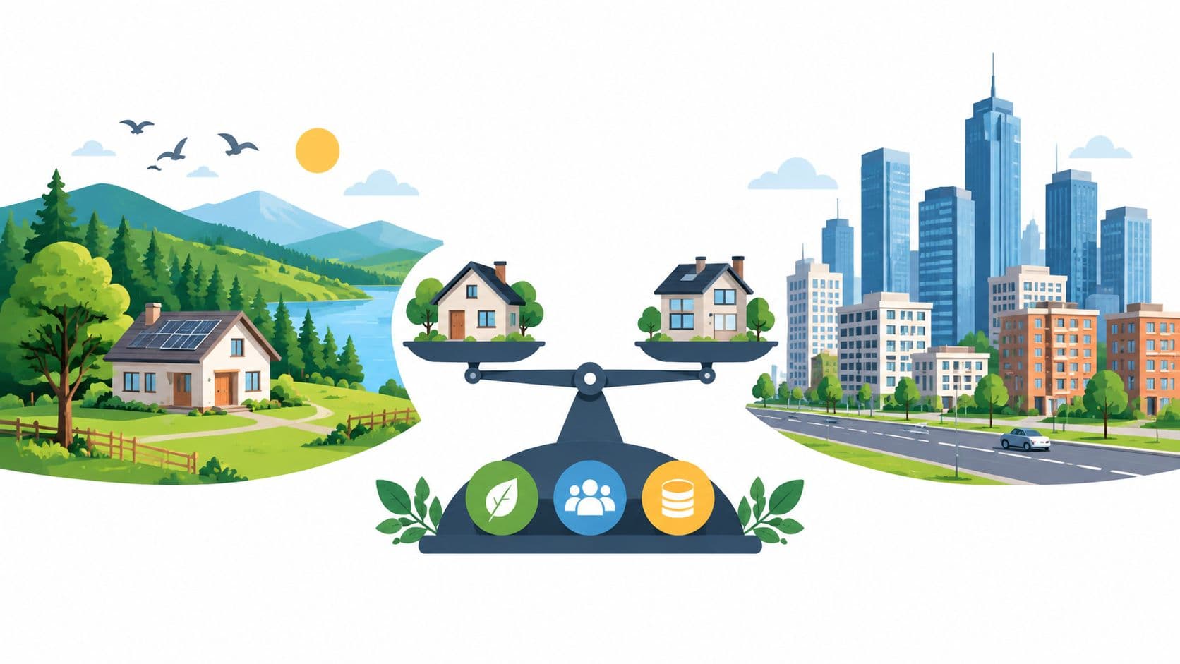
In 2025, cities housed 45% of the world's 8.2 billion people, more than double their 20% share in 1950. Include towns, and urban settlements account for 81% of the global population, with cities representing 45% and towns 36%, according to the United Nations World Urbanization Prospects. Nature vs city is therefore no longer a lifestyle debate between parks and buildings. It's a question about where people live, how governments finance services, and whether land policy encourages compact growth or pushes development into farms, forests, and other ecosystems.
Table of Contents
- Introduction Why Nature vs City Choices Now Shape Policy
- Understanding What Nature and City Mean in Planning Terms
- Detailed Comparison of Ecological Social and Economic Trade Offs
- How Density Green Space and Biodiversity Can Align
- Land Value Policy Levers That Shape Nature vs City Outcomes
- Real World Scenarios for Housing Planning and Conservation
- Choosing the Right Balance for Your Community and Next Steps
Introduction Why Nature vs City Choices Now Shape Policy
City officials face a linked set of decisions. Housing agencies must decide whether to accommodate growth through infill or outward expansion. Planning departments must weigh density against heat, congestion, and access to open space. Finance ministries must consider how land values arise from public infrastructure and community growth, then determine whether public revenue captures enough of that value to fund services.
The land question sits beneath each choice. A building is capital. The work performed inside it is labor. The location itself is nature, even when a site is paved, serviced, or surrounded by towers. Tri-factor economics keeps those categories separate, which matters because taxing construction or employment can discourage productive activity, while a charge on land value targets the benefit associated with a scarce location.
The physical scale of urban expansion makes this distinction urgent. The Food and Agriculture Organization's analysis of urban expansion estimates global urban growth at about 20,000 km² per year, with roughly 80% occurring on agricultural land. A separate FAO synthesis reports that more than 145,000 km² shifted to urban or artificial uses between 2000 and 2014, representing a 23% increase in urbanization in five years. City growth changes land use, not just population counts.
This briefing is designed for municipal governments, planning departments, housing agencies, finance officials, researchers, and civic organizations. It compares ecological function, social livability, economic productivity, and fiscal design without treating either nature or density as an automatic answer. Guidance on designing with nature is useful here because good policy must connect physical design with incentives and public value.
A concise decision lens helps:
| Policy question | Nature-first concern | City-first concern | Better test |
|---|---|---|---|
| Where should growth go? | Habitat and farmland conversion | Housing access and infrastructure efficiency | Compare infill capacity with ecological constraints |
| How should land be priced? | Conservation and low-impact use | Productive urban use | Charge for location value without penalizing buildings |
| How should green space be delivered? | Biodiversity and ecological continuity | Access, safety, and maintenance | Measure distribution, function, and long-term cost |
| How should public revenue be raised? | Protect shared natural value | Fund services near value creation | Capture land value while reducing pressure on work and capital |
The practical conclusion is straightforward. Nature vs city is best understood as a land-allocation and land-pricing problem, not a binary choice between green space and density.
Understanding What Nature and City Mean in Planning Terms
Planning discussions become confused when "nature" means both untouched habitat and a designed plaza, or when "city" means both a dense neighborhood and a low-density subdivision. A useful vocabulary distinguishes natural, urban, and hybrid environments according to ecological function, built intensity, and governance.
Natural areas have limited human intervention and support ecological processes such as habitat formation, water regulation, and species interaction. Urban areas concentrate buildings, infrastructure, jobs, and residents. Hybrid environments include peri-urban farmland, urban forests, greenbelts, restored wetlands, community gardens, and green infrastructure woven through developed districts.
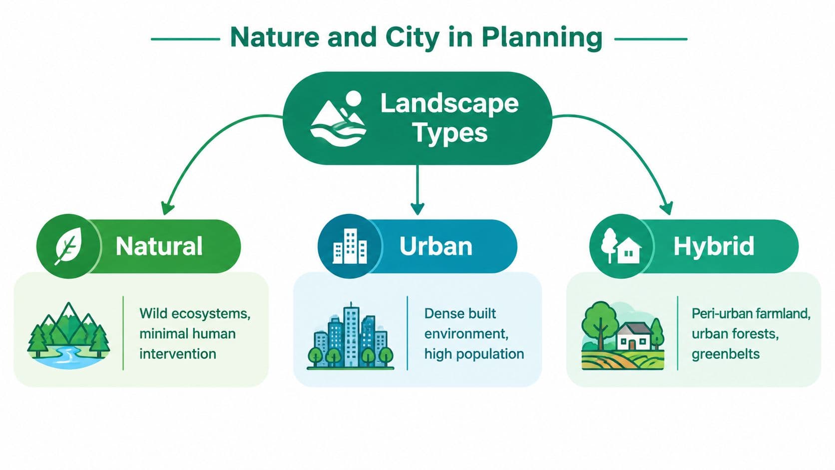
The three categories overlap in practice. An urban forest can provide habitat while also shading streets. Peri-urban farmland can produce food, absorb rainfall, and face intense pressure from speculative development. A compact district can have high economic output while remaining ecologically poor if it lacks canopy, permeable surfaces, or connected habitat.
Three lenses for evaluating land
Ecological function asks what a area does for living systems. Does it maintain habitat, support biodiversity, moderate heat, retain water, or connect fragmented ecosystems?
Social livability asks who can reach and use the benefits. A green corridor that improves biodiversity but is unsafe, inaccessible, or concentrated in affluent neighborhoods produces an incomplete public outcome.
Economic productivity asks how land supports work, housing, firms, and public revenue. Density can lower the land area needed for infrastructure and bring workers and firms closer together, but it can also intensify heat and raise the value of well-located sites.
Land connects all three lenses. Its location value reflects accessibility, public investment, environmental qualities, and community activity. Buildings and infrastructure improve a site, but they don't create the underlying scarcity of a central or well-served location. That distinction supports a more disciplined approach to land-use policy.
The tri-factor mental model
Labor supplies human effort. Capital includes buildings, equipment, and infrastructure. Nature includes land and the wider ecological systems that support life and production. These factors interact, but they aren't interchangeable.
A planning decision that protects a wetland preserves ecological function. A zoning decision that enables housing near transport changes the value of nearby land. A tax on construction can make infill less attractive, while a charge on site value can encourage owners to use well-located land more intensively. The same parcel can therefore carry environmental, social, and economic significance at once.
Officials should ask three separate questions before approving a project:
- What happens to ecological function?
- Who receives access and who bears the costs?
- How does the policy change the price and use of land?
That separation prevents a common error, treating a building's economic output as proof that every form of urban expansion is efficient.
Detailed Comparison of Ecological Social and Economic Trade Offs
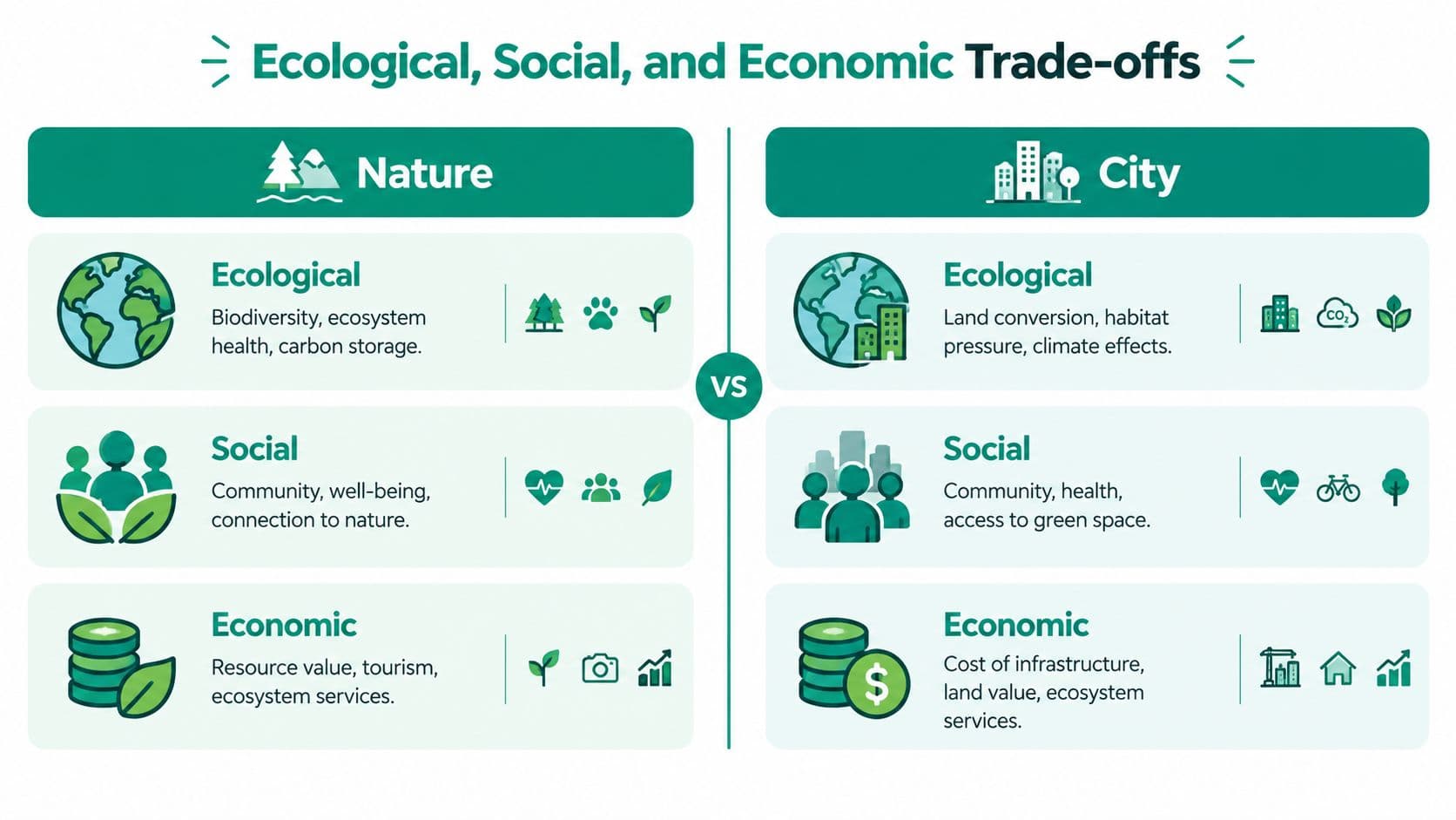
The nature versus city choice is a land-allocation problem with ecological, social, and fiscal consequences. Natural areas and urban areas provide different combinations of services, access, and economic capacity. Officials should compare those outcomes by site and by land-pricing mechanism, rather than treating either category as uniformly beneficial or harmful.
Ecological trade-offs
Urban expansion converts land and can divide continuous habitat into isolated pieces. Evidence on agricultural land conversion shows why outward growth affects areas beyond municipal boundaries. A city may protect a central park while permitting peripheral expansion, preserving visible greenery but transferring ecological costs to farmland and rural ecosystems.
Developed areas can also support ecological repair. Urban forests, connected greenways, restored waterways, and native planting improve ecological function within built-up districts. These measures cannot replace every function of a large natural system, but they can reduce heat, manage stormwater, and reconnect habitat.
Canopy offers a measurable example. A Nature Cities analysis of urban tree canopy and heat modeled a 30% increase in canopy cover as reducing mean hotspot temperatures by 1.5 °C on average. The strongest canopy effect explained about 57% of observed temperature variation, while best-case cooling reached 8.2 °C in hotspots. The analysis also found a significant negative relationship between canopy and surface temperature, with Spearman ρ = -0.49.
Planning implication: Dense development and canopy can coexist, but canopy should be directed toward areas with the greatest heat exposure, not installed only where land is easiest to acquire.
Social trade-offs
Nature supports health, recreation, identity, and social connection, but physical access determines who receives those benefits. A large regional reserve may have high ecological value while remaining difficult to reach for residents without time, transport, or safe routes. Small, distributed green spaces can provide more equal everyday access, although they require continuing management.
Urban density places homes, services, employment, and public transport closer together. It can also expose residents to heat, noise, overcrowding, and limited private space. Equity analysis should therefore assess both the amount of green infrastructure and the distribution of its benefits.
Land pricing shapes these outcomes. If well-located sites receive higher values from public transport and public services, policies that capture part of that value can help fund accessible parks and infrastructure. Lease terms or annual land-use rights can also make conservation and infill more attractive than holding serviced land vacant or extending development outward.
Economic trade-offs
Compactness can support productivity. Evidence summarized by the World Bank's work on density and agglomeration associates a doubling of city density with roughly a 4% wage premium, while another comparative estimate associates a doubling of density with about a 10% increase in sales per worker on average. These relationships make density economically relevant, but they do not justify every high-density project. Heat, land competition, displacement, and infrastructure capacity still matter.
Natural systems generate economic value through services that markets often underprice. Shade can reduce heat exposure, vegetation can support water retention and habitat, and conservation can prevent costly conversion. The fiscal challenge is that benefits are widely shared while protection costs may fall on particular owners or agencies.
A sound comparison asks which land pattern delivers the required housing, ecological, and fiscal outcomes at the lowest total cost. Site-value capture, leases, and annual land-use rights change that calculation by aligning private returns with public land-use goals.
How Density Green Space and Biodiversity Can Align
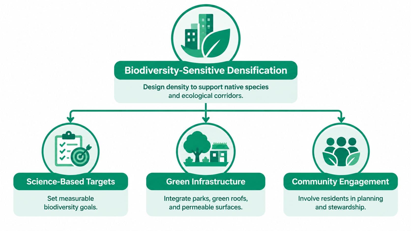
Density and biodiversity are often presented as opposites. That framing is increasingly inadequate. The BIODENCITY project is explicitly examining how density and biodiversity can align through open datasets, interactive maps, and planning guidance. The Science Based Targets Network's city guidance also places land-use development and sprawl at the center of urban nature priorities.
The policy question has shifted from “Should the city be dense or green?” to “How can growth reduce pressure on surrounding ecosystems while improving ecological function inside the urban fabric?”
Design density around ecological function
Biodiversity-sensitive densification starts with the site, not a generic green label. Planners can map habitat connections, existing canopy, waterways, heat exposure, and areas suitable for restoration before selecting development intensity. Buildings can then be arranged to protect corridors, retain mature trees where feasible, and integrate roofs, courtyards, streets, and public spaces into a connected ecological network.
Three-dimensional greening expands the available design space. Green roofs, planted façades, shaded streets, and layered vegetation can support habitat and comfort where ground-level land is scarce. These features still need engineering, maintenance, and public access standards. A green wall that fails after poor maintenance isn't an ecological strategy, it's an unfunded asset.
Practical training can help architects, planners, and project teams apply these principles. For professionals working across design and construction, courses for AEC professionals offer a way to build relevant knowledge around green architecture and delivery.
Account for disservices and unequal access
More nature isn't automatically better in every location or form. A BioScience review of urban biodiversity argues that urban biodiversity can create disservices, including potential infectious-disease risks, and calls for balancing benefits with risks. Nature-inclusive architecture can support stress reduction, cognition, and social cohesion, but it can also raise concerns about hygiene, safety, wildlife disturbance, maintenance, accessibility, and social equity.
Officials should attach management plans to green infrastructure approvals. Those plans should identify responsible agencies, maintenance funding, safety requirements, access standards, and monitoring indicators. They should also ask whether a project shifts costs into neighborhoods with fewer resources.
The smart-growth principles approach is strongest when it combines compact land use with measurable ecological targets. Density can preserve surrounding land only if the urban form is livable, the benefits are accessible, and the land market doesn't reward speculative vacancy or peripheral expansion.
Land Value Policy Levers That Shape Nature vs City Outcomes
Physical design cannot determine nature versus city outcomes on its own. Land pricing shapes whether owners hold central sites idle, develop serviced parcels, or seek cheaper land at the urban edge. Site-value taxation captures part of the location value created by community activity and public investment. It can support public finance while placing less pressure on buildings, wages, and productive capital. A comparison of site-value taxation and property taxation clarifies why taxing land value can produce different development incentives from taxing improvements.
Land leases and land-use rights require precise definitions. A land lease is a fixed-term arrangement, renewable or non-renewable, at a fixed price. A true land-use right, as defined here, is indefinite, requires no renewal, never expires, and is repriced annually. Some fixed leases are described as land-use rights, but an instrument that expires or requires renewal remains a lease.
Fixed leases postpone risk
A renewable lease provides certainty only until its term ends. If its rate falls below market value, renewal can close the accumulated gap through a major repricing event. A non-renewable lease becomes harder to refinance and sell as its remaining term shortens.
Fixed leases therefore defer risk instead of pricing it continuously.
China provides a concrete fixed-term example. State-owned land is typically granted for 70 years for residential use, 50 years for industrial use, and 40 years for commercial use, according to legal guidance on entering a lease agreement in China-20230228.pdf). These are fixed terms, not land-use rights that are repriced annually.
An academic analysis of expiring Chinese land-use rights states that reacquisition for a new term can require payment equal to the then-current fair market value of the upcoming term. It also examines proposals to reassess annual fees as property values change. That contrast shows why renewal can create abrupt repricing rather than gradual adjustment. A legal overview of China's land law distinguishes grants, which involve a substantial down payment plus a small annual fee, from leases, which involve higher annual rent without a large upfront payment.
Annual repricing changes the incentive
A recurring land-rent model links the charge to current site value rather than to a historic fixed price. A Lincoln Institute analysis of publicly owned land in China describes annual land rent as an alternative to a one-time leasing fee, with auctions determining the annual amount.
| Feature | Fixed Term Land Lease | Indefinite Land Use Right |
|---|---|---|
| Duration | Ends at a stated term or requires renewal | No expiration |
| Price | Fixed for the agreed term | Repriced annually |
| Risk | Accumulates until refinancing, sale, or renewal | Adjusts continuously through annual valuation |
| Transfer | Can become harder to refinance or sell as the term shortens | Can be bought and sold at lower transaction cost |
| Planning effect | May encourage delay, speculation, or abrupt repricing | Prices location more continuously |
| Burden on enterprise | Can require a large upfront payment or create renewal uncertainty | Does not burden productive enterprise with a fixed-term expiry |
The distinction also affects conservation. A land-value tax or annual land rent can make underused, well-located sites more costly to hold, encouraging infill. Remote land with low market location value may remain less attractive for development, although zoning and conservation rules are still needed to protect ecological function. Pricing cannot substitute for environmental regulation, but it can reduce incentives for leapfrog expansion.
For practical land-management context, guidance on eco land clearing Newcastle Lake Macquarie shows why site preparation must account for ecological constraints rather than treating clearing as a purely construction-led activity. The fiscal principle is direct: price the location value, protect ecological function, and avoid taxing the improvements that make housing and productive activity possible.
Real World Scenarios for Housing Planning and Conservation
Policy choices become clearer when officials apply the framework to actual planning situations. The same instrument can produce different results depending on land supply, ecological sensitivity, infrastructure capacity, and administrative strength.
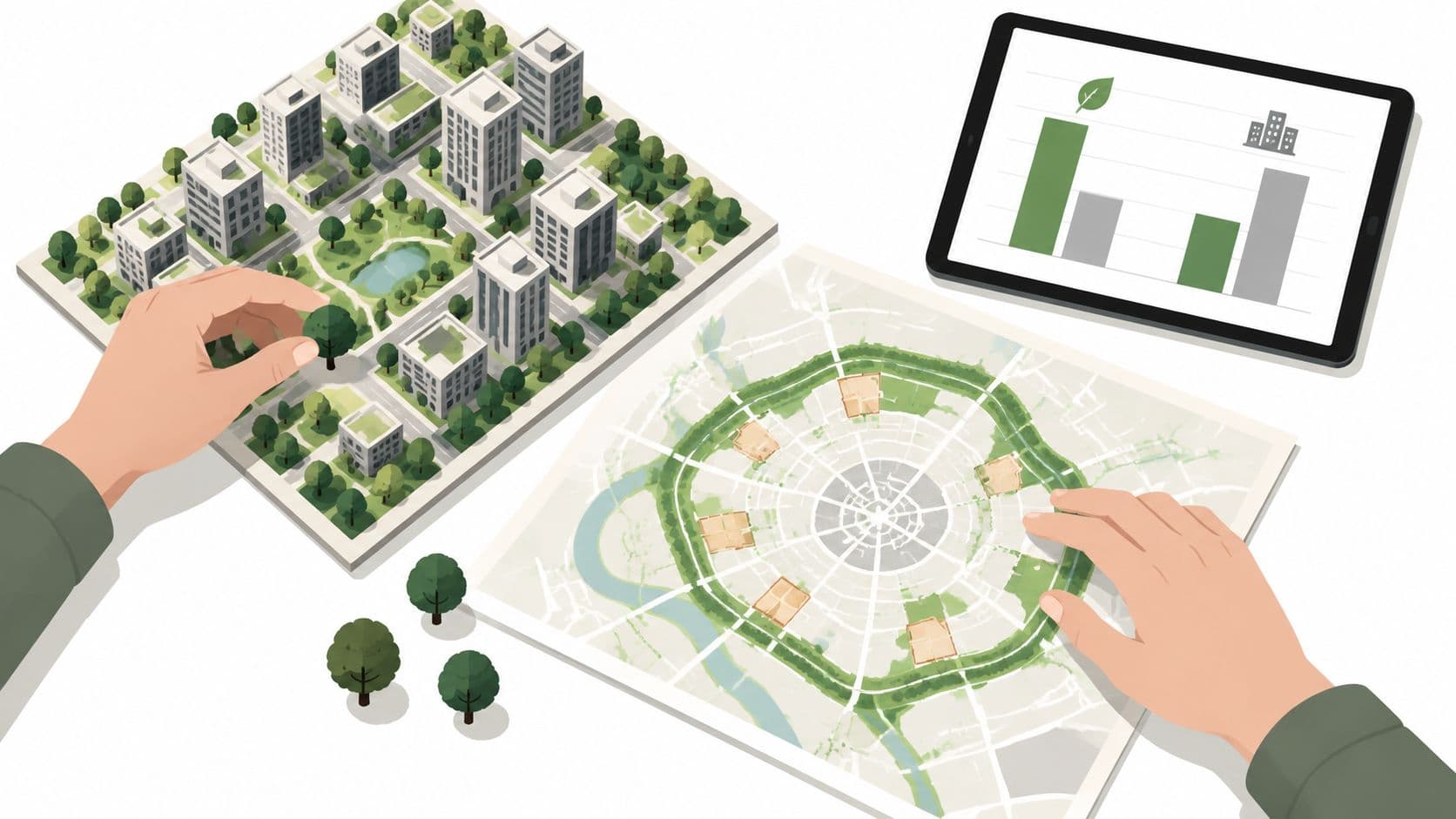
A growing metro weighs a greenbelt against infill
A metropolitan government may face pressure to expand a greenbelt while housing demand rises. Protecting the belt can prevent conversion, but if serviced sites inside the existing urban area remain idle, outward pressure may continue. Officials should first map vacant and underused land, infrastructure capacity, heat exposure, and ecological corridors.
A site-value charge can make centrally located underuse less attractive without taxing new buildings. The city can pair that measure with predictable approvals, targeted infrastructure, and permanent protection for ecologically critical land. The objective isn't maximum density everywhere. It's efficient density where services already exist, conservation where ecological function is irreplaceable, and transparent pricing between the two.
A housing agency addresses idle sites
A public housing agency may control land that is well located but difficult to develop. A fixed lease can create uncertainty at renewal or make the initial transaction costly. An annually repriced, indefinite land-use right can separate access to the site from a large upfront payment, while the recurring charge reflects location value.
The agency still needs affordability safeguards, design standards, and a way to prevent the land charge from undermining viable housing. A community land trust may also help hold land for long-term affordability. Officials exploring that model can use what a land trust is as a starting point for understanding shared ownership and stewardship structures.
A heat-prone district needs canopy
A dense neighborhood with limited shade may not need outward expansion. It may need canopy, permeable surfaces, shaded walking routes, and better maintenance. Officials should prioritize locations with high heat exposure and low access to cooling green spaces, then monitor whether investments reach residents most at risk.
The canopy evidence shows that placement and scale matter. Planting trees in already green districts may improve those districts further while leaving hotspot neighborhoods exposed. A fair program combines ecological performance with distributional analysis, maintenance funding, and access.
Choosing the Right Balance for Your Community and Next Steps
There is no universal nature vs city formula. A community with abundant serviced land may prioritize compact development and habitat corridors. A constrained city may need vertical growth, canopy, and carefully managed public space. A region facing speculative vacancy may benefit from site-value taxation or annual land rent before it considers peripheral expansion.
Use four tests:
- Affordability: Does the policy make well-located land available for housing without penalizing construction?
- Fiscal resilience: Does public revenue reflect land value created by community investment?
- Climate adaptation: Does green infrastructure target heat and ecological function where need is greatest?
- Biodiversity: Does growth protect connected habitat and avoid shifting conversion into surrounding ecosystems?
Choose site-value taxation when the government has reliable valuation capacity and wants recurring revenue from location value. Consider annually repriced, indefinite land-use rights when public ownership or land allocation can support low-cost transfer without renewal cliffs. Use fixed leases cautiously, because their apparent stability can conceal future repricing or declining transferability.
Implementation should begin with parcel data, valuation methods, ecological mapping, fiscal modeling, and public education. Then pilot the approach in a district where officials can compare infill, conservation, canopy, and revenue outcomes before scaling. The strongest policy doesn't choose nature over city. It creates a compact, livable urban pattern that preserves natural systems by pricing land use fairly.
Unitism® helps governments and organizations assess land values, design land-value capture policies, model distributional and fiscal effects, and plan implementation around housing, conservation, and public finance. Visit Unitism® to explore practical tools and policy support for aligning land pricing with compact development and ecological stewardship.