Learn how to determine value of land using mass appraisal and residual methods, and discover how accurate valuation enables equitable site-value taxation.
September 25, 2026
How to Determine Value of Land for Reform
Learn how to determine value of land using mass appraisal and residual methods, and discover how accurate valuation enables equitable site-value taxation.

The most popular advice on how to determine value of land starts with a formula. That's the wrong starting point. Land value isn't a fixed attribute waiting to be calculated. It's an evidence-based judgment about what a site can support, what buyers will pay, how access is legally structured, and which use represents the site's highest and best use.
That distinction matters in a private sale, but it matters even more for a municipality designing a land-value tax. An appraisal that works for one vacant parcel may fail across a whole jurisdiction. Public authorities need a repeatable system that separates land from buildings, applies consistent dates and data, and explains uncertainty instead of hiding it behind a precise-looking figure.
Table of Contents
- Rethinking Land Value Beyond Simple Formulas
- Executing a Rigorous Valuation Workflow
- Selecting the Right Valuation Method
- Navigating Land Leases and Land-Use Rights
- Translating Valuation into Site-Value Taxation
- Implementing Land Value Reform in Practice
Rethinking Land Value Beyond Simple Formulas
A parcel doesn't have one universal value independent of context. Agricultural land, redevelopment land, urban infill land, and a site held under a short remaining lease each produce different evidence and different risks. The practical question is not just, “What is this land worth?” It's, “Which value is being estimated, for which use, under which legal and market conditions?”
The recognized framework includes six land-valuation methods: sales comparison, ground-rent capitalization, cost of development, allocation, extraction, and land residual. The Lincoln Institute's land-valuation discussion explains why method selection depends on the evidence available and the land's highest and best use. A method isn't sound merely because its arithmetic is simple.
Highest and best use controls the analysis
A site's current use may not be its economically relevant use. A low-intensity activity on land with stronger development potential can produce an income stream that understates the site's market value. Conversely, a theoretical development scheme may overstate value if planning constraints, access problems, environmental conditions, or financing make it unworkable.
A professional analysis therefore tests whether a proposed use is:
- Physically possible, given the site's size, shape, access, topography, drainage, and services.
- Legally permissible, under zoning, planning rules, easements, title restrictions, and environmental regulation.
- Financially feasible, after accounting for construction, infrastructure, finance, marketing, holding costs, and developer profit.
- Maximally productive, compared with realistic alternatives.
This is why a sales comparison result can be misleading when comparable parcels had different permissions or development expectations. A price per area may look comparable while embedding a very different set of rights.
Practical rule: Treat the unit price as an output of the analysis, not as the analysis itself.
The same discipline applies to site rental value. A land-value tax needs an estimate of the value attributable to the site, not a blended figure that includes buildings and other private improvements. A useful primer on what land value means in economic terms can help separate the underlying site from the capital placed on it.
Why one formula fails
The sales comparison approach is usually preferred when enough recent, arms-length sales of similar vacant land exist. Those transactions reveal what buyers paid, but only after adjustments for location, size, access, planning status, services, timing, and other material differences.
When comparable sales are scarce, the valuer needs a different lens. Development land may be analyzed through a residual calculation. Income-producing land may support ground-rent capitalization. An improved parcel may require extraction or allocation to isolate the land component.
The result should be a reconciled conclusion, not a mechanical average. A strong valuer explains why one indication deserves more weight, what assumptions drive the result, and where the estimate is vulnerable.
Executing a Rigorous Valuation Workflow
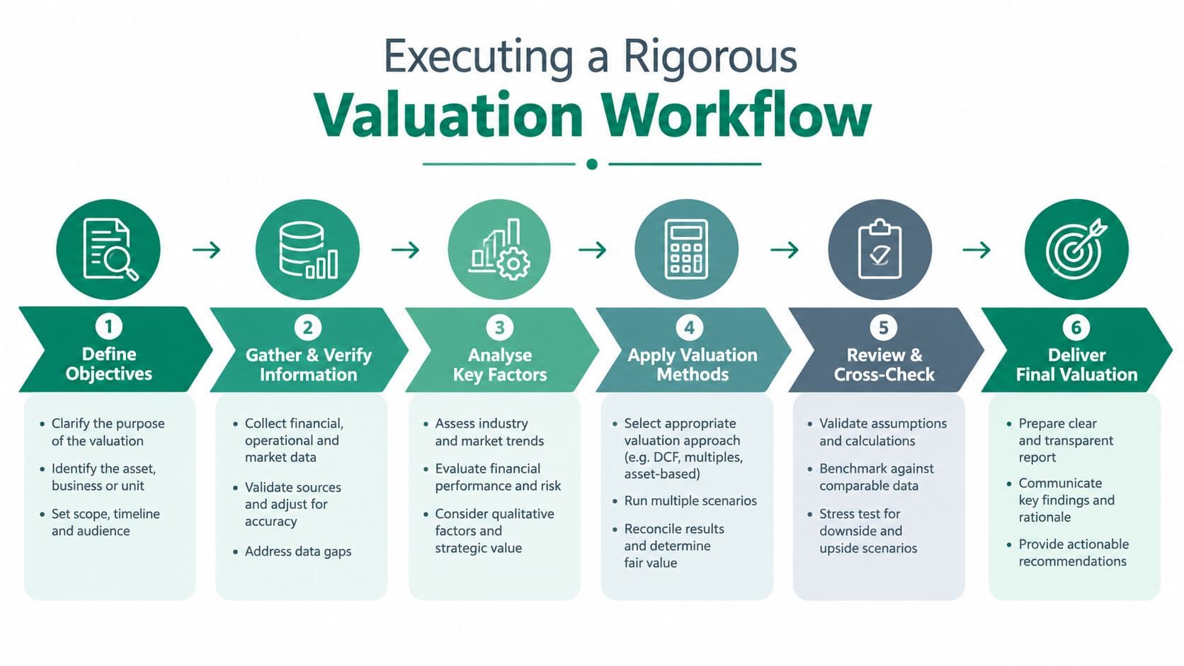
Before choosing a method, establish the assignment. A defensible valuation begins by defining the property rights, valuation date, intended use, relevant market, and question the estimate must answer. A tax assessment, acquisition decision, compensation claim, development appraisal, and private negotiation may require different assumptions even when they concern the same parcel.
The formal workflow described in the appraisal process guidance follows a disciplined sequence: define the problem, survey and plan, collect and analyze general and specific data, apply valuation approaches, reconcile the indications, and issue a final value conclusion. For land, the site is first considered as vacant, then compared with similar vacant parcels while physical characteristics and highest-and-best-use analysis shape the reconciliation.
Build the evidence before the model
A municipal team should separate general market data from property-specific data. General data describes the wider economy, planning environment, infrastructure network, and relevant land market. Specific data describes the parcel itself and the rights attached to it.
A practical file should address:
- Identity and boundaries. Confirm the cadastral reference, surveyed area, title, ownership interests, easements, covenants, and access rights.
- Physical conditions. Record topography, soil, drainage, flood exposure, contamination indicators, vegetation, frontage, services, and development constraints.
- Legal and planning status. Verify zoning, permitted uses, density, setbacks, heritage controls, infrastructure obligations, and current applications.
- Market evidence. Screen transactions for arm's-length status, date, motivation, financing conditions, property rights conveyed, and the buyer's expected use.
- Use scenarios. Test current use and credible alternatives, rejecting schemes that aren't legally permissible or financially feasible.
- Reconciliation. Compare the indications, document weighting, and state assumptions and uncertainty clearly.
The weakest files often contain plenty of data but no decision rule. A database of transactions does not tell the assessor which sales are comparable. A complex model can still produce a poor result when the cadastral area, planning status, or improvement classification is wrong.
Move from individual appraisal to mass appraisal
Governments rarely value a tax base one parcel at a time using wholly bespoke reports. Modern systems increasingly use mass appraisal, which values many properties together at scale through standardized data and methodologies. The Welsh review of land-valuation methods describes this approach and also discusses formula-based administrative values, such as a value per square metre, as a transparent alternative.
Queensland provides another operational example. Its government states that land is valued through mass appraisal at a common date to support fairness and consistency, using unimproved value for rural land and site value for most other land. Those categories matter because the assessment basis must identify what belongs to the land and what belongs to private improvements.
A credible mass-appraisal workflow should include:
- A common valuation date, so owners aren't assessed against shifting market conditions.
- Standardized property attributes, including location, area, access, planning status, services, and relevant site constraints.
- Market segmentation, so rural, residential, commercial, industrial, and redevelopment land aren't forced into one model.
- Quality control, including outlier review, sales validation, model diagnostics, and appeal analysis.
- Transparent documentation, so taxpayers and elected officials can understand the principal value drivers.
Municipalities developing this capacity can use mass-appraisal methods and workflows as a policy reference, but the governing principle is straightforward: standardization should improve consistency without concealing local differences.
Selecting the Right Valuation Method
The sales comparison approach is the first choice when the market offers enough recent, arms-length sales of genuinely comparable vacant parcels. The valuer adjusts for differences in location, size, shape, access, planning permissions, services, timing, and other rights. The method works because it anchors the estimate in observed behavior, but it fails when the supposedly comparable sales reflect different development expectations or unusual motivations.
A municipality shouldn't force every parcel through that method. A thin market requires alternative indications and careful reconciliation.
| Method | Best Used When | Key Adjustment Factor |
|---|---|---|
| Sales comparison | Comparable vacant-land sales are sufficiently available | Differences in rights, timing, location, and highest and best use |
| Ground-rent capitalization | The site produces or supports a reliable ground rent | Rent definition, capitalization rate, lease terms, and risk |
| Land residual | A feasible development scheme can be modeled | Finished value less all development costs, finance, and profit |
| Allocation | Improved sales provide a credible land-to-total-value relationship | Local ratio evidence and improvement differences |
| Extraction | The improvement value can be estimated independently | Depreciation, obsolescence, and the reliability of the improvement estimate |
| Cost of development | Development or subdivision costs are central to the use case | Infrastructure, approvals, timing, finance, holding costs, and profit |
Use the residual method carefully
For development land, the residual method estimates the value of the completed scheme and subtracts the costs required to create it. Those costs include construction, infrastructure, professional fees, approvals, marketing, finance, holding costs, and developer profit. The remainder is the indicated site value.
The logic is simple. The assumptions are not.
A small change in the permitted scheme, sale prices, construction costs, delivery timing, financing terms, or required profit can materially change the residual. The valuer must therefore test realistic scenarios rather than present one optimistic scheme as fact. Guidance on residual land value is useful for understanding the relationship between completed value, development expenditure, and the site remainder.
Separate the site from improvements
Mixed-use and developed parcels create a classification problem. A price paid for a property may include the land, buildings, paving, drainage, clearing, utility connections, landscaping, and other site work. If those components aren't separated, a government may tax or value private capital as if it were the underlying site.
Queensland guidance distinguishes unimproved value for rural land from site value for most other land. It states that site value includes land-preparation improvements but excludes structural improvements such as houses and fences, as explained in the government valuation lesson. The precise legal definition varies by jurisdiction, but the analytical requirement is universal: define the assessment base before estimating it.
Allocation can help where improved sales are common and local evidence supports a relationship between land and total property value. Extraction estimates the improvement component and subtracts it from the improved sale price. Both methods become fragile when buildings are unusual, obsolete, highly specialized, or difficult to value independently.
Capitalize income, but don't hide risk
Ground-rent capitalization converts a sustainable land rent into a value indication. It's most defensible when the rent reflects the site alone and the lease terms, expenses, risk, and market conditions are clear. A rent attached to a building, a heavily serviced site, or a non-market agreement isn't automatically a land rent.
When evidence is incomplete, use several methods. The aim isn't to manufacture agreement. It's to identify why the indications differ and decide which evidence best answers the valuation question.
Navigating Land Leases and Land-Use Rights
A land price can conceal a legal limitation that changes the entire valuation. The buyer may appear to acquire land, while acquiring only a time-limited contractual interest subject to expiry, renewal uncertainty, or a fixed payment that no longer reflects current market conditions. Governments assessing land at scale must classify the legal interest before comparing sales or setting a site-value tax base.
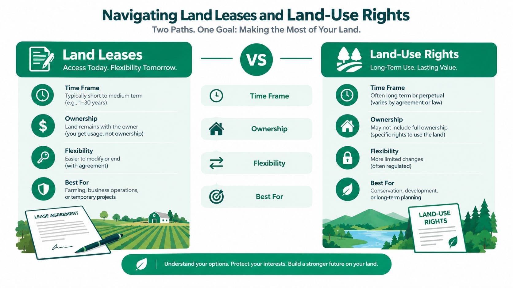
Land leases generally take the form of renewable or non-renewable fixed-term arrangements with a fixed price. Renewal provides certainty only until the stated term ends. If the fixed lease rate falls behind market value, renewal can force a single substantial repricing. The contract has deferred the risk, not removed it.
A non-renewable fixed-term lease creates pressure in a different way. As expiry nears, the remaining interest becomes harder to refinance or sell because buyers and lenders must price the approaching loss of access. Analysis of fixed-term lease risk highlights this progressive difficulty as the term shortens. The same issue is examined in this overview of 99-year land leases.
Fixed leases postpone repricing
A fixed lease can support operating plans during its term, yet its stability has a cost. If the payment does not adjust as site value changes, it may become too low or too high relative to market conditions. That gap affects decisions about holding, development, refinancing, and sale. For a municipal assessor, it also affects whether observed lease payments are usable evidence of current land value.
The distinction is clearest in this comparison:
| Feature | Fixed-term land lease | True land-use right |
|---|---|---|
| Duration | Renewable or non-renewable fixed term | Indefinite |
| Renewal | Required for a renewable arrangement | Not required |
| Expiry | The interest can expire | The right doesn't expire |
| Price adjustment | Fixed price unless the contract provides otherwise | Repriced annually |
| Transferability | Risk increases as renewal or expiry approaches | Trading can occur at low cost because access isn't approaching expiration |
| Risk allocation | Risk is postponed and may surface through repricing or declining financeability | Current land value is reflected through regular repricing |
Calling a fixed lease a “land-use right” does not change its legal or economic character. The label is accurate only where the right is indefinite, requires no renewal, doesn't expire, and is repriced each year. A fixed-term arrangement remains a fixed lease, regardless of the wording used in a contract or policy document.
Annual repricing changes the economic signal
True land-use rights grant access to a site, as leases do, but their duration and pricing mechanism produce a different signal. Because they are indefinite and repriced annually, buyers and sellers do not face an approaching expiration date that controls the transaction. The current land charge becomes more visible in decisions about whether a site is worth occupying.
That clarity matters for productive enterprise. Operators can assess a location using its current land charge instead of accepting a hidden renewal cliff or an increasingly difficult refinancing problem. Public authorities also receive a more current indication of site value, rather than allowing outdated fixed prices to accumulate large gaps.
China shows why terminology requires careful legal analysis. State-owned land-use rights have maximum terms that vary by use, including 70 years for residential land, 50 years for industrial land, and 40 years for commercial, tourist, and recreational land, as described in this China land-use-rights overview-20230228.pdf). These interests should not be treated as true indefinite land-use rights merely because that name is used.
For valuation and tax administration, classify the right by its legal mechanics, not its branding. Record the duration, renewal requirement, expiry treatment, and repricing rules in the valuation model. Those fields determine how assessors interpret transactions, how lenders price risk, and whether a payment reflects current site value or a deferred adjustment.
Translating Valuation into Site-Value Taxation
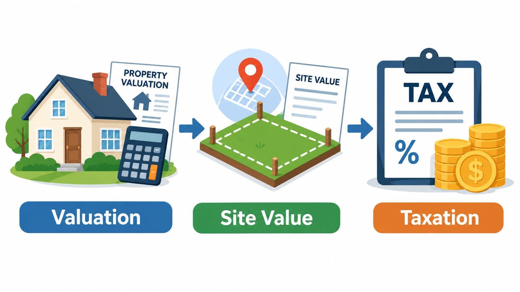
A site-value tax depends on one separation above all others: the value of the location and natural opportunity from the value created by labor and capital. If an assessment blends the site with the building, the tax can penalize construction and improvement. If it isolates the site, the policy can target the economic advantage associated with location and land scarcity.
Tri-factor economics makes that distinction explicit by separating labor, capital, and nature. In practical assessment terms, the site is valued independently from structures and other private improvements. The policy question then becomes how much public revenue should be raised from the site's rental value, and how the charge should interact with existing taxes and public services.
Design the base before setting the rate
Officials should define the taxable base, assessment date, treatment of site preparation, exemptions, relief rules, appeal rights, and interaction with other charges before debating a tax rate. The land-value-tax overview provides a framework for considering these choices, but local law and administrative capacity determine the workable design.
A land-based charge can encourage owners to use well-located sites rather than hold them idle while waiting for appreciation. It can also make infill more attractive because the charge falls on the site rather than increasing solely because an owner builds or renovates. Those are policy mechanisms, not guaranteed outcomes. They depend on accurate assessments, planning capacity, infrastructure, credit conditions, and protections for households or businesses that face cash-flow constraints.
Use valuation to improve policy feedback
A recurring assessment schedule gives officials information about how land values respond to transport investment, planning changes, public services, and market conditions. That information can support better infrastructure decisions and expose whether public investment is being capitalized into private site values.
The strongest system doesn't pretend valuation is perfectly precise. It publishes the data fields, model logic, adjustment principles, confidence limits, and appeal process. It also reports distributional effects, because a reform can improve economic incentives while creating short-term burdens for owners with valuable land and limited income.
Policy test: If the assessment can't explain what belongs to the site, what belongs to capital, and why the value changed, it isn't ready to support a new revenue system.
Implementing Land Value Reform in Practice
Implementation starts with administrative readiness, not a public announcement. A finance ministry or city government needs a reliable cadastre, consistent parcel identifiers, current planning data, verified sales records, improvement classifications, valuation staff, appeal procedures, and a process for updating the model. Without those foundations, a land-based charge may inherit the weaknesses of the existing property system.
The transition should be modeled before legislation is finalized. Distributional and fiscal analysis should show which owners gain, which owners pay more, how renters and businesses may be affected, what revenue is available, and how relief or phased adoption would operate. Officials should test vacant sites, owner-occupied homes, agricultural parcels, commercial corridors, redevelopment land, and properties with unusual structures rather than relying on an average parcel.
Build a defensible operating model
A practical roadmap includes:
- Create the parcel framework. Integrate the cadastre with zoning, infrastructure, environmental, sales, and building records.
- Define the assessment base. State clearly whether the system measures unimproved value, site value, or another legally defined land component.
- Segment the market. Use different evidence and models where land uses, market behavior, and data quality differ.
- Validate the estimates. Compare modeled values with verified transactions and investigate outliers rather than smoothing them away.
- Publish the reasoning. Give owners understandable explanations, adjustment factors, appeal rights, and correction channels.
- Model the transition. Pair revenue estimates with household, business, sectoral, and geographic impact analysis.
- Train the people who administer it. Assessors, planners, tax officials, elected representatives, and community groups need a shared vocabulary.
Documented precedents from Denmark, Estonia, Singapore, Alaska, Canberra, Norway, and Allentown show that land-based policy can be connected to real institutions, but no jurisdiction can import a system without adapting its legal definitions, cadastre, market data, and fiscal structure. The transferable lesson is administrative discipline. Reform becomes credible when residents can see how the site value was estimated and what happens when the estimate is wrong.
Unitism® offers valuation assessments, site-rental estimation, policy design, distributional and fiscal impact modeling, cadastre integration support, legislative drafting assistance, and training for public-sector teams working on land-based revenue systems.
Visit Unitism® to discuss a land-valuation framework that separates site value from improvements and supports practical site-value-tax reform. Start with a data and impact assessment so your government can identify feasible methods, model transition effects, and build an implementation path before changing the tax base.