Learn how urban growth boundaries shape land use, housing costs, and fiscal policy. A practical guide for city and national leaders evaluating UGBs.
July 24, 2026
Urban Growth Boundaries: A Policy Guide for Modern Cities
Learn how urban growth boundaries shape land use, housing costs, and fiscal policy. A practical guide for city and national leaders evaluating UGBs.
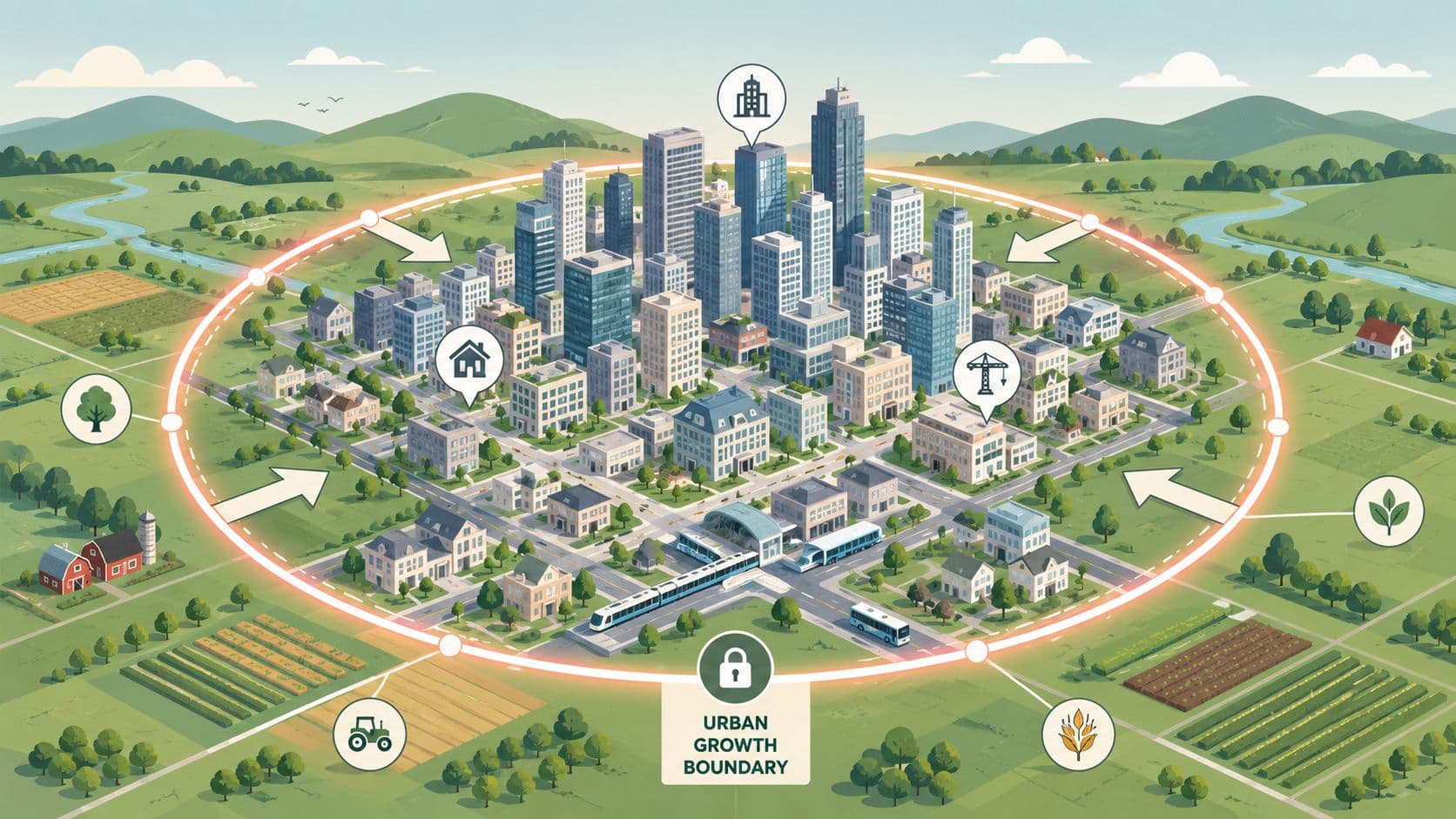
Most advice about urban growth boundaries starts in the wrong place. It treats the boundary line as if it can solve sprawl on its own, when the question is whether a city can absorb growth inside the line without choking housing supply, infrastructure, and land markets.
That shift matters because a boundary changes incentives, it doesn't erase demand. When governments direct growth inward without enough infill capacity, transit access, higher-density zoning, and permitting throughput, the policy can push prices up inside the line and nudge development to leapfrog locations outside it, which is exactly why boundary design has to be judged as an institutional problem, not a slogan.
Table of Contents
- Why Urban Growth Boundaries Are Misunderstood
- What an Urban Growth Boundary Actually Is
- Core Design Choices for a Boundary
- How UGBs Interact With Land Value Capture and Land Use Rights
- What the Case Studies Show
- When Boundaries Backfire
- A Practical Checklist for Evaluating and Implementing a UGB
- Pairing Boundaries With the Right Fiscal Tools
Why Urban Growth Boundaries Are Misunderstood
The usual debate frames urban growth boundaries as a clean fight between sprawl and density. That framing is too simple. A boundary can steer development, but it can't create housing capacity, fix a broken permitting system, or conjure infrastructure inside the line.
The real constraint is institutional capacity
The best evidence points to a more uncomfortable conclusion. A study of permits issued between 2003 and 2010 found that parcels just outside UGBs had a 7 percentage point lower probability of development than parcels just inside the boundary, which is direct evidence that the policy curbed edge expansion. In California, another review found that during 1990–2000, cities with UGBs grew more slowly in both population and land area than comparable places without them, while housing prices in UGB-adopting communities rose by as much as 14% more over the same period, showing the same policy can contain outward spread and intensify price pressure at once, AEA conference paper.
That trade-off is why the boundary line itself is not the policy. It is only a rule about where growth should happen, not a guarantee that growth can happen there cheaply or quickly.
Practical rule: If a city can't add homes, roads, water, sewer, schools, and transit inside the line, the boundary will mostly rearrange scarcity instead of resolving it.
The policy question, then, is not whether boundaries are “pro-growth” or “anti-growth.” The question is whether the city has the zoning, infrastructure, and administrative capacity to absorb demand in the places the boundary protects for urban use.
Two cities can draw the same line and get different outcomes
That's why outcomes diverge so sharply across jurisdictions. One city can use a boundary to focus public investment and channel private capital into already-served land. Another can draw a similar line and only trap growth behind low-density zoning, slow approvals, and infrastructure bottlenecks.
The difference is not ideology. It's whether the inner city is prepared to receive the growth the boundary deflects. When it isn't, the boundary becomes a price-making device first and a planning device second.
What an Urban Growth Boundary Actually Is
A useful way to think about a boundary is as a city's edge budget. The city decides how much land it is willing to keep in the urban development pipeline, then uses that line to separate land expected to carry homes, schools, businesses, and infrastructure from land reserved for non-urban uses.
The definition is simpler than the function
Melbourne's Urban Growth Boundary was established in 2002 through Melbourne 2030: Planning for sustainable growth, which set a planning line around the city to manage outward expansion and protect peri-urban land and environmental features from development pressure, according to the Victorian Planning Authority's key facts on the boundary. The same guidance says the boundary is meant to direct growth to places that can be served by infrastructure and services, and to preserve land outside the line for non-urban uses, Victorian Planning Authority.
A boundary is usually drawn around a metropolitan area, not a single municipality, because housing markets, commuting patterns, and infrastructure systems cross local borders. That's why the tool matters most where land and services are managed at regional scale.
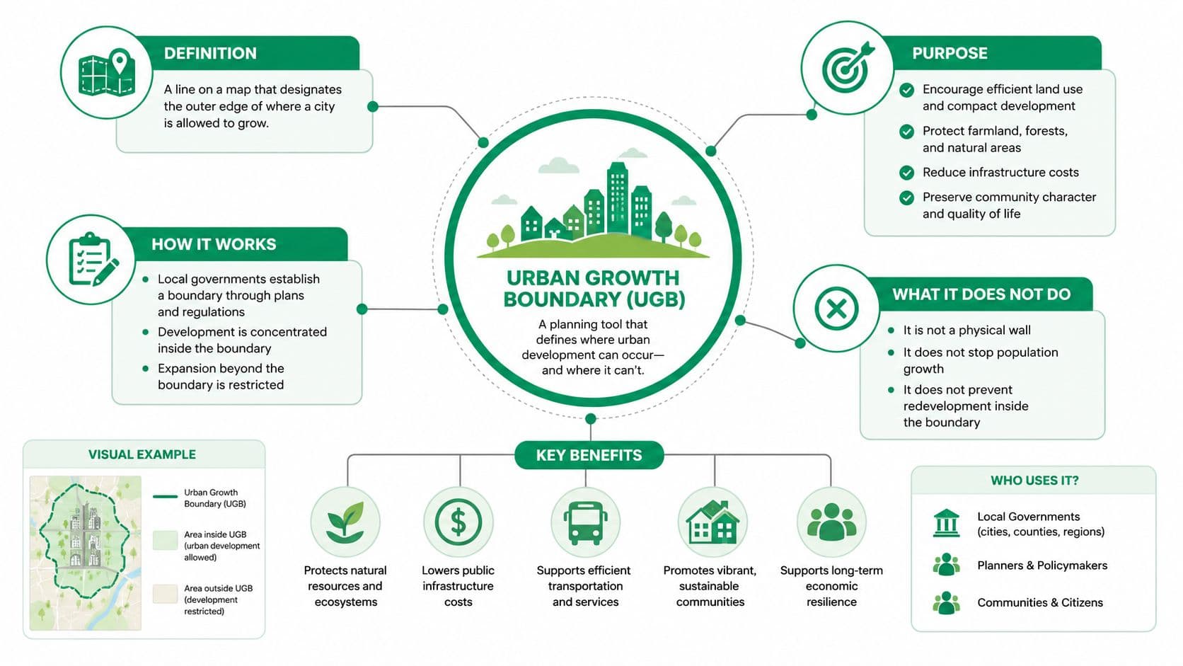
The operational logic is straightforward. The city says, in effect, “this is the land we are prepared to service now, and that is the land we are protecting for later or for non-urban use.”
A boundary is not the same as a greenbelt or a zoning map
A greenbelt protects land by keeping it undeveloped, but a UGB is more explicit about where growth should go. Service areas determine where utilities and infrastructure will be extended. Zoning controls what can be built on each parcel. A boundary works best when those tools point in the same direction.
That is why planning manuals often treat UGBs as long-horizon institutions. Guidance from the Greenbelt Alliance notes that UGBs are typically set for 20 years or more, and Montana transportation guidance describes them as time-bounded planning lines that work only when infrastructure commitments are aligned inside the line, Greenbelt Alliance and MDT guidance.
For a plain-language primer on the property-rights side of land policy, the land use rights guide is a useful companion.
A boundary is not a wall. It's a planning promise about where public services, private development, and political attention will concentrate.
Core Design Choices for a Boundary
The biggest mistake cities make is treating all boundaries as if they work the same way. They don't. A boundary can be rigid or periodically adjusted, centered on service priority or just greenfield containment, and backed by law or left as an indicative map that developers can ignore.
Melbourne shows why adjustment rules matter
Melbourne's experience shows why a boundary needs governance, not just geography. A line that never changes can become politically brittle when growth assumptions shift. A line that changes too casually can turn into a signaling device that landholders watch for windfall timing rather than a real constraint.
The better design question is whether the city has a formal review process. South Carolina's model ordinance is blunt about this. It tells local governments to project population growth over the next 5 to 7 years, estimate how many acres of vacant land will be needed, and then delineate the boundary accordingly. It also requires public hearings and adoption onto land-use maps used for development decisions, which makes the rule operational instead of advisory, South Carolina model ordinance.
That procedural detail matters more than many officials expect. A boundary without review rules can become either too tight or too permissive. A boundary with review rules can adapt without losing credibility.
Three design choices shape market expectations
- Rigid versus periodically adjusted. Rigid lines send a strong scarcity signal, but they can become politically toxic if they don't recognize changing demand or infrastructure capacity.
- Greenfield-only versus service-priority. Greenfield-only framing says where new development may not happen. Service-priority framing says where the city will finance roads, water, sewer, and other public systems first.
- Mandatory versus indicative. Mandatory boundaries influence investment. Indicative lines usually don't, because developers and landowners discount them unless they affect approvals and capital plans.
Policy insight: A boundary works when it changes the relative cost of development, not when it merely expresses a preference.
The practical lesson is that the strongest boundaries are tied to service plans, capital budgets, and map-based land-use decisions. Without those links, private actors treat the line as negotiable.
How UGBs Interact With Land Value Capture and Land Use Rights
A boundary shifts value. It does not decide who keeps the uplift. That is why any serious discussion of urban growth boundaries has to include land-value capture and the institutional difference between recurring land taxes and land-use rights.
The tools are related, but they are not interchangeable
Land-value taxes are recurring charges on the rental or site value of land. They are designed to discourage speculation and make holding land expensive when it sits idle inside a valuable urban area. Land-use rights are different. In China, they are leasehold rights, not ownership of the land itself, and they are typically sold for a fixed term through market sale or auction as a major local revenue source. They are time-limited property rights, not annually repriced taxes with no expiration date.
That distinction matters because a city with a UGB needs two things at once. It needs a boundary that keeps growth from scattering inefficiently, and it needs a fiscal tool that helps the city absorb the growth it does allow. A one-time auction of land-use rights can monetize access to land, but it doesn't function like a recurring charge that continually discourages speculative vacancy. A land-value tax does.
Comparing Land Value Capture Instruments Under a UGB
| Instrument | Mechanism | Revenue pattern | Effect on land inside a UGB | Key limitation |
|---|---|---|---|---|
| Land-value tax | Recurring charge on site value | Ongoing | Discourages land banking and encourages productive use | Needs valuation capacity and political durability |
| Land-use rights | Leasehold sale or auction for a fixed term | Upfront | Can finance land release and public investment | Does not continuously penalize idle holding |
| Resource dividend | Public sharing of resource rent | Ongoing or periodic | Can broaden the fiscal base linked to land and nature | Depends on a measurable rent source |
| Rate reform | Shift from taxing buildings to taxing land more heavily | Ongoing | Reduces penalty on construction inside the boundary | Requires tax-system redesign and transition management |
The policy implication is simple. If a city makes land scarcer with a boundary, it should not let scarcity become private windfall. It should use land-based fiscal tools to recapture part of the uplift for infrastructure and infill.
For a broader policy framework on that mechanism, the land value capture explainer is a useful reference.
What the Case Studies Show
The case for or against a boundary changes once you look at actual land systems instead of theory. Portland, Melbourne, Singapore, and Tallinn each show a different way of handling scarcity, price pressure, and public control.
Portland and Melbourne show containment without clean affordability gains
Portland is the clearest North American example of a boundary that changed land patterns and didn't solve housing pressure. Empirical work already shows the boundary reduced development near the edge and raised housing prices relative to comparable places without such a line. That makes Portland a cautionary case, not a template.
Melbourne is more instructive as a governance case. The city's boundary has been treated as a long-run planning instrument inside a metropolitan strategy, rather than as a static ring. That difference matters because the political problem is not whether the line moves occasionally, it's whether movement is governed by transparent land-needs logic instead of ad hoc pressure.
Singapore and Tallinn highlight the fiscal side
Singapore shows what a tightly managed boundary can look like when land policy, public acquisition, and infrastructure planning are aligned. The lesson for policymakers is not to copy the city wholesale, since its state capacity is unusual. The lesson is that a boundary performs better when public authorities are willing to coordinate land assembly, service planning, and development sequencing.
Tallinn points in a different direction. Estonia's land system uses taxation and land administration to discipline holding without relying on a formal UGB in the way Anglo-American planning systems often do. That's useful because it shows a boundary is only one way to manage scarcity. Fiscal design can do part of the work too.
If you want a visual review of how planning patterns differ across places, the new urbanism examples guide is a practical companion.
The transferable lesson is not “copy this boundary.” It's “copy the institutions that make the boundary credible.”
A city that borrows the line but not the fiscal and zoning machinery usually gets the worst of both worlds, constraint without absorption capacity.
When Boundaries Backfire
The failure modes are well known, but they're easy to ignore when a boundary feels politically clean. Development can leapfrog outside the line, prices can rise inside it, lower-income households can be displaced, and elected officials can start expanding the boundary only after land values have already been bid up.
The second-best problem is real
Economic theory treats the UGB as a second-best instrument compared with direct congestion pricing. One model finds UGBs can improve welfare, but the gain is only a very small fraction of what a toll regime would deliver, economic model on UGB welfare. That doesn't make the boundary useless. It does mean the tool is about containment and signaling, not about pricing travel or land scarcity directly.
The practical risk is obvious. If the boundary is too tight, or if officials refuse to adjust it when inner-city capacity runs short, the policy can push development to leapfrog locations beyond the line rather than satisfying demand in compact form.
The boundary often exposes internal bottlenecks
That's the part many cities miss. The constraint is often not raw land supply inside the boundary. It's low-density zoning, slow approvals, and infrastructure limits that keep infill from materializing.
The most useful question is not “is there enough land inside the line?” It is “can the city build the right kinds of homes on the land already inside it?” When the answer is no, the boundary turns scarcity into a policy artifact, not a planning success.
That's why boundary debates shouldn't stop at the edge. They should also ask whether the city has made room for enough redevelopment, transit access, and capital investment inside the line.
For a related finance lens on redevelopment tools, see the TIF district explainer.
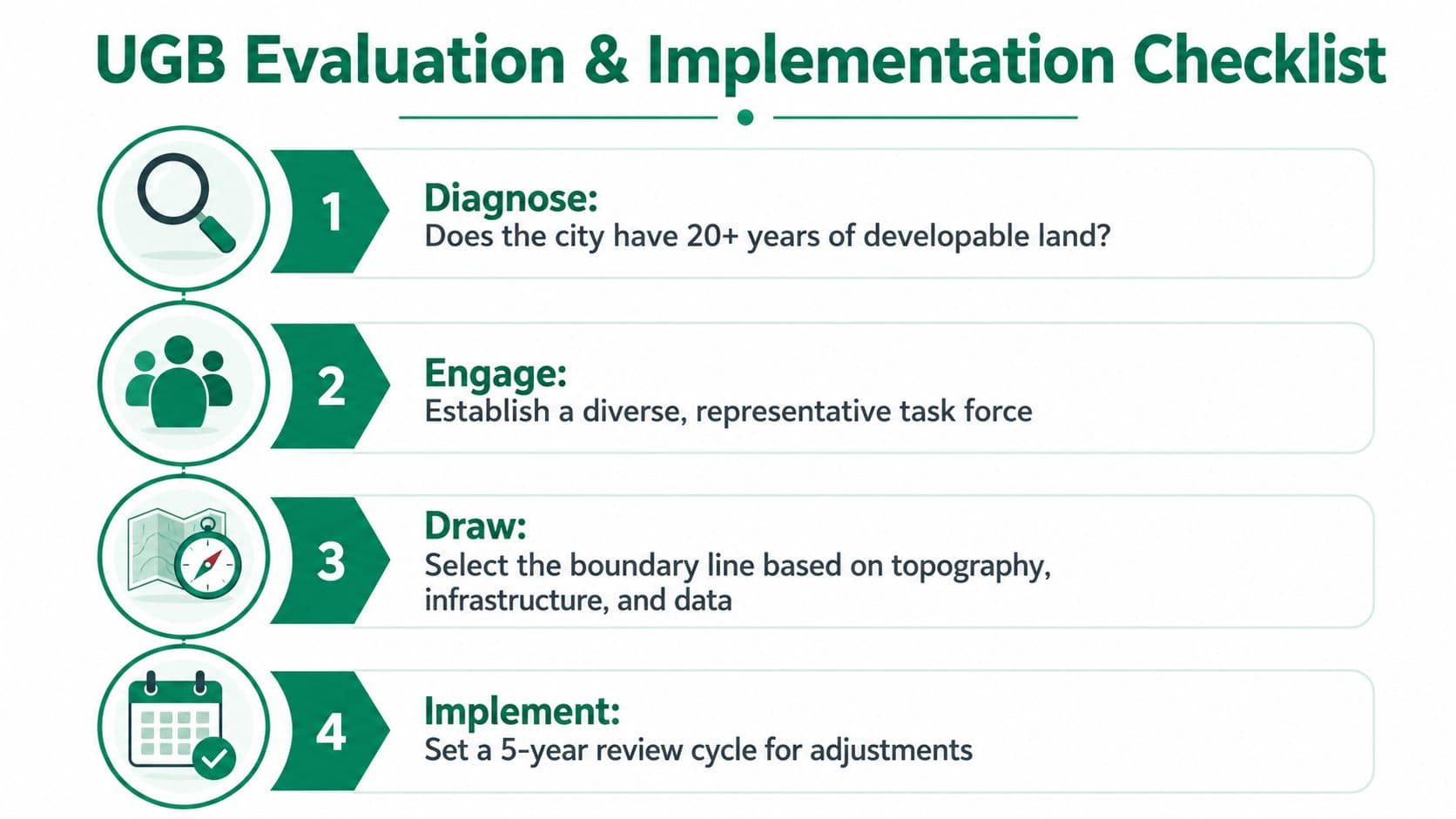
A Practical Checklist for Evaluating and Implementing a UGB
The best UGB decisions start with diagnostics, not ideology. Municipal and national policymakers need to check whether the city can absorb growth before they decide how hard to draw the line.
Start with capacity, not symbolism
- Test land supply. Determine whether the city already has a 20-year growth horizon or whether the remaining developable land is too thin to support housing, schools, and infrastructure.
- Map the infill pipeline. Look at vacant parcels, underused commercial strips, parking lots, and sites that could take higher density without opening new fringe land.
- Identify infrastructure bottlenecks. Water, sewer, schools, roads, and transit all matter. If these systems can't support inward growth, the boundary will only shift pressure into a weak inner market.
- Check zoning compatibility. A boundary can't do the work of missing density permissions.
Build the rule so it can survive politics
The next decisions are institutional. Officials should decide whether the line is rigid or reviewable, whether it has statutory force, and whether its revision follows a fixed cadence. They should also write the rule so it lands on the cadastre, land-use map, and capital plan at the same time.
If the boundary never shows up in permits, budgets, and map updates, it's only a planning narrative.
Monitor the right signals
The simplest tracking set is practical rather than perfect.
- Permit activity inside the boundary, to see whether the city is absorbing growth.
- Price-to-rent ratios, to detect when scarcity is being capitalized into land cost.
- Leapfrog development outside the line, to catch spillover early.
- Revenue from land-based charges, to see whether the city is funding absorption rather than just creating scarcity.
That monitoring stack gives officials an early warning when the boundary is too tight, too loose, or disconnected from infrastructure delivery.
Pairing Boundaries With the Right Fiscal Tools
A boundary is worth the political capital only when the city can use it to organize growth and finance it at the same time. That is why the strongest land-policy packages pair urban growth boundaries with recurring land-value charges, targeted public land assembly, and service planning that channels investment into the area inside the line.
Scarcity should fund absorption, not just appreciation
When land becomes more valuable because the city has constrained outward expansion, public policy has a choice. It can let the uplift flow almost entirely to private owners, or it can capture part of that value and put it into infrastructure, transit, and infill readiness. A recurring land-value charge is the cleanest way to do that because it taxes the site, not the building, and it keeps pressure on owners to use land productively.
That logic is not theoretical. The broader land-economics literature and policy practice point to precedents in Denmark, Estonia, Singapore, Alaska, Canberra, Norway, and Allentown as evidence that land-based fiscal tools can be made operational in different institutional settings. The exact structures differ, but the common thread is the same: public authorities try to align land value, public services, and development timing instead of treating them as separate systems.
For infrastructure financing design, the infrastructure funding guide is a relevant next read.
The decision is not whether to have a boundary
The decision is whether the boundary sits inside a system that can absorb growth and share the value it creates. If the city has the zoning, infrastructure, and fiscal machinery to do that, a UGB can be a disciplined tool for containment and urban form. If it doesn't, the boundary becomes a scarcity machine that lifts land prices without making housing easier to build.
That's the standard policymakers should use. Draw the line only if you can make the city behind it work.
If you're evaluating a UGB for your city or ministry, use it as part of a land-and-infrastructure package, not as a standalone slogan. Unitism® can help you design the fiscal, planning, and implementation pieces that turn a boundary into a workable urban policy.