What is vacant land? A practical guide to classifications, city measurement, and how land taxes differ from leases and land-use rights.
November 1, 2026
What Is Vacant Land and Why It Matters
What is vacant land? A practical guide to classifications, city measurement, and how land taxes differ from leases and land-use rights.
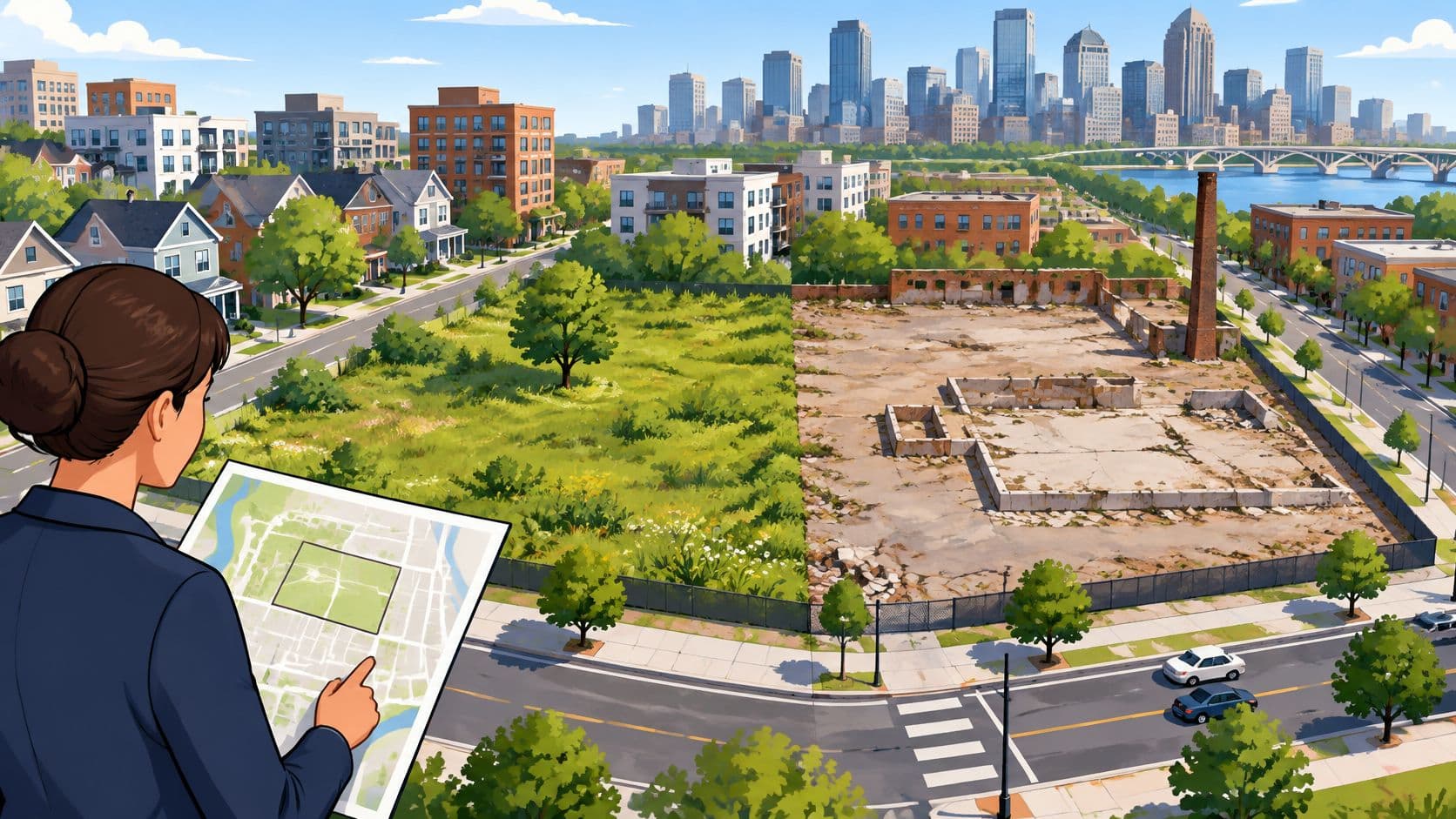
Vacant land is land unused or abandoned for an extended period, including cleared, contaminated, and derelict sites, not only raw dirt.
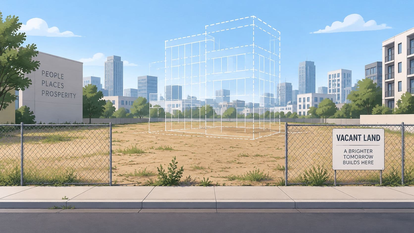
An empty-looking parcel isn't necessarily wasted space, and it isn't necessarily ready for construction. For municipal planners, the useful question is what prevents an appropriate use, who pays while the land waits, and whether keeping it open serves the city better than building on it.
Table of Contents
- What Vacant Land Means in Practice
- Greenfield Brownfield and Underused Parcels
- How Planners Measure a Vacant Parcel
- Highest and Best Use of Idle Land
- Land Taxes Leases and Land-Use Rights
- What Vacancy Costs a Neighborhood
- Decide How the City Prices Idle Land
What Vacant Land Means in Practice
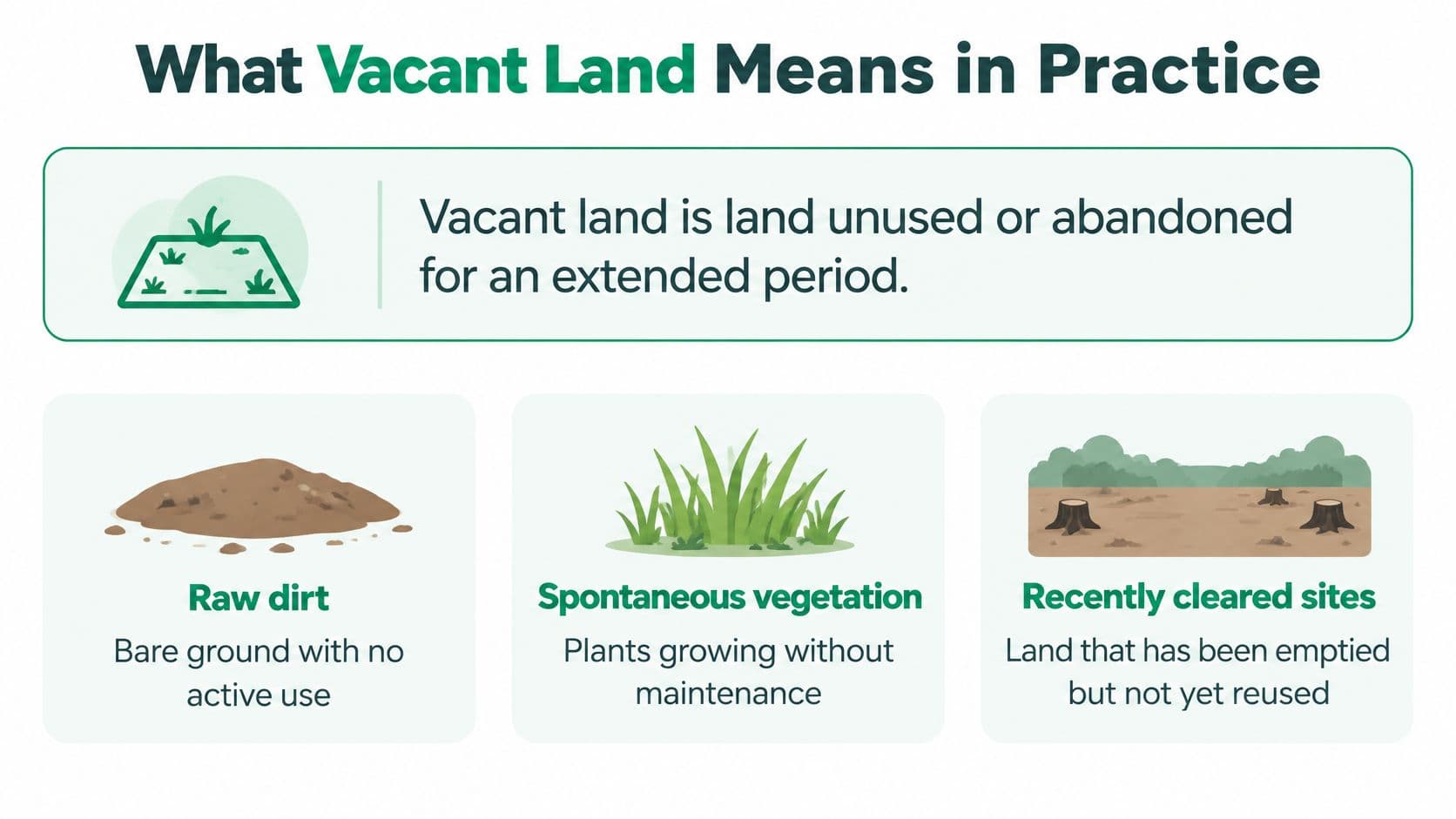
A practical municipal definition should cover unused or abandoned land, whether it has been developed before or not. That includes bare ground, spontaneous vegetation, recently cleared sites, former agricultural land, brownfields, contaminated parcels, and sites with long-term derelict structures.
The scale is substantial. The Journal of Urban Ecology inventory reports historical U.S. city averages of 20.7% in 1964, 24.5% in 1971, and 15.4% in 2000, followed by 16.7% in a 2016 inventory of 215 cities with populations above 100,000.
How much urban land cities have called vacant
| Measure | Vacant share | Where and when |
|---|---|---|
| Historical city average | 20.7% | United States, 1964 |
| Historical city average | 24.5% | United States, 1971 |
| Historical city average | 15.4% | United States, 2000 |
| Inventory of 215 cities over 100,000 | 16.7% | United States, 2016 |
| Survey of 70 cities | 15% | United States, 70-city survey |
| Southern cities in that survey | 19.3% | Highest regional average |
| Northeastern cities in that survey | 9.6% | Lowest regional average |
| Phoenix | 43% | After 1980–1995 growth of 55% in population and 30% in land area |
The survey and regional figures come from Brookings' examination of vacant land in cities, which found 15% average vacancy across 70 cities, 19.3% in Southern cities, and 9.6% in Northeastern cities. Its Phoenix example is especially revealing: the city reported 43% vacant land despite population growth of 55% and land-area growth of 30% between 1980 and 1995.
Vacancy isn't simply a symptom of decline
A growing city can contain extensive unused land because infrastructure, subdivision, ownership, and demand don't advance together. A shrinking industrial city may instead have abandoned buildings on relatively compact parcels. Neither pattern can be understood from the vacancy percentage alone.
Nor does the absence of formal development establish the absence of value. Vegetated land may support habitat, while residents may use an unbuilt parcel as an informal meeting place. Planners should record those functions rather than erase them with an empty-map label.
For a proposed commercial use, the next questions become specific to the activity. Partitioning Services Limited's resource on choosing a site for self-storage is relevant when assessing that particular reuse, but a development concept still needs to be tested against the parcel's actual constraints.
What is vacant land? The answer must include the municipality's counting rules. Before comparing percentages, establish whether each city counted open lots, abandoned industrial property, cleared sites, or land containing structures. Otherwise, an apparent difference in land supply may be a difference in classification.
Greenfield Brownfield and Underused Parcels
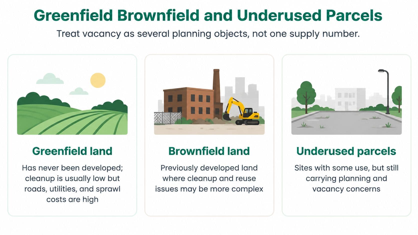
Two neighboring lots can sit equally empty while demanding completely different work before a new occupier moves in. Prior use and present condition set that workload, so an inventory that treats every unused parcel as interchangeable development capacity will misprice the city's land supply.
The Nevada land-use code manual makes this concrete by counting raw land alongside prepared or developed land whose improvements are not sufficient to identify a current use. A site can have absorbed real investment and still register as vacant for classification purposes.
Common classes of vacant and underused land
| Class | Condition | Main constraint | Typical setting |
|---|---|---|---|
| Greenfield | Never developed | Infrastructure and sprawl cost | Farm fringe or urban edge |
| Brownfield | Prior use, often industrial or contaminated | Investigation and remediation before reuse | Factories, depots, gas stations |
| Cleared previously developed | Structures or foundations removed | Remaining buried material and title gaps | Demolished urban lots |
| Underutilized parcel | Weak use below zoning potential | Often not coded vacant | Surface parking, leftover yards |
| Land with derelict structures | Abandoned building remains | Safety and demolition cost | Older urban neighborhoods |
Greenfield parcels rarely need cleanup tied to earlier development, yet serving them can still be expensive. Roads, drainage, utilities, and connections to public services can dominate the project budget, and agricultural or ecological conditions deserve assessment instead of assumptions about clean, uncomplicated ground.
Brownfields begin from the opposite question: what happened here before, and what did it leave? Investigating prior activity and potential contamination comes before any judgment about whether remediation is required. A cleared site is a third case. Demolition removes the building, while buried foundations, old utility connections, title gaps, and environmental liabilities can remain attached to the parcel.
Underuse needs its own register
A surface parking lot is in use, even where zoning and existing services could support far more activity. Labeling it vacant erases its current function, while leaving it out of redevelopment analysis erases its potential. Keep separate vacancy and underutilization fields so staff can study both without merging them.
Servicing records need the same care. Where communications capacity is uncertain, confirm the parcel's actual connection capacity and requirements with the relevant utility and telecom providers, such as Southern Tier Resources telecom expertise, and check the municipal infrastructure records before projecting what a reuse can support.
Ownership problems call for an institutional response instead of another development advertisement. Understanding what a land bank is helps planners tell coordinated acquisition and stewardship apart from merely listing land for sale.
Vacant parcels work like unoccupied rooms in a building: one was never finished, another was stripped after a fire, a third is full of unusable furniture. All are unavailable today, and each needs different work before anyone moves in. A city's estimate of usable land should rest on that difference.
How Planners Measure a Vacant Parcel
Begin with different readings of vacancy, not a single yes-or-no field. Staff need to establish what they observed, what the law permits, what a viable project can support, and whether non-development already provides a public benefit.
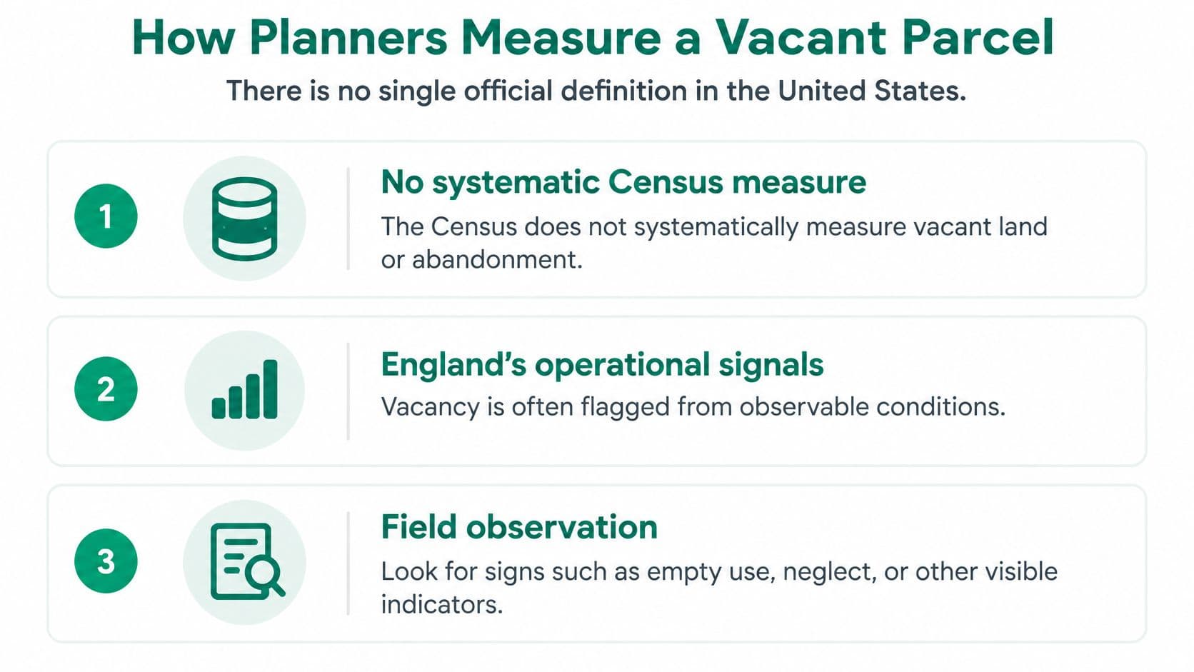
Brookings' municipal survey report notes that the United States lacks a formal standardized definition and that the Census doesn't systematically measure vacant land or abandonment. Operational indicators, including hoardings around unclassified land or the absence of an address association, can help identify candidate sites, but they aren't substitutes for investigating their condition.
Separate the readings before counting
- Physical vacancy means there's no current use. A site visit helps establish what is happening, including informal occupation or activity.
- Legal developability concerns zoning, title, heritage protection, flood rules, and other restrictions. Physical availability doesn't establish permission.
- Market vacancy concerns feasibility. A permitted project may not produce enough revenue to cover construction, servicing, finance, and land.
- Socially useful non-development includes habitat, flood storage, and land reserved for future infrastructure. Such land shouldn't automatically enter a buildable-supply total.
Build a parcel record that explains the obstacle
Use a cadastral parcel identifier to connect the map, ownership record, planning file, and inspection notes. Then collect the following fields consistently:
- Prior use and last known use. Preserve the historical record even where the present surface looks clean.
- Structures and foundations. Note remaining buildings, slabs, buried material, and whether clearance has occurred.
- Demolition or remediation needs. Separate confirmed requirements from issues awaiting investigation.
- Area, access, and utilities. Record legal access and service capacity, not just a nearby road or pipe.
- Zoning and environmental constraints. Include flood exposure, suspected contamination, and relevant protections.
- Ownership and control. Identify the owner, public or private status, and unresolved interests.
- Duration and classification. Record how long the parcel has been idle and which readings of vacancy apply.
A field observation should have a date and a named responsible officer. Where staff can't confirm a condition, record it as unverified rather than treating a blank field as evidence that no problem exists.
Practical rule: Ask vacant for whom, for how long, and under which development assumptions.
Use appropriate methods of land valuation alongside the inventory, but don't confuse a valuation with a readiness assessment. A supply estimate is trustworthy only when a serviced infill lot isn't added to a contaminated site as though both were immediately available.
Highest and Best Use of Idle Land
An idle lot remains an economic asset because a purchaser is acquiring possibilities, not just its present appearance. Highest and best use provides a disciplined way to assess those possibilities without assuming that the largest permitted building is automatically the best project.
New York's assessment guidance treats vacant land with no current use as an exception to current-use valuation and directs assessment toward highest and best use. The appraisal framework asks whether a proposed use is physically possible, legally permissible, financially feasible, and maximally productive.
Permission isn't proof of feasibility
Consider a serviced corner lot near transit and a larger former industrial parcel. The corner may support a more valuable project despite its smaller area because access, demand, and available services reduce the work required. The industrial parcel may permit substantial development yet require cleanup and infrastructure spending that prospective buyers can't recover.
Apply the tests to a specific proposal:
- Physical possibility: Can the site accommodate the building, access, drainage, and servicing?
- Legal permission: Do planning rules and property rights allow the proposal?
- Financial feasibility: Can expected income or sale proceeds cover the full project cost?
- Maximum productivity: Among feasible alternatives, which supports the greatest land value?
For more detail on interpreting these tests, the highest and best use guide helps separate a reasonably supportable use from an owner's preferred development story.
Work backward from a completed project
In a residual analysis, estimate what the completed development could sell for or what its income would support. Subtract construction, professional fees, financing, infrastructure, marketing, and an allowance for development risk. The remainder is the amount the project can support for the land.
Don't treat that remainder as certain. Slower absorption, lower rents, higher borrowing costs, or required public improvements can reduce it. Compare the result with sales of similar sites, adjusting for servicing, permission, location, and condition rather than relying on superficial proximity.
A land price is a forecast of future use, not a reward for leaving a parcel empty.
This approach also prevents planners from mistaking an ambitious asking price for demonstrated development potential. Separating the site value from the value of buildings creates a clearer foundation for feasibility testing and for a subsequent charge based on land value.
Land Taxes Leases and Land-Use Rights
Land-value tax, fixed lease, and land-use right
| Instrument | Tenure | How price is set | Effect on holding risk |
|---|---|---|---|
| Land-value tax | Grants no possession | Recurring public charge on site value, not buildings | Makes idle holding costly and returns location value to the community |
| Renewable fixed land lease | Fixed term, renewal is separate | Fixed price until term end, then a catch-up to the applicable market rate | Certainty only until expiry, when the accumulated market gap is addressed |
| Non-renewable fixed land lease | Fixed term, then it ends | Fixed price for the term | Refinance and resale get harder as expiry approaches |
| Land-use right | Indefinite, no renewal, does not expire | Repriced every year to current land value | Prices land currently and keeps transfer costs low |
A land-value tax is a public charge on land itself, not on buildings or improvements. A location's value comes from surrounding people, roads, schools, and businesses rather than the owner's effort. Charging for that value returns it to the community, rewards good use, and makes speculative holding unprofitable when the charge adequately captures the benefit of waiting.
It doesn't grant possession. That distinction matters when evaluating land-holding costs: a tax changes the cost of ownership, while a lease defines a contractual right to occupy.
Fixed leases postpone repricing risk
Land leases are renewable or non-renewable fixed-term arrangements at a fixed price. A renewable lease offers certainty during its term, but the accumulated difference between its rate and the market can close in a major repricing at renewal. A non-renewable lease becomes progressively harder to refinance and sell as its remaining life shortens.
Singapore illustrates the tenure issue. A peer-reviewed examination of Singapore's leasehold system explains that most land is state-owned, residential leaseholds usually run 99 years, and industrial leases commonly run 60 or 30 years, sometimes 20 years. It also describes declining remaining-term value and the rule that a supported renewal generally won't exceed the original tenure or the tenure consistent with planning intentions, whichever is lower.
Fixed leases postpone risk rather than correctly price it throughout the holding period. Their contractual certainty shouldn't be mistaken for permanent security.
Reserve land-use right for an indefinite annual arrangement
A peer-reviewed analysis of expiring Singapore leases considers a continuing right supported by annually reassessed ground rent. Under the distinction used here, a land-use right must be repriced each year, require no renewal, and never expire.
Because the payment follows current land value, buyers and sellers can transfer such rights at low capital cost rather than paying for a large stock of future land rent. This prices land currently without burdening entrepreneurship through a large upfront land purchase. Transaction expenses and the value of improvements remain separate.
Sometimes fixed leases are called land-use rights. A fixed price and an expiration date keep them leases, whatever their label.
Charges can coexist with either tenure arrangement. The Singapore Land Authority's land-value capture rules distinguish a charge on value increases resulting from chargeable consent from the leasehold adjustment applied where 99 years or less remain.
A vacancy tax is another distinct instrument. The State Revenue Office of Victoria recorded 749 vacant-residential-land-tax exemptions or concessions in 2025, representing $5,294,285 in tax not payable. Exemptions therefore belong in fiscal modeling, not just the headline tax rate.
What Vacancy Costs a Neighborhood
Philadelphia's vacant land carried a bill far beyond its owners. A University of Pennsylvania study of vacant-land management estimated that roughly 40,000 vacant parcels reduced surrounding property values by $3.6 billion, required more than $20 million annually in public maintenance, and generated at least $2 million in uncollected property taxes, while only about one-quarter were city-controlled.
That pattern is a transfer of costs. Neighbors absorb lower values and weaker blocks while agencies maintain an inventory wider than the public controls. Calling those parcels a reserve for future development misses what residents pay during the wait.
The same account points to Chicago's Large Lots program to show that who receives a city-owned lot changes the result. The lesson is narrower than “sell every empty parcel”: transfer design, buyer type, and stewardship terms determine whether a block gains care or changes the name on the problem.
Follow the costs on an actual block
Take one block with an unsecured former workshop, a maintained community garden, and a privately held serviced lot. All three can be labeled vacant in a broad count, yet each imposes a different cost and calls for a different test.
- The former workshop needs a safety assessment, an ownership search, and a contamination review before a reuse proposal.
- The garden needs recognition of its existing social function and a decision about secure stewardship.
- The serviced lot needs scrutiny of whether the owner is waiting for a higher price while neighbors bear the effects of inactivity.
Community accounts can help staff understand uses that parcel databases miss. Litter Caterpillars' account of how vacant lots inspire community hope offers a community-oriented perspective, alongside rather than instead of local evaluation.
The right outcome isn't necessarily a building. It's a parcel whose management no longer pushes avoidable costs onto everyone else.
Separate speculation from necessary open space
Most financial crises begin with land speculation. When land cannot be hoarded for speculative gain, homes cost closer to what it costs to build them. That is a reason to examine the economics of holding, not to demand construction on every unbuilt parcel.
A serviced lot held for appreciation shifts risk outward: the owner waits for location value to rise while nearby residents pay through nuisance, lost revenue, and delay. A garden or flood-buffer parcel may be physically empty but socially useful. Conservation and flood protection should be explicit purposes, not accidental outcomes of an unresolved property file. When land use has a fair price, no one wastes land, and land that is not needed stays wild.
The cost question is therefore comparative: a land-value charge, remediation, acquisition, conservation, or community stewardship should be judged against maintenance spending, public revenue, neighboring conditions, environmental function, and residents' security. A new building is useful evidence of activity, but activity alone is not proof of public benefit.
Decide How the City Prices Idle Land
Two parcels can look identical on a vacancy map and need opposite treatment. A serviced infill lot held for appreciation calls for a price signal, while a contaminated site needs cleanup funding before any charge can change behavior. Choose the intervention that matches the obstacle.
Match the action to the problem
- Fix the count first. Separate greenfield, brownfield, cleared, underused, and derelict stock before estimating available capacity.
- Charge strategic waiting. Where an owner holds serviced land for appreciation, assess a charge on site value while leaving buildings and improvements untaxed, so holding becomes steadily more expensive.
- Choose how repricing lands. A fixed lease pushes adjustment to the expiry date, so retain one only with a published plan for expiry and repricing. An annually repriced land-use right spreads the same adjustment year by year, but it requires annual reassessment and no renewal requirement.
- Resolve genuine barriers. Pair pricing measures with remediation where cleanup blocks reuse, or conservation where development would undermine flood protection or habitat.
- Compare stewardship options. Where neighbors already bear substantial costs, evaluate public acquisition and community control alongside private redevelopment.
An idle-land tax needs more than a map of apparently empty properties. Administrators must establish the chargeable interest, valuation basis, exemptions, appeal process, and treatment of constraints. Misclassify a constrained parcel and the charge lands on an owner who cannot respond, while the holding behavior it was meant to change continues next door.
Make implementation part of the decision
We work with governments, cities, and organizations on the concrete steps of land-value reform, including valuation, cadastre integration, administrative processes, and transition design. The practical question is whether staff can identify the liable party, explain the assessment, and update it consistently each cycle.
Martin Adams's Land: A New Approach for a Thriving World, available to read online, develops the underlying argument from classical economists such as Henry George. For a municipal decision, the test stays concrete: price holding appropriately, protect land that should remain open, and spread repricing across regular reassessments so it doesn't land on households all at once.
Unitism® offers land valuation, policy design, fiscal impact modeling, and implementation support to help cities distinguish speculative vacancy from genuine development constraints and valuable open space. Visit Unitism® to explore how your municipality can connect its parcel inventory to a workable land-value reform.