Learn what the Kauai tax map key is, how its nine-digit number works, and how to look up parcels, taxes, and records using county GIS tools.
August 11, 2026
Kauai Tax Map Key: How to Find and Read Your TMK
Learn what the Kauai tax map key is, how its nine-digit number works, and how to look up parcels, taxes, and records using county GIS tools.
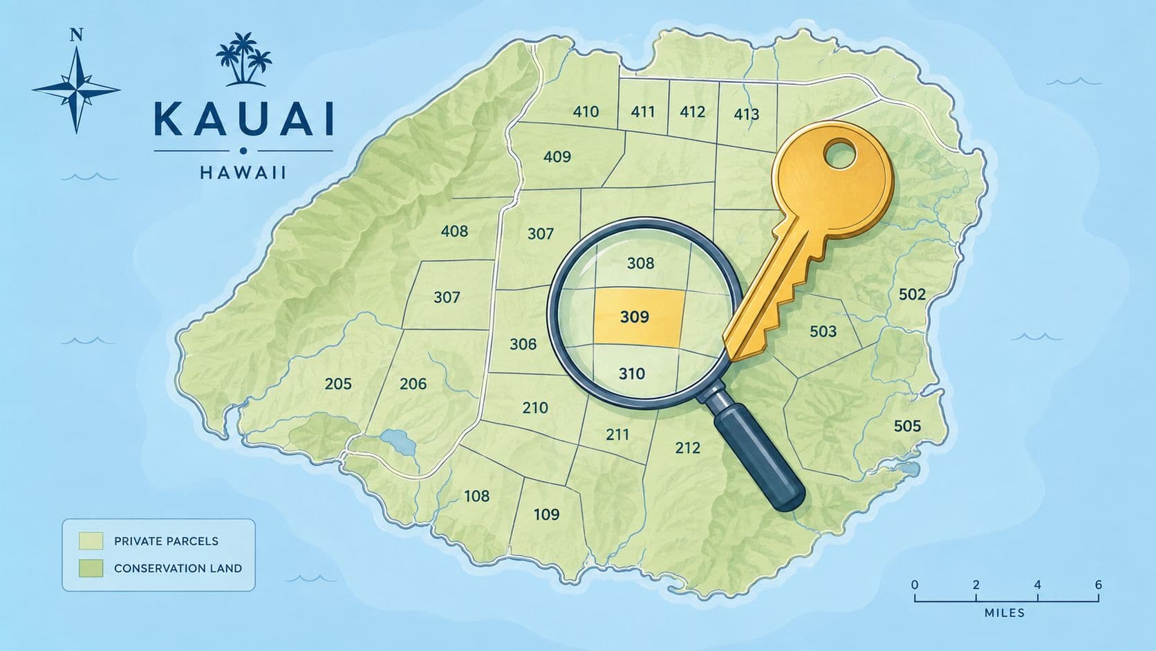
You're staring at a county search box, you have a property address, maybe a tax bill, maybe a deed, and the numbers don't quite match. That's where most first-time users get stuck with the Kauaʻi Tax Map Key, because the problem usually isn't whether a TMK exists, it's which version of the number you're supposed to enter and what the county system expects on that screen.
A TMK is more than a parcel label. It's the county's way of tying one piece of land to a map location, an assessment record, a tax history, and the public record trail that follows it through ownership changes. If you can read the number and enter it in the right format, the rest of the search becomes much less mysterious.
Table of Contents
- Why the Kauai Tax Map Key Matters in Everyday Property Searches
- How the Hawaii Tax Map Key System Was Built
- Decoding the Nine Digits of a Kauai TMK
- Finding a Kauai TMK Through the County Property Search
- Reading the TMK on the Kauai GIS Parcel Map
- From TMK to Tax Bill and Real Property Tax Rates
- Common Pitfalls and What a TMK Does Not Tell You
- Quick Reference Checklist and Frequently Asked Questions
Why the Kauai Tax Map Key Matters in Everyday Property Searches
A buyer calls about a lot in Kōloa. The address sounds right, but the county search shows several similar records, and the tax bill does not match any one of them cleanly. That is a normal Kauaʻi records issue, not a rare error. The TMK, also called the Parcel ID number in county records, is the identifier that ties the parcel to its assessment record, permit trail, and map position in the county system.
The practical problem is usually not whether a TMK exists. It is entering the right digit string in the right format so the county search returns the correct parcel. A person can begin with a street address, but the public record search also works by parcel number, legal information, map, and condo, because an address alone does not always point to a single record. A TMK gives the search a fixed target, which matters when a property has similar addresses, shared site access, or condo-style records that do not read clearly at first glance.
Practical rule: when an address feels fuzzy, the TMK is usually the safer way to anchor the parcel.
The county also uses the TMK as part of the tax record itself. Kauaʻi states that properties are assessed at 100% of fee simple fair market value under the post-1983 truth-in-taxation system, and the tax formula begins with TOTAL NET TAXABLE VALUE / 1,000 × Tax Rate. In other words, the number is not decorative. It is the key that lets the county connect land, valuation, billing, and the public record system in one place.
That is why the format matters so much. If a user knows the parcel exists but mistypes even part of the TMK, the county system may return the wrong map sheet, an unrelated parcel, or no useful result at all. The search box is less forgiving than a street address search, so the code has to be entered exactly as the county expects it.
For anyone comparing a parcel's carrying cost, the tax record is only one part of the picture. Utility assumptions, HOA dues, and site-specific operating costs can also shape the total, which is why a separate planning tool such as an estimate utilities cost guide can help when you are lining up different properties.
How the Hawaii Tax Map Key System Was Built
A first-time user often starts with a property record and only later discovers that the county search box expects a very specific TMK string. That gap between “I know the parcel exists” and “I can enter it correctly” is the reason the system's structure matters so much. The Kauaʻi TMK was not created as a random numbering trick. It grew out of Hawaiʻi's statewide cadastral mapping framework, which began in 1917 when an appropriation act created a branch to make maps for tax assessors, and changed again in 1932 when the state adopted a coordinated plan that mapped the entire land area on uniform sheets and introduced a key system for tracking property by location, boundaries, area, and ownership (Kauaʻi tax maps background).
That history explains why the TMK works more like a map language than a folder number. Kauaʻi was designated the Fourth Tax District and divided into five zones, so part of the code is already set before you look up a single parcel. For someone entering a search, that means the identifier carries geography inside it. You are typing a location code that points to a district, a zone, and a mapped parcel shape.
From paper maps to digital records
The county system still rests on that older mapping logic. The TMK is used across assessment records, GIS parcel polygons, and legal descriptions because one shared key lets different offices refer to the same land parcel without guessing. The county's valuation approach also depends on that link, since the parcel identifier connects the record to the assessed value and the tax file itself, not just to an address label.
A useful way to picture it is as a filing system for an island. The TMK gives you the drawer, the folder, and the page, while the tax map and GIS layer show the layout on the table. If the drawer label is wrong, every lookup becomes harder to trust.
For readers who are working through land policy or local data systems, the same logic connects to land-use policy background, because map-based identifiers are one of the basic tools of property administration.
Decoding the Nine Digits of a Kauai TMK
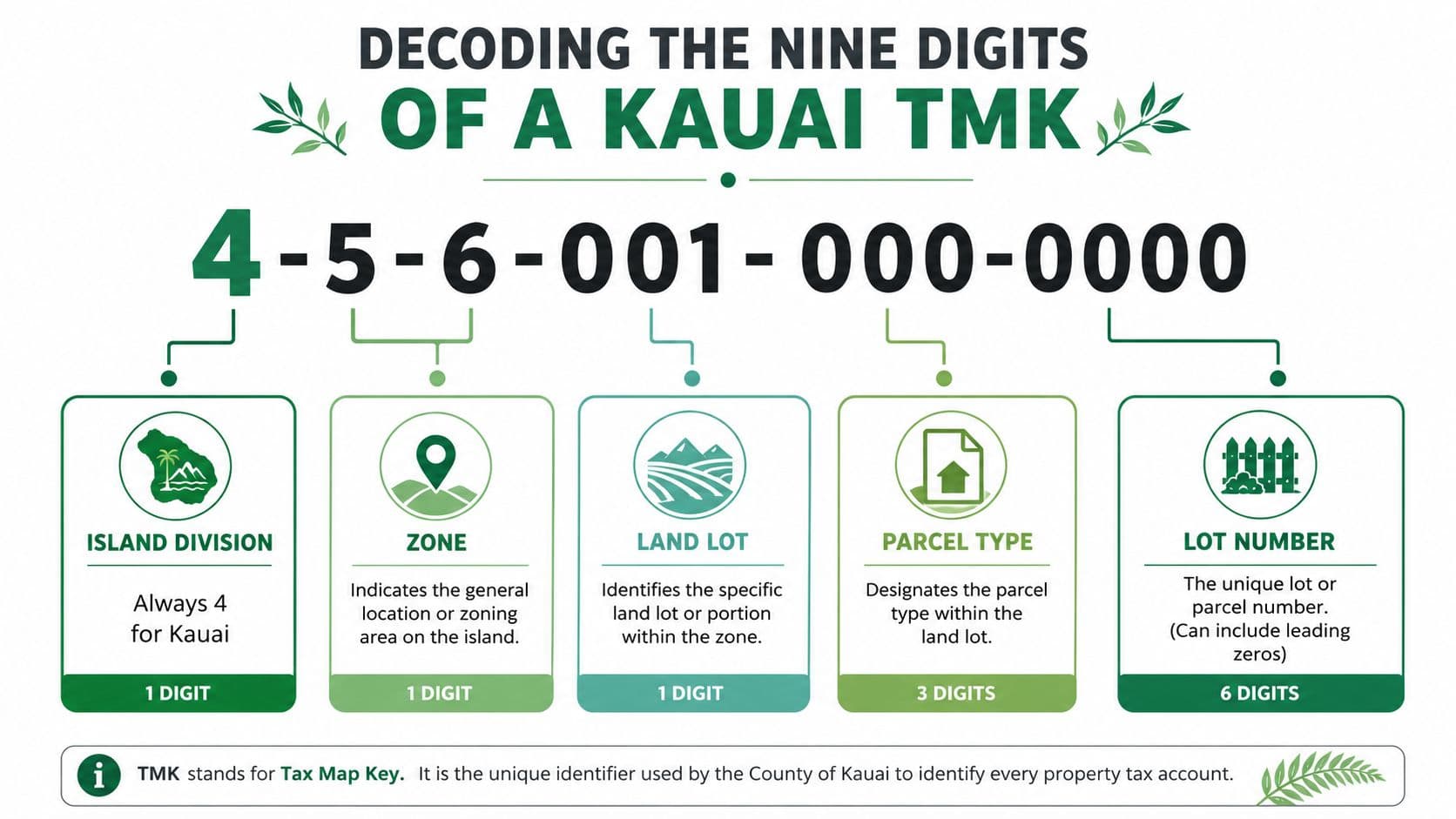
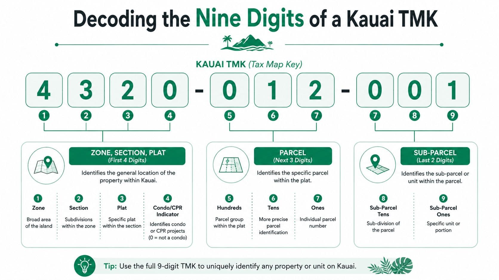
A Kauaʻi TMK is a nine-digit parcel identifier that breaks into division, zone, section, and plat parts. On Kauaʻi, the first digit is always 4, which is why the county metadata starts there (Hawaiʻi TMK metadata). The number does not describe ownership by itself. It points to place first, so a clerk can sort the parcel into the right map area before comparing it with the rest of the record.
A first-time user often has the TMK in front of them but still enters the wrong string in the county search box. That happens because the code has a format, and the search field may want only part of it. Before you type anything, separate the number into pieces and check which version the system expects.
Read it in pieces, not as one long string
The county and state structure map the zone codes to moku-level areas such as 1 = Waimea, 2 = Koloa, 3 = Lihue, 4 = Kawaihau, 5 = Hanalei. That second digit or zone component can narrow the parcel's island location in a way a street address cannot. Once you know the zone, the remaining digits lead you toward the exact section, plat, and lot.
Read the number from left to right. The early digits place the parcel in the county's map structure, and the later digits narrow the exact location.
A worked example like 4-3-9-014-027 shows the pattern. The first digit points to Kauaʻi, the next digit places the parcel in the zone group, and the later groups narrow the parcel inside that mapped area. Even without memorizing every formatting rule, the structure shows why the TMK works as a spatial key. It lets the county match the assessment record, the GIS polygon, and the legal description to the same land reference.
When a person knows the parcel exists but cannot get the digits into the right shape, the problem is usually format, not missing information. A site like this value map guide can help readers compare how identifiers, map layers, and records line up across systems.
Why the TMK stays useful after ownership changes
Ownership can change, but the map position usually does not. The TMK stays attached to the parcel as it moves through sales and transfers, while the geographic record remains the same. If a deed, bill, and map layer disagree, the TMK is the thread that helps an assessor or records clerk trace the parcel back to the county's official land file.
For anyone comparing land data across systems, treat the TMK like a coordinate system, not like a name tag. Once you learn the code structure, you can glance at a Kauaʻi number and get a rough sense of where the parcel belongs on the island.
Finding a Kauai TMK Through the County Property Search
A Kauai TMK is easiest to confirm when you start with the county's public record search and work from the clue you have. The search tool lets you look by location address, parcel number, legal information, map, or condo, which helps when the parcel shows up one way on a tax bill and another way on a listing sheet. First-time users usually have one of those partial references, not a clean deed citation, so the search method has to match the source in hand.
The practical problem is not knowing that a TMK exists. It is entering the right digit string in the right field. County systems often expect a specific version of the number, and a small format mistake can make a correct parcel look wrong. A county search box works more like a filing cabinet label than a free-form search, so the label has to be trimmed to the format the cabinet uses.
The format quirks that trip people up
The county's lookup guidance is specific about how the number should be entered. When you search by parcel number, you drop the leading island digit and enter the parcel-number form the system expects. For tax-bill searches, you also omit the last three owner-sequence digits, which leaves a 12-digit numeric string in the bill-entry field (How to access your property record). That is the step that usually causes confusion, because the number on the page is not always the number the county wants in the box.
A simple check helps keep the input aligned with the source:
- If you have a street address: start with the address search, then compare the result to the parcel number.
- If you have a parcel number: remove the leading island digit before entering it.
- If you have a tax bill: strip off the final three owner-sequence digits.
- If you're checking a condo: use the condo search path, since condos can have their own record logic.
The same rule applies when the number comes from a deed, a tax notice, or a GIS label. One source may show the full TMK, while another expects a shortened version for the lookup field. The county interface is built around record type, so the input has to fit the field, not just the parcel.
Match the field to the source you have
If the number looks close but does not return a record, the mismatch is usually format, not substance. A deed, a bill, and a map label can all point to the same parcel while displaying the identifier in different ways. That is why the first pass should be a quick comparison of the source document against the county field, not an assumption that the parcel has disappeared.
A practical way to check your work is to line up the identifier you have with a reference that shows how the record fields are organized, such as this value map guide. Once the format is clear, the county search becomes easier to read, because you can tell whether the issue is the wrong digit string, the wrong field, or the wrong record type.
For a visual comparison of parcel shape, field boundaries, and mapped improvements, a tool like accurate bids with aerial maps can help you spot why two records that seem close on paper do not line up cleanly. It does not replace the county record, but it gives you another way to confirm that the number you entered matches the parcel you meant to find.
Reading the TMK on the Kauai GIS Parcel Map
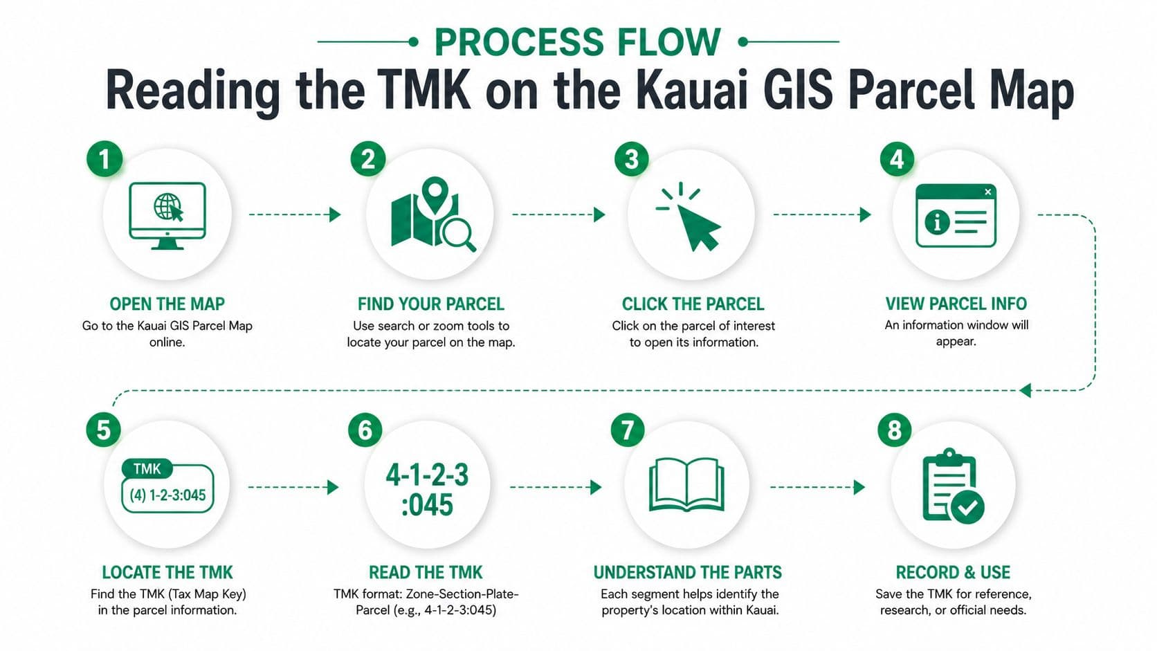
A parcel map is where the Kauai TMK stops being an abstract label and becomes a place you can check line by line. You enter the number, watch the county map zoom to the parcel, and then confirm that the shape on screen matches the property you meant to find. That simple handoff, from digit string to mapped parcel, is where many first-time users get tripped up, because the county search box cares about the exact format you type, not just the number you saw on a deed or tax notice.
Kauaʻi's Real Property Division maintains the GIS parcel layer and updates the tax maps as part of the county's administrative work for discovery, listing, valuation, and tax collection (Real Property Division). The TMK is therefore tied to a live county record system, not a static image. That makes the map useful, but it also means the map is only one step in the record check.
Official records versus map convenience
The map gives you a fast visual check, yet some fields are for orientation only. The state GIS layer includes a GISACRES field, but it is labeled GIS-calculated and not official (Real Property Division). That matters when the acreage is being used for a deed review, a boundary dispute, a permit application, or an appeal. In those situations, the county-maintained parcel record and the legal boundary documents carry more weight than the convenience field on the screen.
Use the map to orient yourself, then verify the record before you rely on acreage.
A first-time user often mistakes a map label for the final record. County files work in the opposite direction. The official record controls the legal treatment, while the GIS map helps you locate the parcel and see how the TMK sits in relation to roads, neighboring lots, and visible improvements.
Moving from number to polygon
Start by entering the TMK in the county search box, then confirm that the parcel outline appears where you expect it to appear. After that, compare the mapped boundary with the street view or aerial layer, and open the parcel record for the assessment details. If the parcel shape, mailing address, or acreage does not line up, each field may be telling a different part of the story.
That is also the point where aerial context can help. A map line may look correct on a screen but still fail to match the ground layout, especially when parcels sit near irregular boundaries or visible improvements. A tool for accurate bids with aerial maps can help you see why two records that seem close on paper do not line up cleanly in the field.
If you want to compare the parcel record with broader tax context, how property taxes are usually broken down is a useful companion for separating what the map shows from what the bill later reflects. For a closer look at whether tax amounts stay the same from year to year, see whether property tax changes each year.
From TMK to Tax Bill and Real Property Tax Rates
A TMK is the parcel label, but the tax bill comes from what the county assigns to that label. Kauaʻi states the formula as TOTAL NET TAXABLE VALUE / 1,000 × Tax Rate = Property Tax. Once the parcel record is matched to the correct assessment file, the tax class and rate decide how the bill is calculated.
Kauai Real Property Tax Rates for Fiscal Year 2026 to 2027
| Property Classification | Tax Rate per $1,000 | Notes |
|---|---|---|
| Owner-occupied property | $2.59 | Published county rate for fiscal year July 1, 2026 through June 30, 2027 (Tax Rates) |
| Commercial and industrial | $8.10 | Published county rate for fiscal year July 1, 2026 through June 30, 2027 (Tax Rates) |
| Agricultural and conservation | $6.75 | Published county rate for fiscal year July 1, 2026 through June 30, 2027 (Tax Rates) |
| Hotel/resort | $11.75 | Published county rate for fiscal year July 1, 2026 through June 30, 2027 (Tax Rates) |
The county also publishes tiered rates for non-owner-occupied residential properties at $5.45, $6.05, and $9.40, depending on taxable value bands, and vacation rental properties at $11.30, $11.75, and $12.20 across three value thresholds (Tax Rates). That is why the assessment record matters so much. The parcel number gets the county to the right file, and the file shows which rate applies.
For readers comparing different tax systems, Global's property tax breakdown helps separate valuation from billing and shows how local rate classes affect the final bill.
If you want a clearer explanation of why a tax bill can change from one year to the next, whether property tax increases every year is a useful companion for sorting out rate changes from assessment changes.
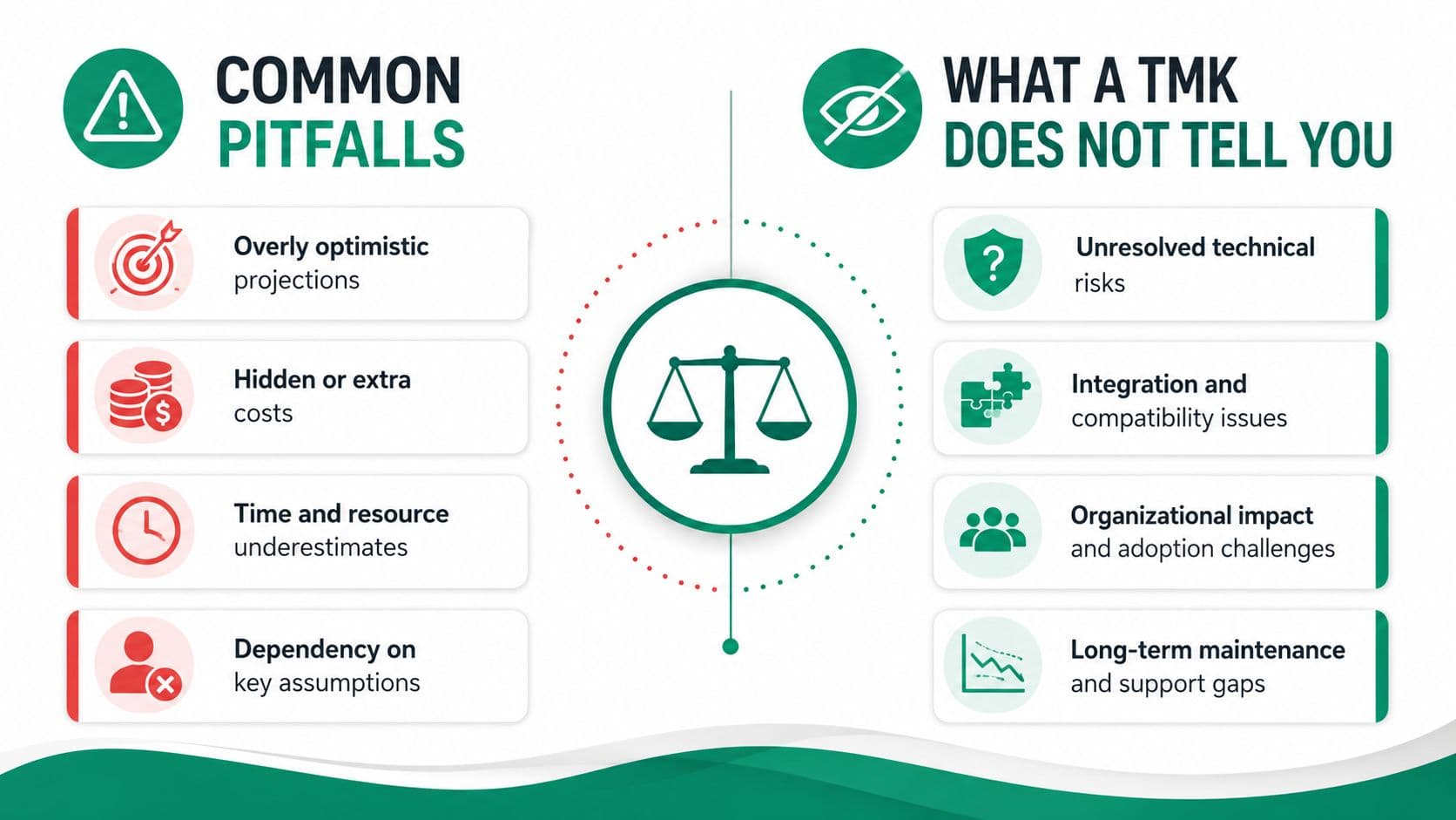
Common Pitfalls and What a TMK Does Not Tell You
A TMK gives you the parcel identifier the county uses, and that is only one part of the picture. It does not resolve every question about what sits on the land, how the parcel is configured, or why one search result may look different from another. A first-time user often assumes the number itself is the answer, then gets stuck when the address, the map, and the recorded description do not line up.
A good example is the gap between a parcel record and the property inside it. A mailing address may point to one structure while the tax parcel covers a larger mapped area. A condo unit can sit inside a parcel-sharing arrangement that does not behave like a single-family lot. Multiple parcels under one ownership can also create confusion, because one owner name does not mean one TMK.
County search tools help because they accept more than one starting point. Search by address, parcel number, legal information, map, or condo when the situation calls for it, since no single field works for every parcel type.
If the record looks off, check the search format first before assuming the parcel itself is wrong.
TMKs also get mixed up with property categories that follow different rules. Difference between real and personal property helps separate land and improvements from movable items, which keeps the search process from blending together details that belong in different records. That matters when a user is trying to read a county file as if it were a simple ownership label.
What to verify before you rely on the number
- Check the source type: a tax bill, deed, county search, and GIS map can each display the parcel in a different format.
- Confirm the search field: the parcel-number field and the tax-bill field do not use the same full string.
- Cross-read the legal description: condos, CPRs, and multi-parcel holdings often need this extra step.
- Treat acreage carefully: map acreage is not the same as county-authoritative acreage.
A TMK is also easy to misread when someone treats it like a full property profile. It identifies the parcel, but it does not by itself explain valuation, use class, or every recording detail that may affect the file. For that reason, the county record remains the place to verify the number against the parcel description, not just the first screen you see.
Quick Reference Checklist and Frequently Asked Questions
A clean TMK lookup usually comes down to four habits. First, start with the right source, address, parcel number, legal description, map, or condo. Second, match the field format to the source you have. Third, confirm the parcel in the county record before you trust acreage or tax treatment. Fourth, use the TMK as the bridge between the map and the tax file, not as a stand-alone answer.
Quick checklist
- If you have an address: search by address first, then compare the parcel number.
- If you have a parcel number: remove the leading island digit when entering it in the county search.
- If you have a tax bill: omit the last three owner-sequence digits.
- If the parcel is a condo: use the condo search path.
- If acreage matters: verify the county record, not just the GIS acreage field.
Frequently asked questions
Does a TMK change when ownership changes? Usually no, because the TMK is a parcel identifier, not an owner identifier.
Do Niʻihau parcels appear in the same system? Yes, Kauaʻi County's property framework covers Kauaʻi and Niʻihau within the county record system.
How is a TMK different from an APN used in other states? An APN is another parcel-number style identifier, but Kauaʻi's TMK has its own county and state formatting rules, so you need to enter it the way the county search expects.
What if my tax bill and map don't match? Start by checking the input format, then compare the legal description and the parcel record before assuming the parcel is wrong.
If you want help turning a confusing parcel number into a clean record trail, explore Unitism® for practical public-policy and property-data guidance. Unitism® works on land-value reform, valuation methods, and plain-language education that can make systems like the Kauaʻi TMK easier to understand and use.