Designing with nature explained: McHarg's legacy, land-value tax vs land-use rights, tri-factor economics, case studies, and policy pathways for cities.
August 5, 2026
Designing with Nature for Policy, Planning, and Land Value
Designing with nature explained: McHarg's legacy, land-value tax vs land-use rights, tri-factor economics, case studies, and policy pathways for cities.
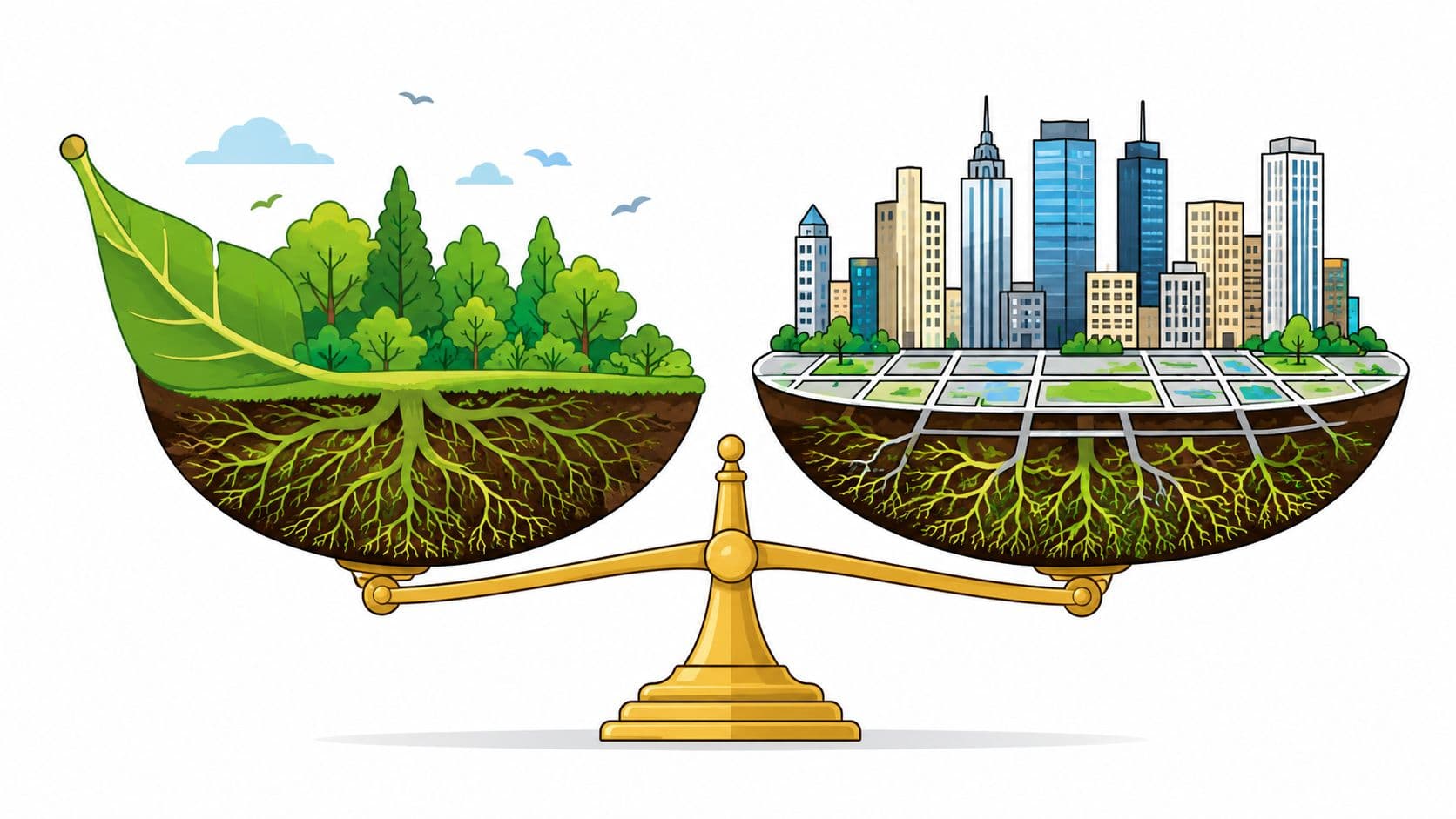
The popular advice on this topic is too small. It treats designing with nature as a nicer way to arrange a site, add trees, or soften a hard edge. That misses the larger point. Nature is not just a visual finish, it is part of how land holds value, absorbs risk, and shapes what governments can afford to build and maintain.
Once you start looking at land through that lens, the conversation changes. Parcel choice affects flood exposure, infrastructure cost, housing supply, and the long-run value captured by owners and the public. That is why ecological planning belongs in the same room as cadasters, budgets, and tax reform, not only in design studios. A useful primer on highest and best use helps clarify why the most profitable use of a site is not always the most resilient or socially useful one.
Table of Contents
- What Designing With Nature Really Means Today
- McHarg's Legacy and the Long Road to Ecological Planning
- Core Principles That Make Nature-Based Design Work
- Land-Value Tax vs Land-Use Rights and Why the Distinction Matters
- Tri-Factor Economics and the Value of Nature in Policy
- Case Studies That Quantify Nature-Based Design
- A Practical Pathway for Land-Value and Nature Reform
- Why Nature Designed Into Policy Is the Missing Lever
What Designing With Nature Really Means Today
The phrase designing with nature gets used so loosely that it often loses its force. Too many projects frame it as greenery, wellness branding, or a nicer-looking public realm. That version is harmless, but it is incomplete. The serious version starts with a blunt question, what does the site want to be, given water, soil, access, ecology, and risk?
Nature is a land-value question
Once planners answer that question, they stop treating land as if every parcel were equally developable. They begin to see why some sites should carry dense use, why some should stay open, and why some should absorb flooding, habitat, or recharge functions instead of buildings. That is not anti-development. It is a way to avoid putting expensive structures in the wrong place.
Practical rule: if the site's ecological logic says “don't build here,” the cost of ignoring that warning usually shows up later in insurance, infrastructure, or disaster recovery.
The economic angle matters because land prices and land-use expectations steer urban form. When the market and the planning code overrate a parcel's capacity, pressure builds for sprawl, hazard exposure, and premature conversion of sensitive areas. When they underread ecological constraints, the public pays twice, once through bad siting and again through repair.
Why the topic reaches beyond landscape architecture
That is why designing with nature belongs inside fiscal policy discussions. If a government sets rules that reward the wrong locations, capital follows the wrong signal. If it prices land in a way that reflects site value and constraint, it can reduce distortion while giving builders a clearer guide for where to put effort and where to leave nature intact.
The Unitism framework matters here because it treats nature as a separate factor, not a decorative afterthought. That distinction helps explain why ecological suitability, land rent, and public revenue are connected. A planning system that sees only buildings misses the value created by the land itself, and often misses the cost of damaging it.
McHarg's Legacy and the Long Road to Ecological Planning
Ian McHarg's Design with Nature, published in 1969, remains one of the most important foundations for ecological planning because it argued that land use should follow environmental suitability rather than zoning habit alone. That idea sounded radical then, but it has aged well because it matches how real environments behave. Water moves, soils differ, wetlands store risk, and the built environment has to work with those conditions, not against them. The Long Island case study shows how durable that argument still is.
Long Island shows what happens when pressure overrides ecology
In one applied study of McHarg's approach on Long Island, the share of area classified as suitable for urban land use rose from 20.5% in McHarg's assessment to 62.6% in the 2012 assessment, a striking sign of how development pressure can expand built-up land beyond cautious ecological planning. The same study concluded that following McHarg's land-suitability guidance could have reduced damages from Hurricane Sandy. That is the kind of result planners should take seriously, because it links land selection to disaster exposure, not just visual quality.
The lesson is not that every site should be left untouched. It is that flood risk, wetlands, drainage, and ecological constraints are not decorative planning inputs. They are hard filters that change the economics of development. If a plan ignores them, the result can look efficient on paper and become expensive in a storm.
Why this old framework still matters
McHarg's contribution survived because it turns environmental judgment into a decision rule. He did not ask planners to admire nature from a distance. He asked them to map suitability and let that guide where buildings go and where they should not.
Urban sprawl has many causes, but a recurring one is that land gets treated as uniformly usable when it isn't. That mistake drives scattered growth, longer infrastructure lines, and higher exposure. Ecological site selection is therefore a risk-management tool, not nostalgia dressed up in green language.
Core Principles That Make Nature-Based Design Work
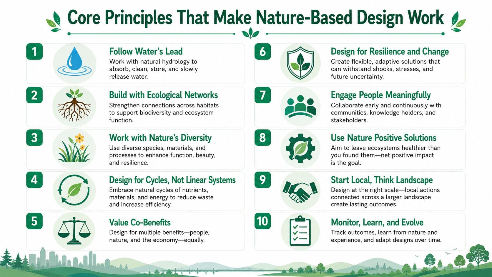
Sound nature-based design starts with diagnosis, not decoration. Practitioners first run a system analysis, identify the dominant physical, chemical, and biological drivers at a site, and then choose measures that influence those drivers directly. That sequence matters because it reduces unintended side effects and can lower lifecycle cost by using natural processes instead of fighting them. The design-with-nature workflow used in practice makes that logic explicit.
The site tells you what matters most
If water is the main issue, the plan should respond to water. If soil compaction, salinity, or habitat fragmentation is the limiting factor, the intervention should address that driver first. A project that skips this step often ends up with attractive features that don't solve the underlying problem.
Nature-based engineering works best when the measure matches the process.
That may sound simple, but it is where many green projects go wrong. A bioswale, a park, or a restored verge can fail if it was added without understanding drainage patterns, maintenance capacity, or local ecological limits. Good design begins by matching intervention to cause.
A practical checklist for built environments
A design-with-nature approach for buildings and outdoor spaces usually shares a few traits. They are not aesthetic preferences, they are operating rules.
- Use local and recycled materials. They cut unnecessary transport and help the project fit the site's material reality.
- Minimize irrigation and energy demand. If a design only works with constant inputs, it's fragile.
- Avoid invasive species. Short-term visual gains can create long-term ecological cost.
- Prefer simple, multifunctional systems. One feature that handles shade, habitat, drainage, and cooling is usually stronger than four separate fixes.
Those principles appear in the technical literature on built environments because they improve resource efficiency, reduce maintenance burden, and build resilience. The deeper logic is alignment, design should sit close to ecosystem behavior rather than importing high-input substitutes.
What to look for in proposals
A credible proposal should explain what process it is trying to influence, what materials it uses, and how maintenance will work. If the document only shows renderings and adjectives, it probably hasn't done enough work. If it names site drivers, operating assumptions, and lifecycle demands, it deserves more trust.
Land-Value Tax vs Land-Use Rights and Why the Distinction Matters
A lot of policy debate blurs two different instruments, and that creates avoidable confusion. A land-value tax is an annual charge on assessed land value. Land-use rights are time-limited, tradable rights to occupy and use land. They are not the same tool, and they do different jobs in reform design. A clean comparison of land-value tax versus property tax helps keep the vocabulary precise.
The comparison side by side
| Dimension | Land-Value Tax (LVT) | Land-Use Rights |
|---|---|---|
| Core idea | Annual charge on site value | Lease or use right for a fixed term |
| What is taxed or paid for | The land itself, not buildings | The right to use land for a period |
| How the state collects value | Recurring fiscal instrument | Upfront or periodic lease mechanism |
| China | Not the standard urban mechanism | Residential 70 years, commercial 40 years, industrial 50 years |
| Singapore | Not the main model | Commonly 99-year leases |
| Estonia | Land-only tax, rate band roughly 0.1% to 2.5% of assessed land value, with municipalities setting the rate within that band | Not the core model |
| Denmark | Site value is the base, with buildings separated in assessment | Not the core model |
Why the distinction changes reform design
China's urban system is a good reminder that land-use rights are marketable without being a land-value tax. The state owns urban land, then grants users a fixed-term right rather than selling land outright. Those rights can be transferred and traded, but the mechanism is a lease term with expiry and renewal conditions, not a perpetual annual tax regime. That distinction is laid out in the land-use-rights literature.
Singapore shows a similar logic in a different institutional setting, with many parcels granted under long lease terms and secondary-market trading of leasehold land. That makes access to land possible without full freehold ownership, but it still isn't an LVT.
Denmark's grundskyld and Estonia's land tax point in the opposite direction. They show how mature land-value taxation can separate land from buildings and tax site value directly. The administrative lesson is simple, if the goal is to tax land value, the assessment system must isolate land. If the goal is to allocate use rights, the legal mechanism is a lease.
Important distinction: a marketable land lease can make land accessible. It does not automatically create the same incentives as a land-value tax.
That difference matters for housing, infrastructure, and ecological siting. A land tax changes the holding cost of land. A lease changes the right to use it for a term. They can work together, but they are not interchangeable.
Tri-Factor Economics and the Value of Nature in Policy
If nature is going to shape policy, it has to appear in the accounts. That's where tri-factor economics is useful. It separates labor, capital, and nature as distinct inputs with distinct policy levers, instead of burying land inside a broad “real estate” category that hides the rental component.
Why splitting nature from capital matters
When land is treated as just another form of capital, the policy system loses sight of the value created by location, access, and environmental endowment. That matters because the return to a site is not the same as the return to a building or machine. A government that taxes work and construction more heavily than site value can end up discouraging productive activity while rewarding passive land holding.
The practical implications are straightforward. Site-value taxation, resource dividends, and rate reform all become easier to design when nature is visible as a separate factor. So does the idea of replacing transaction and building taxes with land-based charges that reward work and construction instead of penalizing them.
Nature becomes governable when it is measurable
This is also the bridge back to ecological planning. McHarg's land-suitability logic becomes auditable in budgets when the state can see nature as a factor that produces value, risk reduction, and public benefit. That makes environmental decisions easier to explain to finance ministries, because the issue is no longer only conservation. It is also revenue, exposure, and allocation.
Land and water are often treated as separate policy silos, yet they function together in site value, flood risk, and urban form. Tri-factor economics gives officials a way to talk about that connection without vague language.
A policy lens, not a slogan
This framework doesn't ask governments to romanticize nature. It asks them to price, plan, and govern around it more truthfully. That shift matters because once nature is recognized as a factor, the public can debate who captures its value, who pays for its protection, and which sites should carry development.
Case Studies That Quantify Nature-Based Design
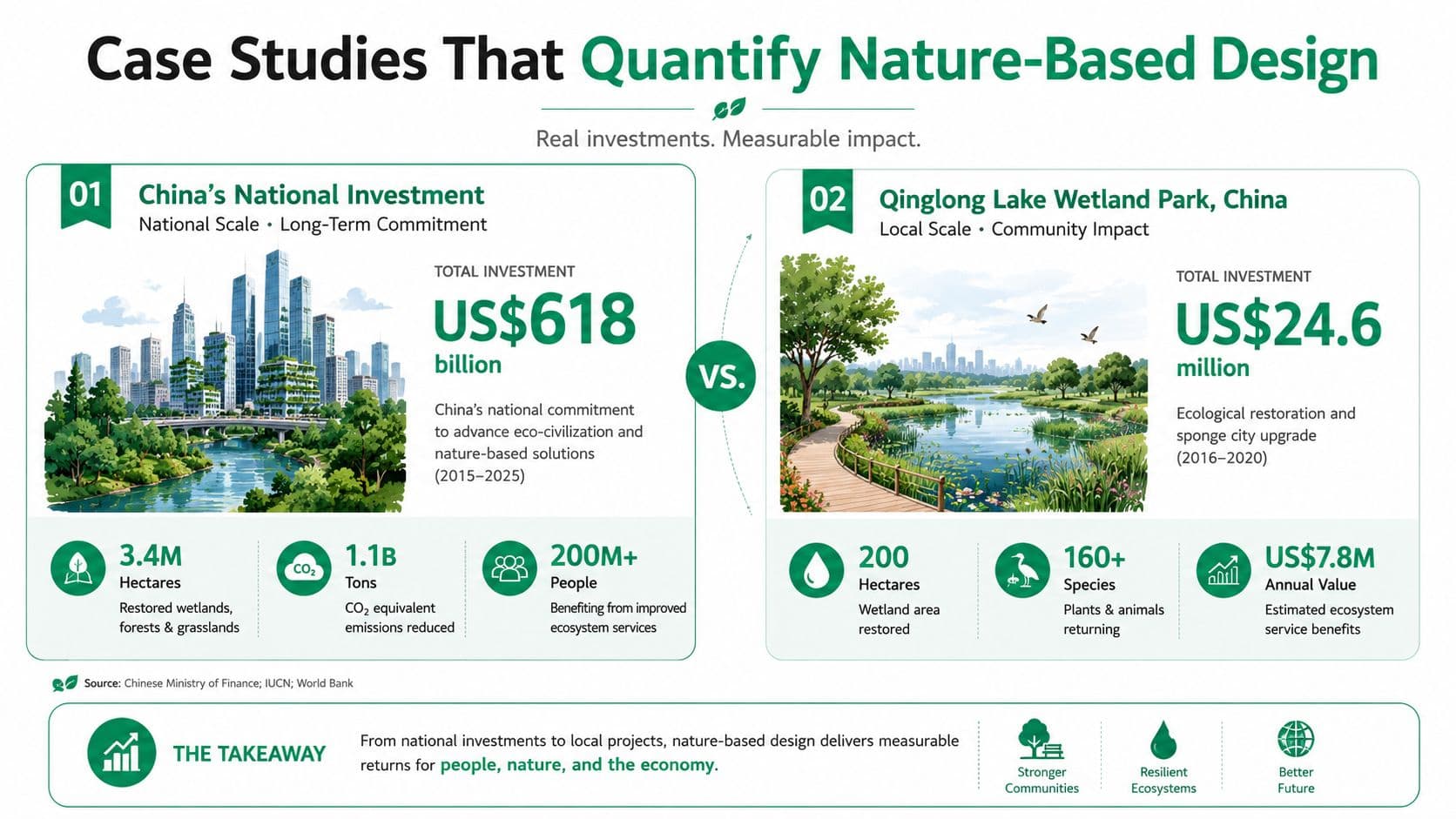
Big ideas gain credibility when they show up in numbers. China is one of the clearest examples of how nature-based planning moved from concept to state-backed development strategy. In a major expansion of eco-city and eco-restoration policy, the government invested US$618 billion in a five-year period from 2011 to 2015, with planned spending projected as high as US$1.124 trillion for 2016 to 2020. Those figures show scale, but they also show intent. Nature-based planning was not treated as a side project.
Wuhan shows measurable ecological gain
In a watershed restoration case in Wuhan, the ecosystem-service equivalent factor increased by 34.5%, rising from 197,958.16 to 266,312.30 after the design intervention. That matters because it turns a common planning claim into something officials can test. Ecological design can raise measurable service output, not just preserve scenery. The study also reports gains across farmland, gardens, forests, wetlands, and water bodies, with culture and entertainment among the improved categories. The ecosystem-service valuation paper shows why this kind of evidence matters, because it ties design to value rather than appearance alone.
The design lesson is practical. If a restoration project produces more service value, planners need to ask which mix of wetland, water body, forest, or farmland treatment created that improvement. The ecosystem-service valuation framework at https://unitism.com/learn/insights/ecosystem-service-valuation explains how to measure those gains in a systematic way. That question matters more than whether the project photographs well.
Why this scales beyond one city
The point is not that every city should copy Wuhan. It is that state-backed financing can make ecological design legible at scale when public agencies are willing to measure outcomes. That creates a useful discipline for finance ministries too. If a policy can show service gains, it becomes easier to compare against alternative infrastructure spending.
For a different lens on the operational side of restoration delivery, WebinOne client success stories show how restoration work can be framed and communicated to a public audience without losing the technical substance. The value is in making ecological work visible, measurable, and easier to understand.
Measured ecological value changes the conversation from “Should we protect this?” to “What does this site produce, and what does it cost to lose it?”
A Practical Pathway for Land-Value and Nature Reform
Reform stalls when it stays abstract. A credible path starts with valuation, because officials can't govern what they don't measure. That means building data frameworks that estimate site rental values, map value drivers, and distinguish land from improvements. Without that base, every later choice becomes guesswork.
Sequence the work
A workable sequence looks like this.
- Valuation and data first. Build the cadastre, assessment, and geospatial tools needed to identify where value comes from.
- Policy design second. Choose the instrument, whether that is site-value taxation, resource dividends, or rate reform.
- Distributional analysis next. Model who gains, who pays, and how revenue potential changes during transition.
- Administrative readiness. Draft legislation, connect the cadastre, and set compliance workflows.
- Public understanding. Educate civil servants, elected officials, and residents so the reform survives beyond one budget cycle.
Each step depends on the one before it. If a government skips valuation, it guesses at fairness. If it skips distributional modeling, it invites backlash. If it skips public education, opponents define the reform before supporters can explain it.
Make the process legible to non-specialists
This is also where communication tools matter. Interactive models and plain-language explainers help people see how land value shapes outcomes. An exploratory research methods guide can be useful for teams that need to choose the right evidence approach before they start building policy materials.
The most effective reform programs don't just publish papers. They create translation layers for finance officials, planners, and the public. Multilingual access matters too, because technical reform often fails when only specialists can read it.
If the public can't tell how a reform works, it will be described for them by the people who want it to fail.
That's why implementation support has to include legislative drafting, administrative process design, and scenario tools, not only policy theory. The shift has to be politically durable, not just technically elegant.
Why Nature Designed Into Policy Is the Missing Lever
The central mistake in most debates is treating ecological design, housing affordability, and tax reform as separate conversations. They aren't. Once nature is treated as a measurable, separate economic factor, three problems start to collapse into one policy agenda, land-price inflation, taxes that penalize work and construction, and fiscal volatility from speculative real estate cycles.
One reform can address three failures
That's why the missing lever is not just greener planning. It is aligning land economics with ecological reality. If governments price land more accurately, they discourage idle holding and reward productive use. If they design settlements around ecological suitability, they reduce exposure to flood and infrastructure loss. If they separate land from buildings in the tax base, they stop punishing improvement.
There's also a governance issue that too many glossy articles skip. Who pays for maintenance? Who measures outcomes over time? Who is responsible when green infrastructure underperforms or when biodiversity loss is offset on paper but not in reality? Those questions matter as much as the initial design. Recent commentary on biodiversity offsetting warns that treating offsetting as a substitute for protecting site values can hide irreversible ecological loss, and that warning deserves attention in any serious planning program. The biodiversity critique is a reminder that not every green label protects real ecology.
What durable reform looks like
Durable reform usually needs phased transition design, stakeholder education, and clear tools that let people test scenarios before the political fight starts. It also needs a willingness to distinguish between green appearance and ecological function. If a policy only beautifies land, it hasn't yet solved the underlying valuation problem.
The better standard is simple. Design the site with its ecology in mind. Then design the fiscal system so the value of nature is shared fairly, protected responsibly, and not buried inside bad incentives.
If you're working on land, housing, or fiscal reform, Unitism® can help you connect ecological planning to land economics, valuation, and policy design. Its work on tri-factor economics and land-value reform is built for the exact problem this article addresses, how to make nature visible in budgets, planning, and public value.