Learn what land value uplift is, why it happens, how to measure it, and how to capture it fairly through site-value taxes and betterment levies.
September 6, 2026
Land Value Uplift Explained and How to Capture It
Learn what land value uplift is, why it happens, how to measure it, and how to capture it fairly through site-value taxes and betterment levies.

A farmer owns a field on the edge of town. One week, the site is worth little more than its existing agricultural use. The next, a planning decision allows residential development, and buyers value the same ground very differently. The owner didn't build a home, improve the soil, or discover a new resource. A public decision changed what the location could earn.
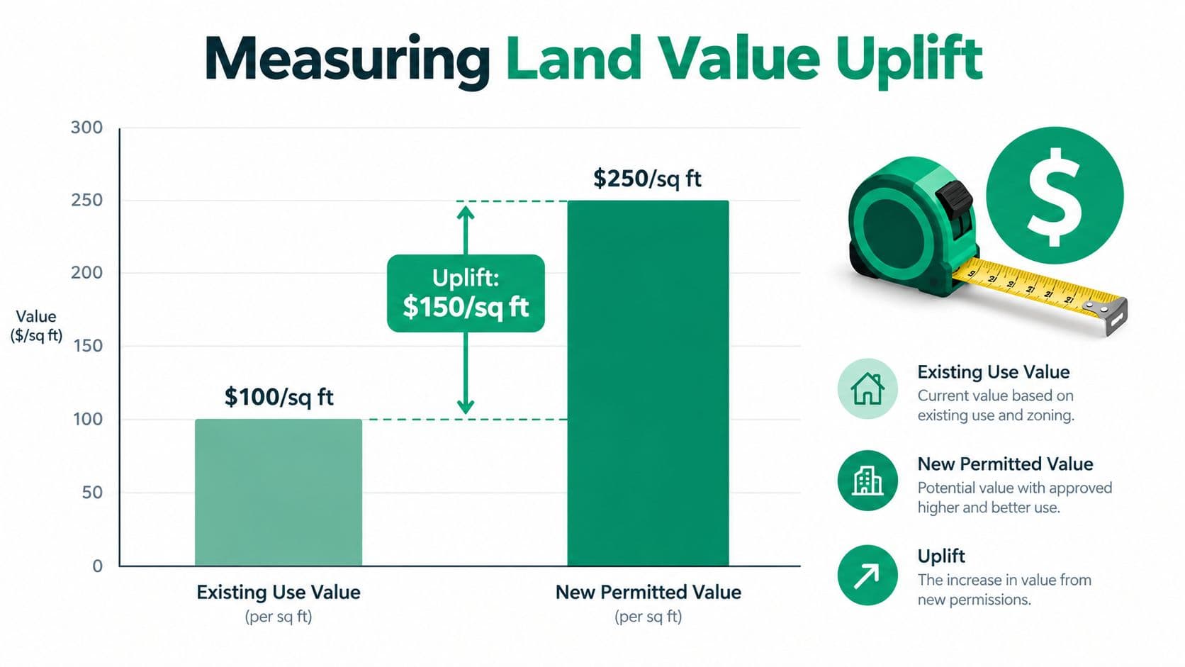
That difference is land value uplift. It's the increase in a site's value when planning permission, transport access, utilities, public investment, or wider economic activity raises the income that the land can support. The central policy question is simple: when the community helps create that gain, how much should return to the community?
The answer isn't found by treating every increase as one uniform windfall. Uplift varies between districts, between residential and commercial land, and between the moment a project is announced and the date it opens. A fair system must measure those differences, separate public-created value from ordinary market movement, and choose a capture mechanism suited to local institutions.
Table of Contents
- Introduction What Land Value Uplift Means for Communities
- How Land Value Uplift Happens and Why Land Captures It
- How to Measure and Map Land Value Uplift in Practice
- Policy Tools to Capture Uplift Without Taxing Buildings
- Land Leases Versus True Land Use Rights and Why the Difference Matters
- Who Gains Who Pays and What Precedents Show
- Practical Steps to Value Land and Implement Capture Fairly
Introduction What Land Value Uplift Means for Communities
Land value uplift becomes visible when a site's permitted use changes, but the underlying principle appears in everyday decisions. A new station can make a distant neighborhood easier to reach. A road, school, utility connection, or rezoning decision can make development more practical. The surrounding land then becomes more valuable because people expect higher future rents, sales prices, or business income from that location.
The owner may benefit even when the owner hasn't made the investment that created the opportunity. That's what distinguishes land value from the value of buildings and other improvements. A developer may add value through design, construction, and management, while a public authority may add value through planning and infrastructure. These contributions shouldn't be confused.
England offers a clear illustration of the scale involved. A Parliamentary evidence submission estimated £12.375 billion of total land value uplift from residential development in 2014–15, calculated by subtracting £2.383 billion of initial use value from £14.759 billion of total residential land value. It estimated that £3.112 billion, or 25% of the uplift, was captured through Section 106, the Community Infrastructure Levy, and public land sales, leaving £9.263 billion, or 75%, uncaptured. The parliamentary evidence submission provides the underlying calculation.
Practical rule: Before debating a tax rate, identify which decision or investment changed the site's earning potential.
This guide follows that logic from beginning to end. It explains how uplift forms, how analysts measure it, why timing matters, and how governments can recover part of the gain without taxing wages, buildings, or productive investment. It also addresses a distinction that policy discussions often blur: a fixed-term land lease isn't the same thing as a true annually repriced, indefinite land-use right.
How Land Value Uplift Happens and Why Land Captures It
Start with the three inputs used in almost every productive activity: land, labor, and capital. Labor means human effort and skill. Capital includes buildings, machinery, infrastructure owned by businesses, and other produced assets. Land means the natural site and its location, including the legal and economic advantages attached to it.
A useful analogy is a shared stage. The plot of land is the stage, with its position, access, permitted uses, and surrounding opportunities. A building is a private prop placed on that stage. The owner can improve the prop through construction and maintenance, but a public decision that moves the stage closer to customers or permits a more profitable performance can increase the value of the stage itself.
That distinction explains the causal chain:
- A public or external change alters access or permitted use.
- People forecast higher future rents or revenue.
- Buyers capitalize those expectations into today's land prices.
- The site becomes more valuable before the full benefit arrives.
A transport project demonstrates the timing clearly. A review of 64 usable studies found that land values near mass-transit nodes increased on average by 6.9% to 9.5%, while the cited Greater London evidence summary found that rail projects generally produced larger uplifts than road schemes and that commuter rail often outperformed other modes. The review of treatment value uplift in cost-benefit analysis also emphasizes that context matters and that expected accessibility gains can be reflected in prices before construction finishes.
Why one neighborhood gains more than another
Land doesn't gain value because a government spends money nearby. The effect depends on what the investment connects, what planning rules permit, whether utilities can support development, and how much demand exists for each use. A station in a dense employment corridor may produce a different result from a station in an area with weak demand or limited development capacity.
The same logic applies to rezoning. Permission for apartments may raise residential land value, but commercial land might respond more strongly to access to shoppers, workers, or freight routes. To understand uplift in your city, ask three questions: what changed, which land uses benefit, and when did buyers begin pricing in the change?
For a deeper explanation of how these inputs interact, see land, labor, and capital.
How to Measure and Map Land Value Uplift in Practice
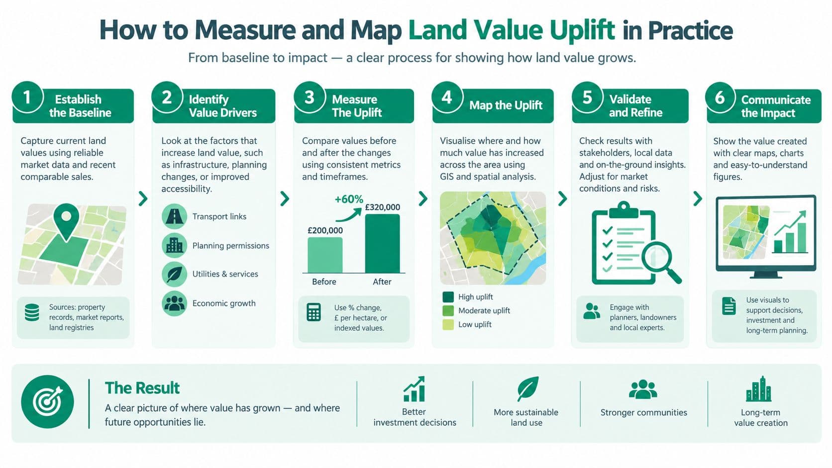
A credible estimate starts with a baseline. Analysts first ask what the site would be worth under its existing lawful use, without the new permission, service connection, or infrastructure benefit. They then estimate its value under the new condition. The difference is the initial measure of uplift:
Uplift = value after the relevant change minus value before the relevant change.
That formula looks simple, but the assumptions determine the result. A site's value after permission must reflect realistic development costs, financing, construction timing, expected rents, and the density legally available. The baseline must also reflect the site's actual alternative use, not an artificially low figure selected to enlarge the apparent gain.
Three practical valuation methods
Residual valuation works backward from the completed project. The analyst estimates the revenue from the permitted development, subtracts construction, professional, infrastructure, finance, and other legitimate costs, and arrives at the residual land value. This method is useful for development sites, but small changes in assumptions can materially change the result.
Comparable sales compare similar sites with similar permissions, access, and market conditions. The comparison is strongest when analysts adjust for differences in size, timing, permitted density, infrastructure, and use. A sale isn't automatically evidence of public-created uplift because it may also reflect changing interest rates, population, business demand, or general market inflation.
Accessibility analysis examines how proximity to transport or services affects site values. The evidence reviewed earlier found average uplift near mass-transit nodes, but the range itself shows why analysts shouldn't apply a single percentage mechanically. A station's effect depends on the quality of the connection, the surrounding land market, and what development rules allow.
Mapping the source and timing of change
A value map should layer planning boundaries, transport access, utilities, parcel ownership, current use, permitted density, and transaction evidence. Analysts can then compare sites that received similar public benefits with sites that didn't, while controlling for local market conditions.
Timing deserves its own field in every valuation file. The value may rise when a project is announced, when funding is secured, when planning permission is granted, during construction, or after opening. Commercial and residential land may respond at different speeds and by different amounts. Japan's 2026 official land prices rose 2.8% nationwide, with commercial land rising 4.3% and residential land rising 2.1%, demonstrating how use types can diverge within the same national market. The Reuters report on Japan's 2026 land prices supplies those figures.
Queensland's 2026 revaluations show why geographic averages can conceal local variation. Reported increases were 23% on the Gold Coast, 24% on the Sunshine Coast, 37% in Noosa, and 56% in Lockyer Valley. The figures don't prove that one public project caused each increase, but they show why valuation dates, districts, and market drivers must be separated.
Use Unitism's value mapping resource to think through the spatial evidence a capture policy would need.
Policy Tools to Capture Uplift Without Taxing Buildings
No single instrument fits every land market. The right choice depends on whether the authority can value parcels regularly, maintain a reliable cadastre, identify the public action connected to the gain, and collect charges without delaying development.
A site-value tax applies to the value of land rather than the value of buildings. Because construction doesn't increase the taxable base in the same way, the charge can avoid penalizing improvements. It works best where assessments are frequent, parcel records are dependable, and the government can administer a broad recurring levy.
A betterment levy targets an identifiable increase associated with a public improvement or planning decision. It can be closely matched to the event that created the gain, but officials must define the baseline, timing, affected area, and share captured. Disputes become more likely when several causes overlap.
A development charge collects money when a project receives permission or proceeds. It can fund infrastructure directly, but it may fall on the development process rather than the full value of land, particularly if the owner holds the site without building.
A resource dividend shares rental value from natural assets with the public. It suits resources such as minerals, energy sites, or other common assets where ownership and extraction rights can be clearly defined. Its administration differs from urban land taxation.
Land value tax and related land-based policy provides a useful framework for separating the site from the structure.
Choosing the right land value capture instrument
| Instrument | What it captures | When it applies | Strengths and limits |
|---|---|---|---|
| Site-value tax | Recurring land value | Broadly across a jurisdiction | Stable and neutral toward construction, but requires strong valuation and parcel data |
| Betterment levy | An identified uplift | After a specified public action | Direct connection to public investment, but attribution and timing can be contested |
| Development charge | Value associated with permission or development | At approval or commencement | Easy to link to projects, but can discourage building or miss gains from non-development |
| Resource dividend | Rental value from natural assets | Where public resources generate private income | Matches common-resource principles, but needs clear rights and monitoring |
High uplift doesn't automatically justify a simple windfall tax. Some of the increase may reflect general market inflation, private development economics, or risk taken before the public benefit becomes certain. A charge set without those distinctions can make viable projects harder to finance.
The practical test is whether the instrument captures economic rent created or enabled by public action, while leaving a reasonable return for labor, capital, and legitimate development risk. Authorities should model both the public revenue and the effect on building decisions before setting rates.
Land Leases Versus True Land Use Rights and Why the Difference Matters
The label land lease can hide two different economic arrangements. A land lease is a renewable or non-renewable fixed-term agreement at a fixed price. A true land-use right, as defined here, is indefinite, does not expire, needs no renewal, and is repriced annually.
The distinction matters because land value uplift arrives unevenly across uses and districts. A fixed lease may preserve yesterday's price while nearby infrastructure, zoning, or demand raises today's site value. The gain then sits inside the leaseholder's interest until renewal, sale, or expiration brings the difference into view.
A renewable fixed lease provides certainty only until its term ends. Renewal can force one large repricing, closing the accumulated gap between the old lease rate and the market. Long-term lease structures therefore postpone the adjustment rather than spreading it across the years in which value changes. A non-renewable lease creates another risk: as expiration approaches, lenders and buyers may treat the interest as harder to refinance or sell.
What true land-use rights change
An indefinite right repriced annually keeps the land payment connected to current site value. The arrangement works like an updated rent meter rather than a bill that stays unchanged until a renewal date. Buyers and sellers can transfer the right without negotiating a large terminal payment or absorbing the uncertainty of expiration.
Annual repricing also makes capture more responsive to local conditions. A fast-growing district and a stagnant one need not carry the same land charge, while different uses can reflect different earning capacity. That timing matters because uplift is not one universal windfall. It can emerge gradually in one area and sharply after a public decision in another.
The structure does not remove ordinary commercial risk. Businesses still face demand, construction, operating, and financing risks. It removes a large artificial tenure risk from the land interest itself, making it easier to distinguish land value from the risks of productive enterprise.
China illustrates the fixed-term model. Standard maximum terms for state-owned urban land-use rights are 70 years for residential land, 50 years for industrial land, and 40 years for commercial land. At expiration, the right must be reacquired for the next term at a price tied to then-current fair market value. The University of Tennessee legal publication on Chinese land-use rights describes this arrangement as different from a permanent, annually repriced right.
The purchaser must also pay the entire fee in advance and cannot register the right until the full fee is paid. The related Chinese legal analysis explains how that requirement creates a substantial upfront capital burden.
A policy document may call a fixed lease a “land-use right,” but the label does not change its structure. A true land-use right is repriced each year, requires no renewal, and doesn't expire. The Lincoln Institute's discussion of taxing publicly owned land in China distinguishes an annual land-rent system from a one-time leasing fee.
Who Gains Who Pays and What Precedents Show
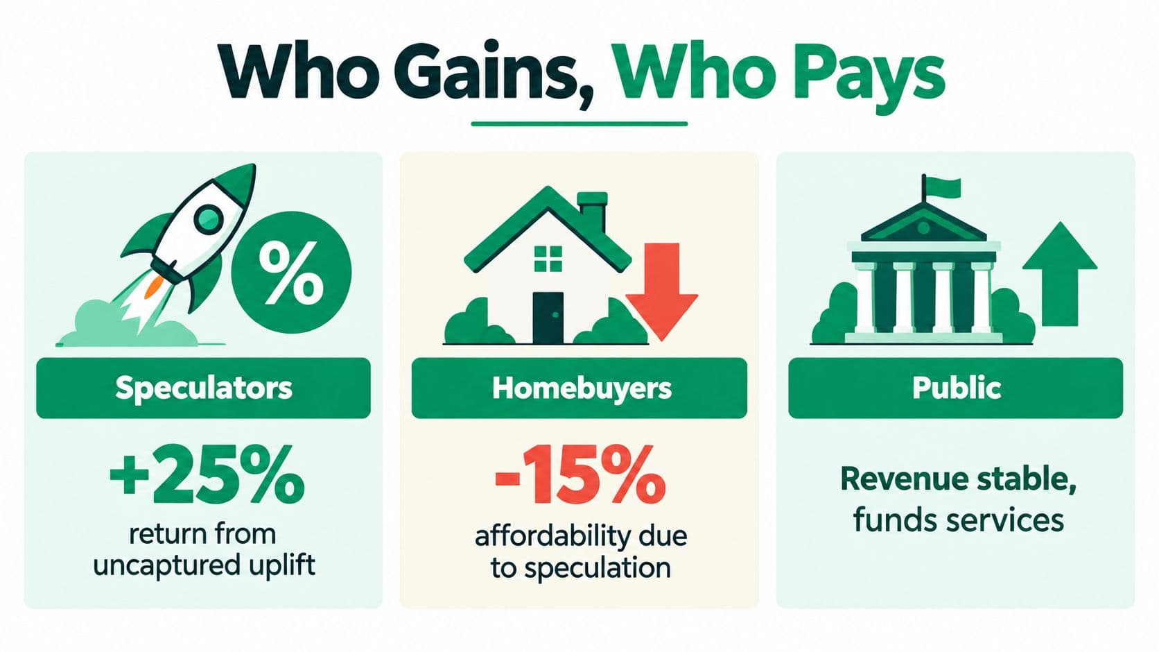
Uncaptured uplift can reward whoever already controls the site when a public decision changes its prospects. The gain may appear as a higher sale price, a larger borrowing capacity, or a stronger negotiating position. People who need homes or business premises may face higher entry costs, while the public authority pays for the infrastructure that helped create the gain.
Captured uplift changes the fiscal relationship. The authority can use revenue for transport, utilities, public services, or future investment. That doesn't mean every charge is fair automatically. The design still determines whether existing owners, new buyers, tenants, developers, or taxpayers carry the cost.
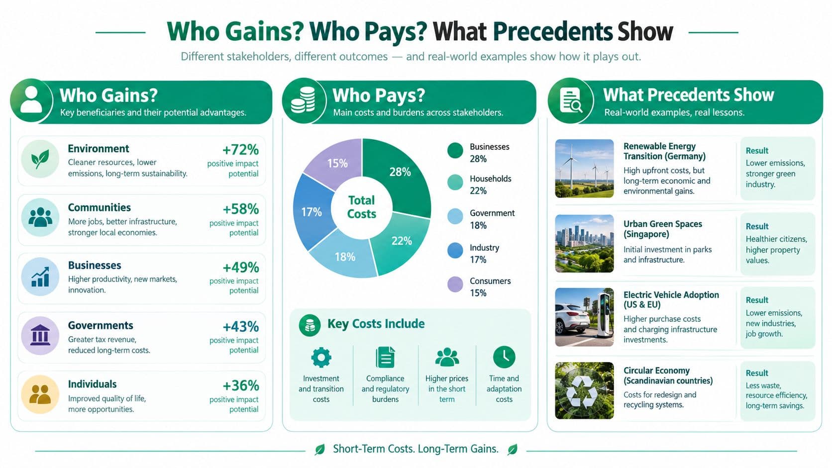
The documented precedents named in land-value reform discussions show several routes rather than one universal model. Denmark and Estonia are associated with land-based fiscal approaches. Singapore demonstrates strong public control over land and development. Alaska and Norway provide examples of sharing value from natural resources. Canberra illustrates public land development, while Allentown is associated with a split-rate property-tax approach. These examples differ in law, history, ownership, administration, and market conditions, so they shouldn't be copied without adaptation.
Why location changes the distribution
A transport line can benefit one corridor more than another. A rezoning decision can help residential land while leaving industrial land largely unchanged. A resource discovery can concentrate gains in a particular region. The distribution follows the location of the rent, not an abstract national average.
Japan's 2026 figures make that point through land use. Commercial land rose more than residential land nationally, while Queensland's reported revaluation increases varied sharply between districts. Those observations support a localized approach to valuation and rate design, rather than assuming that every owner received the same public-created gain.
The capture question is also a risk question
A high uplift estimate doesn't tell policymakers how much to collect. One 2025 consultation response argued that land value capture for residential development in England could account for 52% of land value uplift, but that figure is a policy position and negotiating proposition, not a settled universal rule. The 2025 consultation response highlights why capture shares must be tested against viability, timing, and local bargaining conditions.
The wider policy lesson is that governments need an instrument suited to their administrative capacity, cadastre quality, and development cycle. An annual land charge may fit a jurisdiction with strong valuation systems. A project-linked levy may be more practical where the authority can identify a specific improvement but lacks continuous assessment capacity.
Practical Steps to Value Land and Implement Capture Fairly
Implementation works best as a sequence, not a single legislative announcement. Start by building a land valuation framework that records parcels, existing uses, permitted uses, infrastructure access, transaction evidence, and valuation dates. Separate the site value from buildings and other improvements so the public charge doesn't rise because an owner renovates or constructs.
Next, connect the valuation system to the cadastre. Officials need consistent parcel boundaries, ownership records, planning information, and appeal procedures. Without that foundation, even a well-designed land charge can produce disputes and uneven enforcement. A practical guide to calculating land value can help organize the analytical questions.
A workable implementation sequence
- Establish the baseline. Record existing-use value before the relevant planning or infrastructure change.
- Identify the driver. Link the estimated gain to permission, access, utilities, public investment, or broader market conditions.
- Model distribution. Test who gains, who pays, how renters and owners are affected, and how development decisions might change.
- Choose the instrument. Match a recurring tax, betterment levy, development charge, or resource dividend to local administrative capacity.
- Phase the transition. Use clear valuation dates, payment arrangements, protections for genuine hardship, and transparent review rules.
- Publish the evidence. Give residents and officials access to maps, assumptions, valuation methods, and revenue scenarios.
Legislation should define the taxable base, valuation method, appeal rights, collection process, treatment of delayed development, and use of revenue. Administrative teams need compliance workflows that handle transfers, exemptions, arrears, reassessments, and annual repricing where true land-use rights are used.
Education matters as much as mechanics. Officials must understand why buildings and labor are treated differently from site rent. Residents need plain-language explanations of who created the value and where the revenue goes. Interactive maps can make the policy visible before implementation, while phased modeling can expose transition problems before they become political crises.
A readiness checklist is short:
- Data: Are parcel, ownership, use, and valuation records connected?
- Attribution: Can the authority distinguish public-created uplift from general market movement?
- Capacity: Can officials reassess and collect reliably?
- Fairness: Have distributional and hardship effects been modeled?
- Design: Does the instrument avoid discouraging construction and productive activity?
- Transparency: Can the public inspect assumptions and expected revenue?
Unitism® offers land valuation assessments, value mapping, capture-policy design, distributional modeling, implementation support, and public education for governments and organizations working through these questions. Visit Unitism® to explore tools and advisory support for measuring land value uplift and designing a fair capture system.